Cambridgeshire
Including Cambridge, Wisbech, Ely, March, Whittlesey, Chatteris, Linton
|
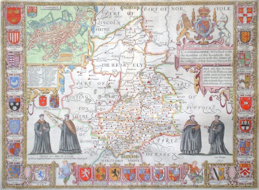
Cambridge 'Cambridgeshire described with the devision of the hundreds, the Townes situation with the Armes of the Colleges...' Speed, J. (c. 1676) 53 x 39 John Speed's superb map of Cambridgeshire engraved by Hondius. Herewith Basset and Chiswell edition. Features include, top left, town plan and Arms of Cambridge, to the centre right the Royal arms, to the left arms of the Earl of Cambridge and of Charles Stuart. Bordering the county map on three sides, no less than twenty-five arms of Cambridge University colleges. English text verso. Later colour. Excellent condition 1100.00 GBP |


|
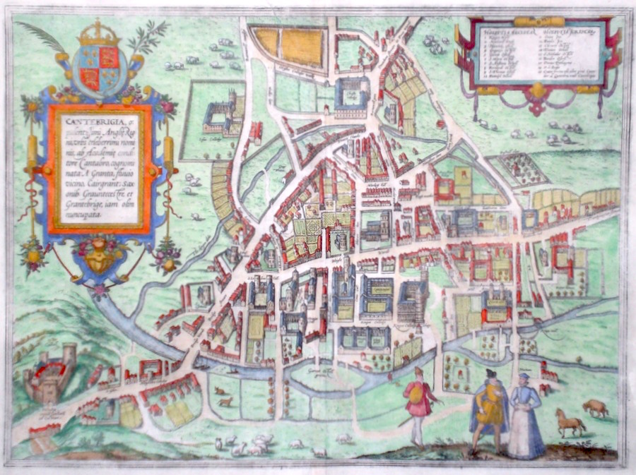
Cambridge 'Cantebrigia Opulentissimi Angliae...' Hogenberg, F. (c. 1575) 45 x 33 Superb early engraving depicting Cambridge by Frans Hogenberg for volume two of the famous work "Civitates Orbis Terrarum". Produced in conjunction with George Braun this six volume work was the first atlas of town plans covering the world. The Cambridge plan (more properly called a bird's eye view) being thus one of the earliest British cities depicted in the work. The engraving was based on the survey made by the Tudor artist Richard Lyne for Archbishop Parker in 1574. North is to the left. A large number of colleges, streets and places of interest are marked. Latin text verso. Later colour, full margins and fine condition 995.00 GBP |
|
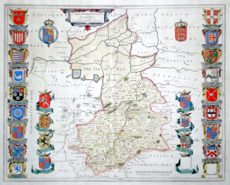
Cambridge 'Cantabrigiensis comitatus Cambridge shire' Blaeu, J. (c. 1645) 53 x 42 Very fine map of the County by Joan Blaeu. The map embodies the finest features of Dutch cartography of the seventeenth century. Superbly engraved and arranged, with a large number of coats of arms of aristocracy and various colleges. Arms of the university top right. Dutch text verso. Margins slightly trimmed but condition generally excellent. Original colour with an early wash colour to the county. 365.00 GBP |
|
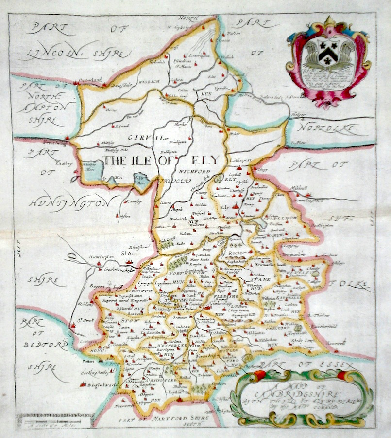
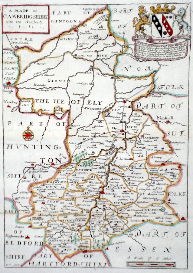
Cambridgeshire 'Cambridge Comitatus quem olim Iceni Infederunt' Kip, W. (1610) 32.5 x 29 Fine early map of the county by William Kip after Christopher Saxton. From the first English translation edition of Camden's Britannia. One of the earliest maps of the single county and predating Speed. No text verso. This copy with generous margins all round. Later colour. Relevant text will be sent with this map 260.00 GBP |

|
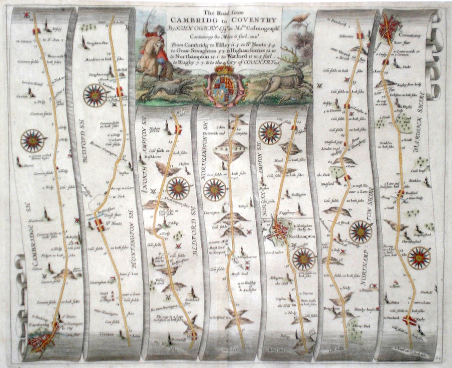
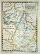
Cambridgeshire 'The Road from Cambridge to Coventry' Ogilby, J. (1698) 43 x 35 The road from Cambridge, to St Neots, Higham Ferrers, Northampton, Rugby, Coventry. From John Ogilby's Britannia, generally considered one of the most important cartographical works of the seventeenth century. Features include town plans of Cambridge, Northampton, Coventry and a fine cartouche. Later colour. Plate number 61. Excellent condition. 185.00 GBP |
|
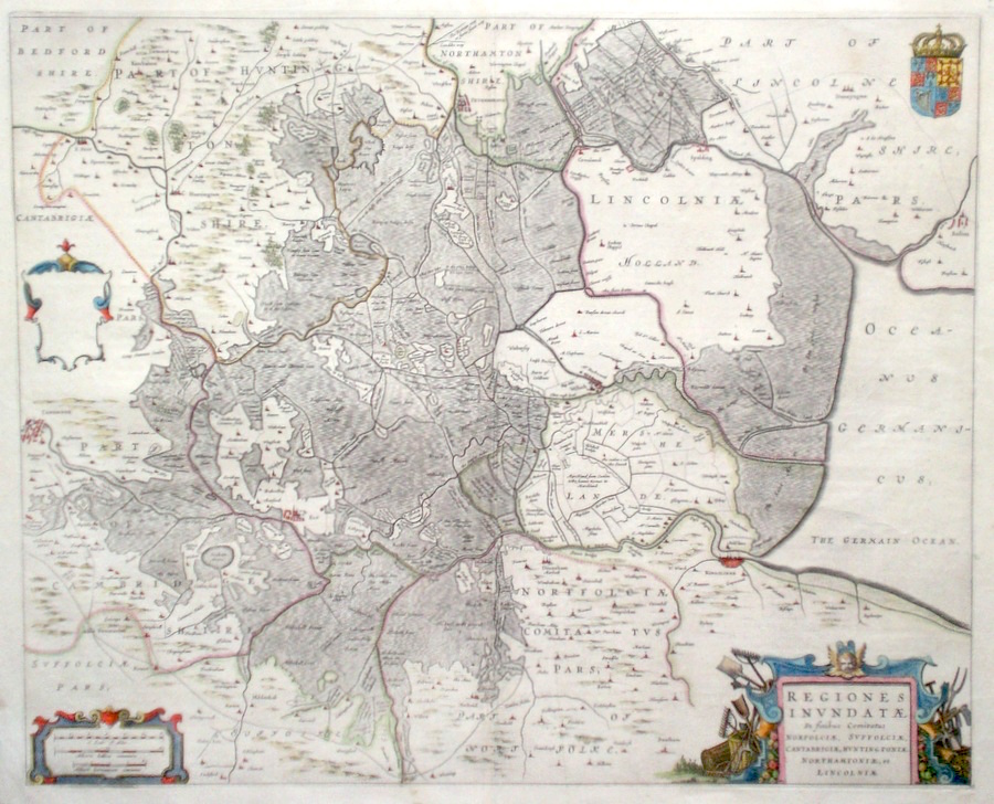
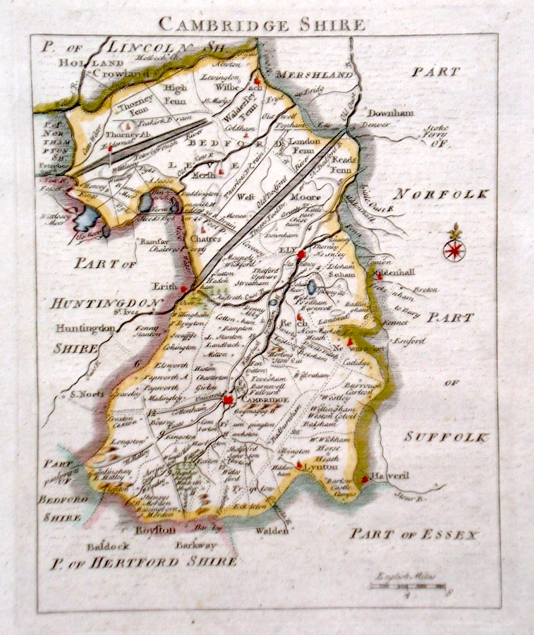
Cambridgeshire 'Regiones Inundatae...' Blaeu, J. (c. 1646) Unusual and attractive map of the fenlands by Johannes Blaeu. The area covered is the area south of the wash opening onto the North Sea. Bounded by several counties Norfolk, Suffolk, Cambridgeshire, Huntingdon, Northants and Lincolnshire. The area was later drained by Dutch and English engineers to provide increased farmland. The map is oriented to the west. North to the right. The shaded area represents the lower terrain. Thus the towns such as Wisbech, Ely etc are located on the unshaded and slightly higher land. Features also include a fine cartouche illustrating agricultural ways of life. Latin text verso, original hand colour. Excellent condition 180.00 GBP |
|
Cambridgeshire 'A Mapp of Cambridgshire' Blome, R. (1673) 27 x 30 Decorative map of the County by Richard Blome for his publication "Britannia". The largest series of county maps published by Blome, and generally based on those of Speed. Maps by Blome are characteristic and attractive. Fine condition, later colour. 140.00 GBP |
|
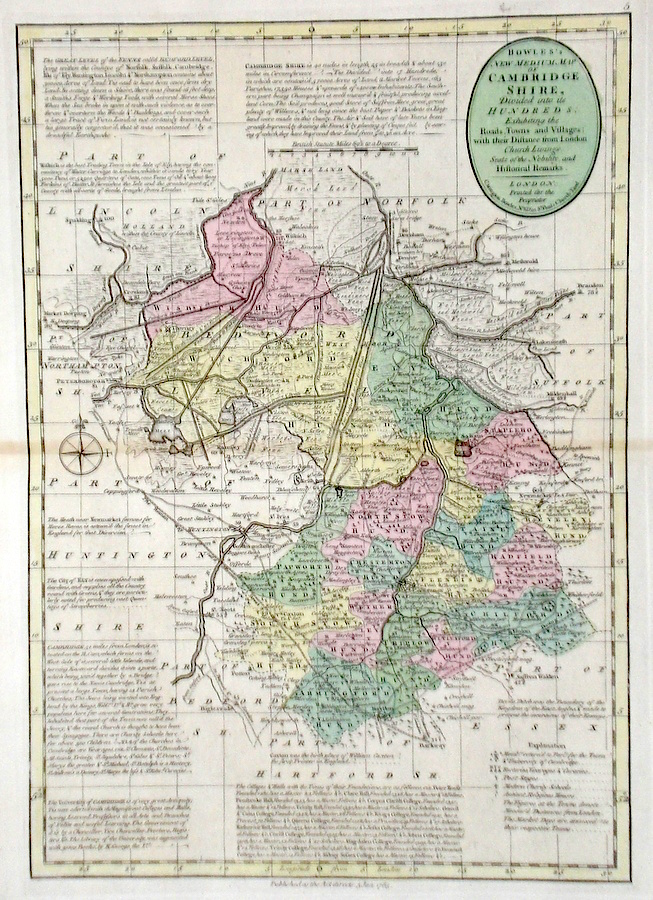
Cambridgeshire 'Bowles's New Medium Map of Cambridge shire...' Bowen, E. & T. (1785) 23 x 33 Finely engraved and detailed map of the county from "Bowles's New Medium English Atlas". The maps in this series are based on those in Emanuel and Thomas Bowen's Atlas Anglicanus, and feature extensive county information on the map. They are distinguished primarily by having newly engraved cartouches, distances from London added to towns, and different imprints at the bottom. Full original colour. Some slight offsetting to the left hand side, othewise Fine condition 125.00 GBP |
||||||||||||||
|
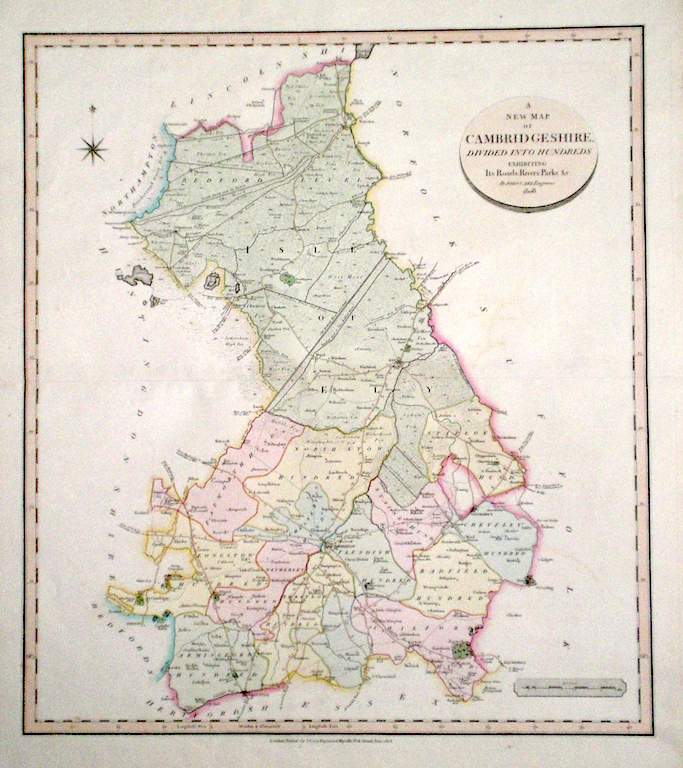
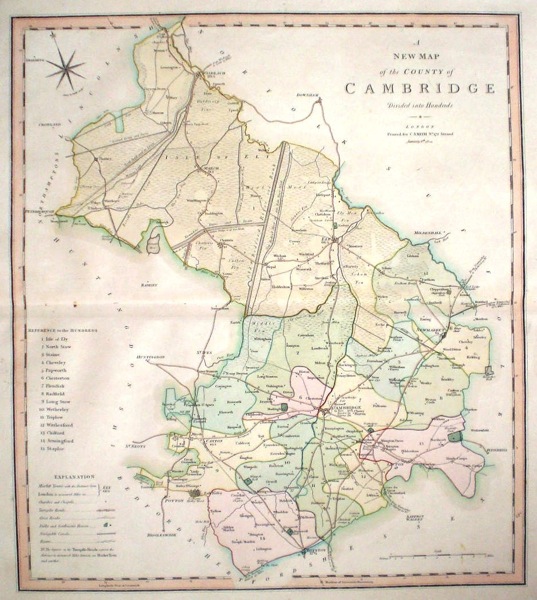
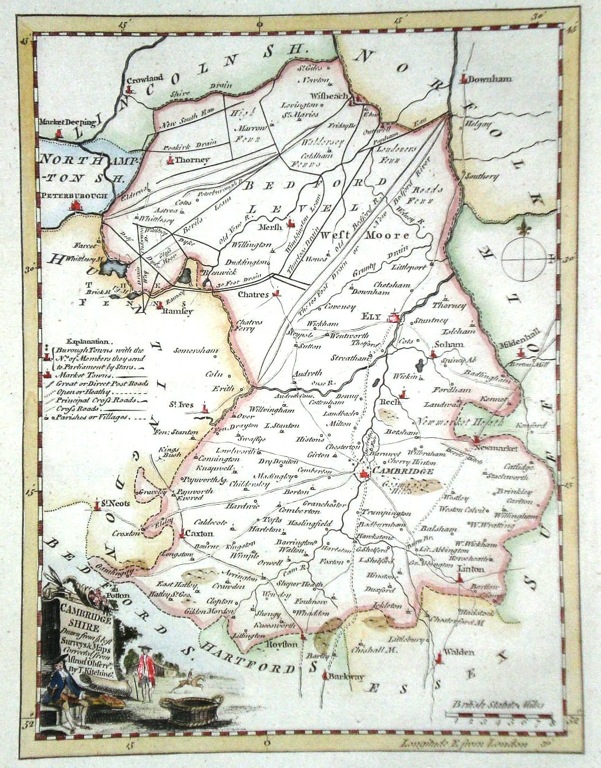
Cambridgeshire 'A New Map of Cambridgeshire divided into Hundreds exhibiting its Roads, Rivers, Parks...' Cary, J. (1809) 49 x 54 Superbly engraved map of the county by John Cary. From "Cary's New English Atlas". The atlas was issued in parts from 1801 to 1809 and published as a complete work in 1809. Very fine original hand colour. 95.00 GBP |
|
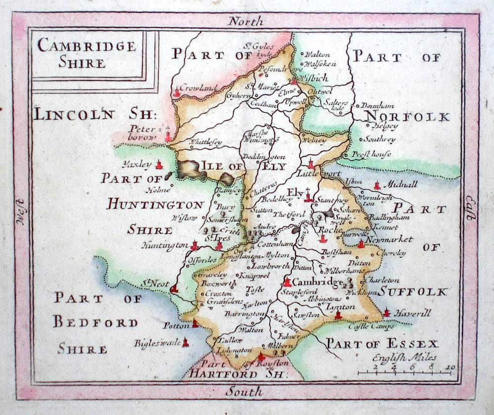
Cambridgeshire Nicholls, S. (c. 1722) 36 x 43 Attractive copperplate map of the County by Robert Morden and engraved by Sutton Nicholls published in the 1722 edition of Camden's Britannia. Later colour. 85.00 GBP |
|
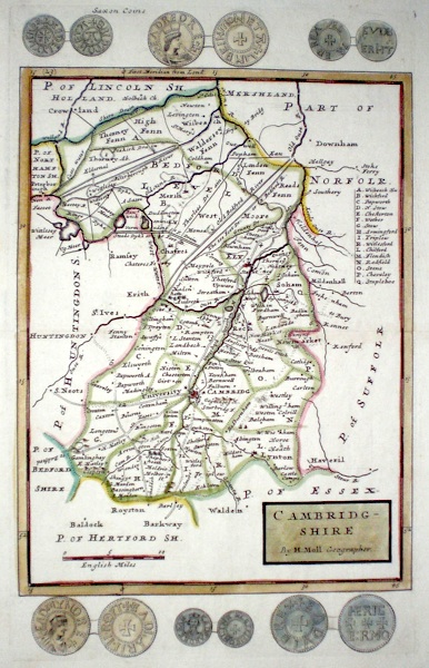
Cambridgeshire 'Cambridgeshire by H. Moll Geographer' Moll, H. (1724) 20 x 32 Fine early map of Cambridgeshire by Herman Moll. This map used for the publications "A New description of England and Wales…" and "A set of fifty new and correct maps of England and Wales..". Attractive original colouring and excellent condition. 85.00 GBP |
|
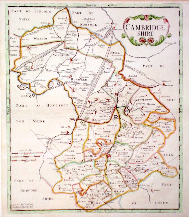
Cambridgeshire 'A Mapp of Cambridgshire with its Hundreds' Blome, R. (c. 1731) 18 x 25 Finely engraved map of the county by Richard Blome from the atlas "England Exactly Described or a Guide to Travellers…" first published by Thomas Taylor, but herewith from the later edition published by Thomas Bakewell. A major addition to the earlier plates is that roads and distances between towns are now included, after the road surveys of John Ogilby. On this map (dedication, top right) Bakewell has not erased the name of Blome. Fine condition. Later colour 80.00 GBP |
|
Cambridgeshire 'A New Map of the County of Cambridge divided into hundreds' Smith, C. (1804) 45 x 50 Large size and decorative map of the County by Jones, Smith & Co. for Smith's New English Atlas. The first map of the County to show longitudes measured from the meridian of Greenwich. Very fine original hand colouring. 75.00 GBP |
|
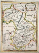
Cambridgeshire Cambridgeshire by Robt. Morden Morden, R. (1701 or poss. later) 16 x 21.5 From Morden's smaller series of county maps. The plates being used unaltered for various publications between 1701 and 1738. Later colour. Three cm remargin to bottom right border. 55.00 GBP |
|
Cambridgeshire An Improved Map of Cambridge-shire. Cowley, J. (1744) 13.5 x 19 Cambridgeshire from the rare publication "The Geography of England" Published by Robert Dodsley. Later hand colour 55.00 GBP |
|
Cambridge 'A Map of Cambridgeshire' Kitchin/Jefferys (1751) 13.5 x 18 Finely engraved map of the county by Thomas Kitchin and Thomas Jefferys from their publication "The Small English Atlas". This rare series of maps are distinctive by featuring considerable county information below the map. Later colour. 50.00 GBP |
|
Cambridgeshire Rocque, J. (c. 1769) 16 x 21 Finely engraved map of the county by John Rocque, for the publication "England Displayed". Later colour 50.00 GBP |
|
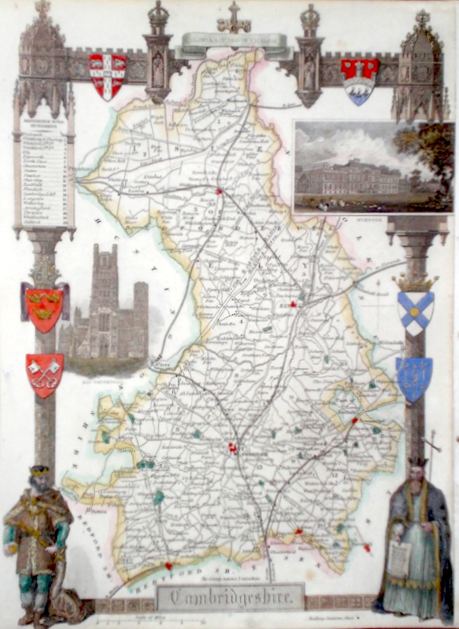
Cambridgeshire Moule T. (c. 1848) 20 x 26 Decorative Steel engraved map of the county by Thomas Moule. Inset views of Wimpole, and Ely Cathedral. Later colour. 50.00 GBP |
|
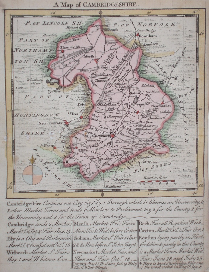
Cambridgeshire 'A Map of Cambridgeshire from the Authorities' Cary, J. Camden's Britannia (1798) 42 x 52.5 Finely engraved double page map. Strong dark impression, later hand colour to the hundreds. 50.00 GBP |
|
Cambridgeshire Collins, H. (1852) 38 x 43 Ornately decorative map produced by lithographic transfer. Later colour, good condition 48.00 GBP |
|
Cambridgeshire Kitchen, T. (c. 1786) 17 x 22 Finely engraved map of the county by Thomas Kitchin. From Alexander Hogg's "Historical descriptions of new and elegant picturesque views..." published in 1786. Later colour 45.00 GBP |
|
Cambridgeshire 'A New Map of Cambridgeshire Drawn from the Latest Authorities' Conder, T. (1784) 16 x 20 Finely engraved and decorative map of the county by Thomas Conder for the publication "The New British Traveller". Features include a cartouche of a rural scene and coat of arms. Later colour 45.00 GBP |
|
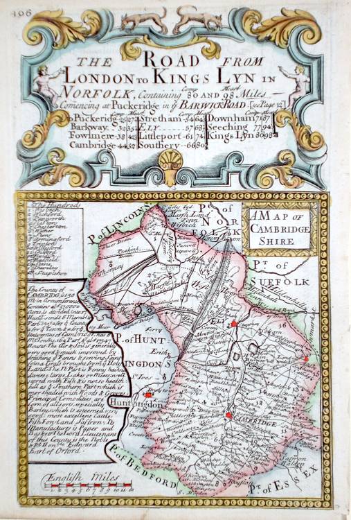
Cambridgeshire 'A Map of Cambridgeshire' Bowen E. (c. 1724) 12 x 19 Finely engraved map of the county by Emanuel Bowen and John Owen for the publication "Britannia Depicta". To the top are given details of the Road from London to Kings Lyn and verso the road from Hull to Flamborough Head is engraved. After John Ogilby. Later colour 40.00 GBP |
|
Cambridgeshire Seller, J. (c. 1703) 15 x 13 Fine map of the county by the Hydrographer and instrument maker John Seller for his "Anglia Contracta". This series of maps were first published in 1695. They were later used in a simplified form by Francis Grose for his "Supplement to the Antiquities of England and Wales", published from 1787. 40.00 GBP |
|
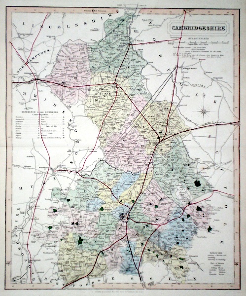
Cambridgeshire Walker J & C (c. 1860) 33 x 40 Finely engraved and detailed map of the county by John and Charles Walker from their “British Atlas”. Original colour. Excellent condition 40.00 GBP |
|
Cambridgeshire Becker, F. (c. 1842) 28 x 35 Detailed steel engraved map of the county with original colour. Published in Fisherís County Atlas, the only cartographical work from this company. 30.00 GBP |