Central America & The Caribbean
|
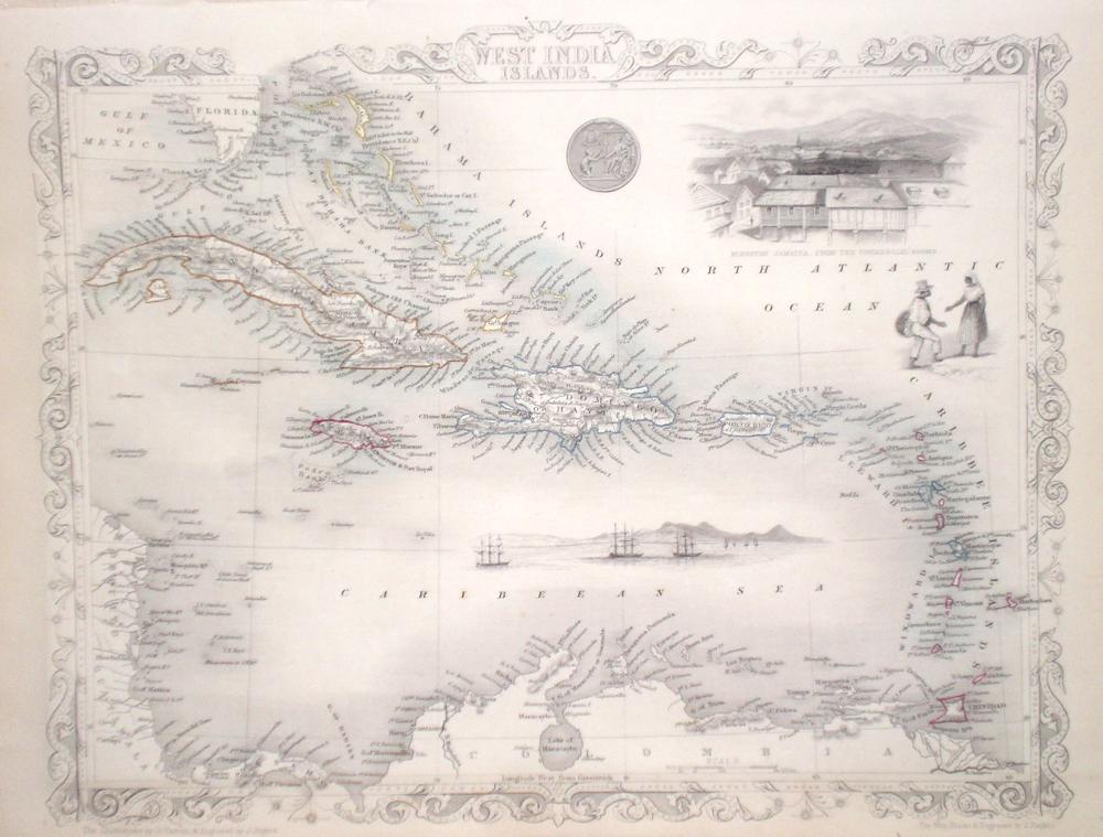
The West Indies Rapkin, J. (1851) 33 x 26 Attractive map of the area by John Rapkin, for John Tallis's highly decorative "The Illustrated Atlas". The vignettes show; Kingston, Jamaica from the commercial Rooms, Local people, Galleons at harbour. Single page (no central fold). Original colour as published. Condition fine. 80.00 GBP |


|
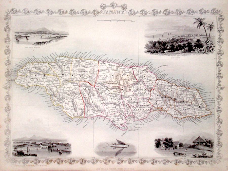
Jamaica Rapkin, J. (1851) 34 x 26 Fine map of Jamaica, engraved by John Rapkin, for John Tallis's highly decorative "The Illustrated Atlas". The vignettes show; Kingston, Port Royal Harbour, Port Antonio, a Flying Fish and a Sugar Mill. Single page map, (no central fold). Original colour as published. Condition fine. 75.00 GBP |
|
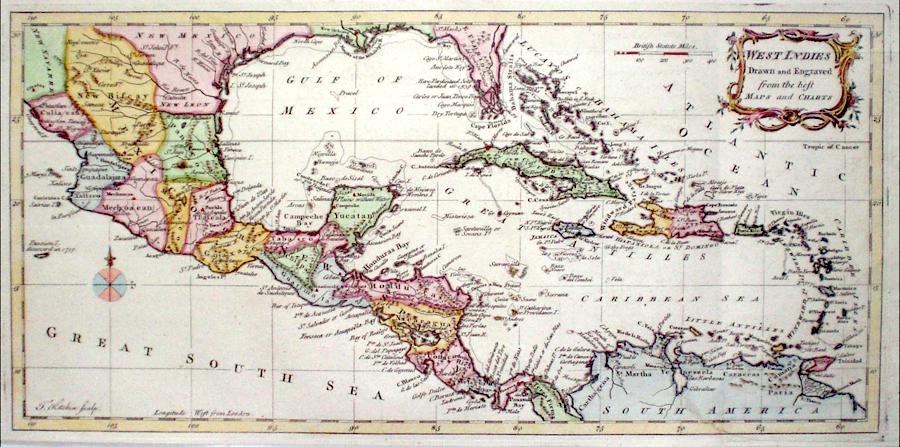
The West Indies Kitchin, T. (c. 1771) 38 x 18 Fine copperplate map of Mexico and the Caribbean area by Thomas Kitchin. Features also include Florida whose southern area is depicted as a group of Islands and much detail on the Pacific (Great South Sea) coast of Mexico. Later colour 70.00 GBP |
|
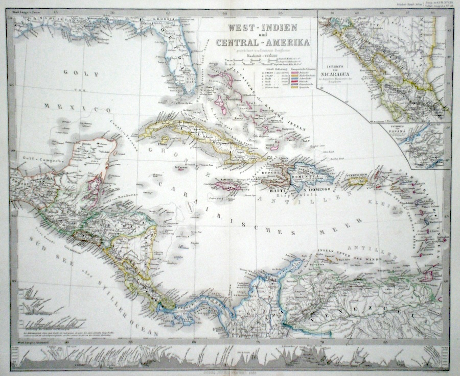
The West Indies 'West Indien and Central Amerika' Perthes, J. (1868) 41 x 34 Finely lithographed and detailed map covering The West Indies including , Central America, and the Caribbean. Inset maps show the Isthmus of Nicaragua and the Isthmus of Panama in detail. By Justus Perthes for Stieler's Hand-Atlas. A table along the bottom shows the heights of various mountain ranges occurring on the map. Original colouring, excellent condition. 60.00 GBP |
|
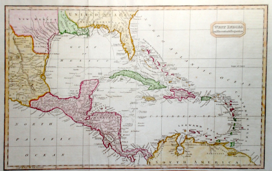
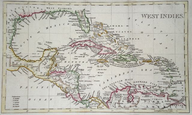
The West Indies 'West Indies on Mercator's Projection' Findlay, A. (c. 1820) 38 x 24 Fine map of the area engraved by Alexander Findlay and published by Thomas Kelly. In addition the map shows much of Central America and Mexico. To the North also delineated is East and West Florida. Condition excellent. Later colour 60.00 GBP |
|
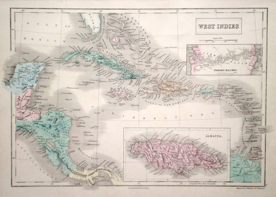
The West Indies Hall, S. (1854) 40 x 27 Finely engraved map of The West Indies, by Sidney Hall. Steel engraving published in the "General Atlas of The World". Inset maps of Jamaica and The Panama Railway. Condition excellent. 50.00 GBP |
|
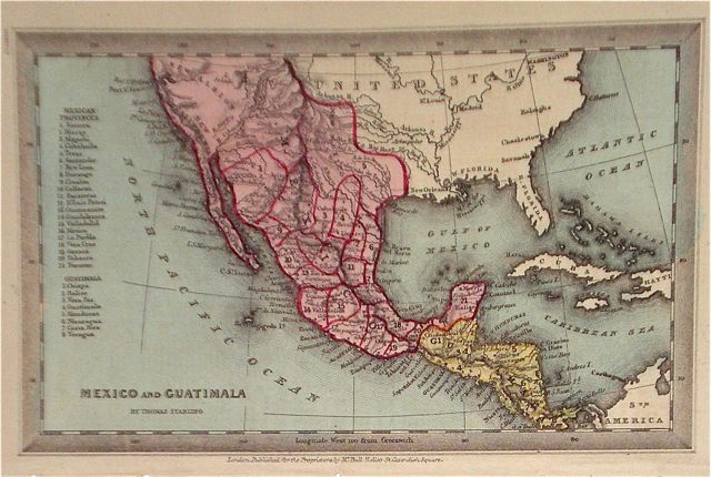
The Americas 'Mexico and Guatimala' Starling, T. (c. 1832) 15 x 9 Uncommon and finely engraved map of Mexico from The Royal Cabinet Atlas. The map shows no northern border for Mexico, which extends north of the 40 degee parallel. Bright original colouring. 45.00 GBP |
|
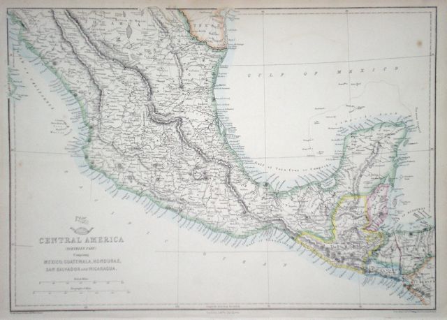
The Americas 'Central America (Northern Part)' Ettling, T. (1863) 43 x 31 Map of Mexico and including, Guatemala, Honduras, San Salvador and Nicaragua. Original colour. 40.00 GBP |
|
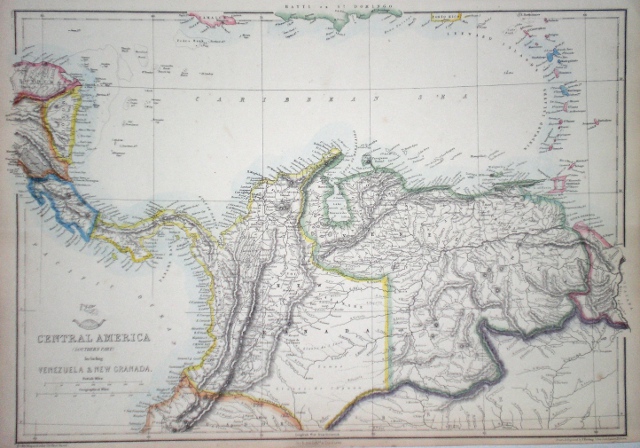
The Americas 'Central America (Southern Part)' Ettling, T. (1863) 45 x 32 Map of Northern South America bordering the Caribbean. Including Mosquito Coast, Costa Rica, Panama, Venezuela, and New Granada. Also including the Leeward and Windward Islands, Trinidad etc. Original colour. 35.00 GBP |
|
The Caribbean West Indies Walker's Gazeteer (1801) 32 x 19.5 Caribbean and Gulf of Mexico area. Later hand colour. Traces of old folds but generally good condition. 40.00 GBP |
|
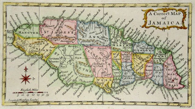
The Caribbean 'A Correct Map of Jamaica' Cole, B. (1760) 20 x 11 Jamaica engraved by Benjamin Cole. Rare copperplate engraving. Later hand colour. Excellent condition 50.00 GBP |