China & Japan
|
China 'A New and Accurate Map of China' Bowen, E. (1766) 43 x 35 Finely engraved and detailed map of China by Emanuel Bowen. The map is based primarily on earlier surveys by the Jesuit missionaries who surveyed the various provinces. Details are given in the panel top left. Features also include a fine cartouche depicting a rural scene in China. Condition excellent, a dark impression on thick paper. Later hand colour 395.00 GBP |


|
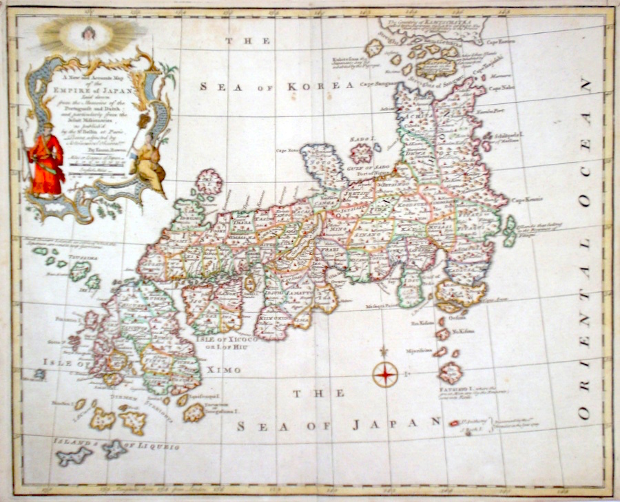
Japan 'A New and Accurate Map of the Empire of Japan' Bowen, E. (1766) 44 x 36 Finely engraved and detailed map of the Islands of Japan by Emanuel Bowen. The map is based primarily on earlier Dutch and Portuguese cartography and that of the Jesuit Martino Martini. Features include a fine cartouche depicting a Japanese military man and a Japanese lady. Condition excellent, a dark impression on thick paper. Later hand colour 385.00 GBP |
|
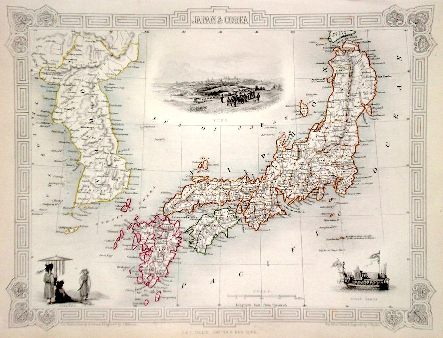
Japan 'Japan and Corea' Rapkin, J. (1851) 34 x 26 Fine map of Japan and Korea, engraved by John Rapkin, for John Tallis's highly decorative "The Illustrated Atlas". The vignettes show; Yedo, State Barge and Coreans. Single page map (no central fold). Original colour as published. Condition fine. 275.00 GBP |
|
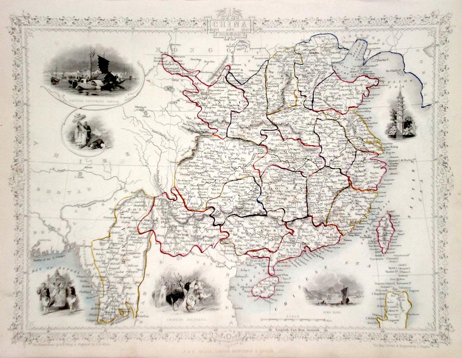
China 'China and Birmah' Rapkin, J. (1851) 34 x 26 Fine map of China and Birmah, engraved by John Rapkin, for John Tallis's highly decorative "The Illustrated Atlas". The vignettes show; Canton, Hong Kong, Chinese Soldiers, a Pagoda, Carrying Chair and A Nobleman with parasol bearer. Single page map, (no central fold). Original colour as published. Condition fine. 250.00 GBP |
|
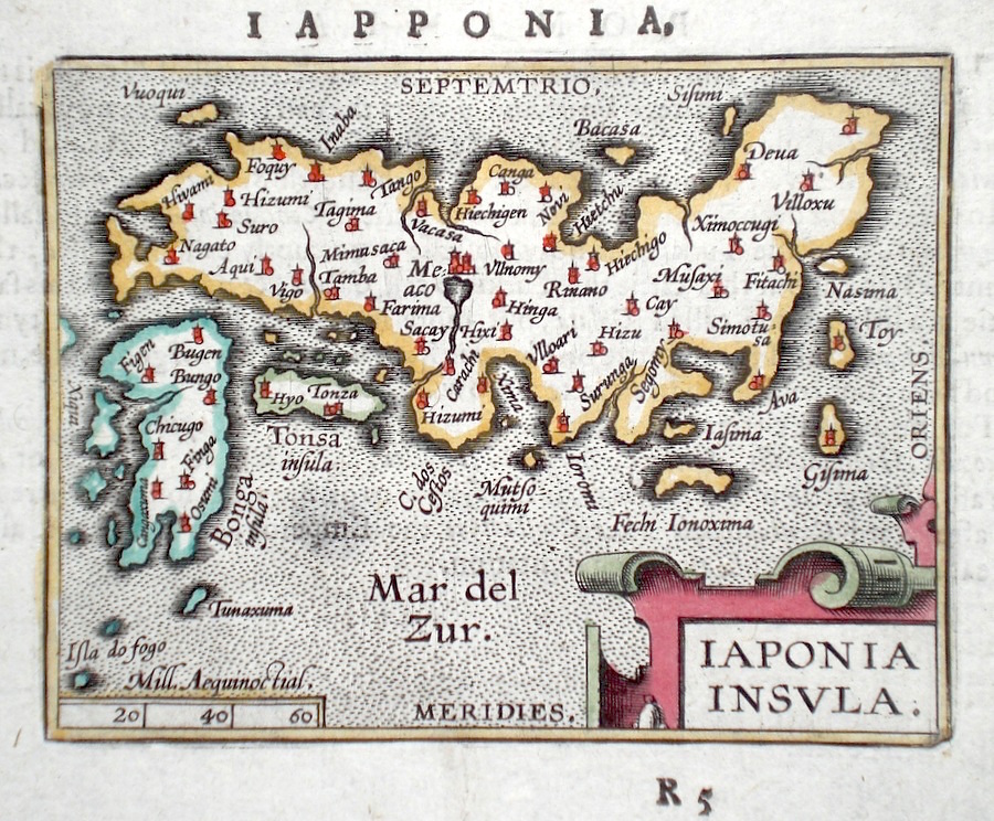
Japan 'Iaponia Insula' Ortelius, A. (c. 1603) 10 x 8.5 Fine early map of Japan by Abraham Ortelius, engraved in small format by Philippe Galle, and published in the Epitome, or pocket-edition of the "Theatrum Orbis Terrarum". This map from an English text edition of c.1603 published in London and thus one of the first world atlases published in England. Fine condition. Later colour 180 GBP |
|
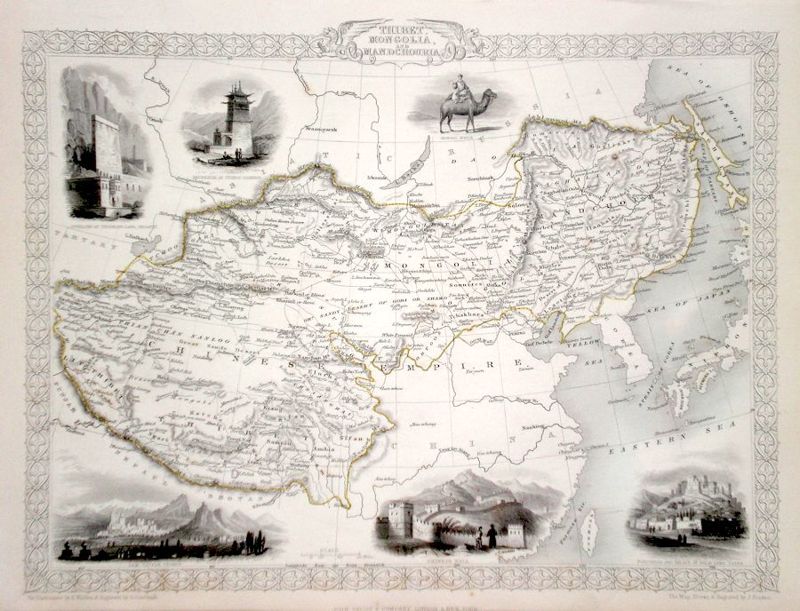
China 'Thibet, Mongolia and Mandchouria' Rapkin, J. (1851) 34 x 26 Fine map of Tibet and northern China, engraved by John Rapkin, for John Tallis's highly decorative "The Illustrated Atlas". The vignettes show; A Mongol Noble, Mausoleum at Teshoo Loomboo, Dwelling of Tessaling Lama, Leh Little Thibet, The Great Wall and The Palace of The Dalai Lama. Single page map (no central fold). Original colour as published. Condition fine. 140.00 GBP |
|
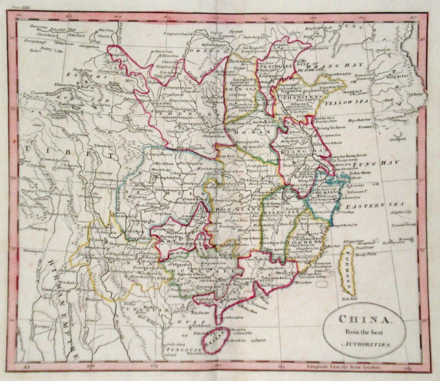
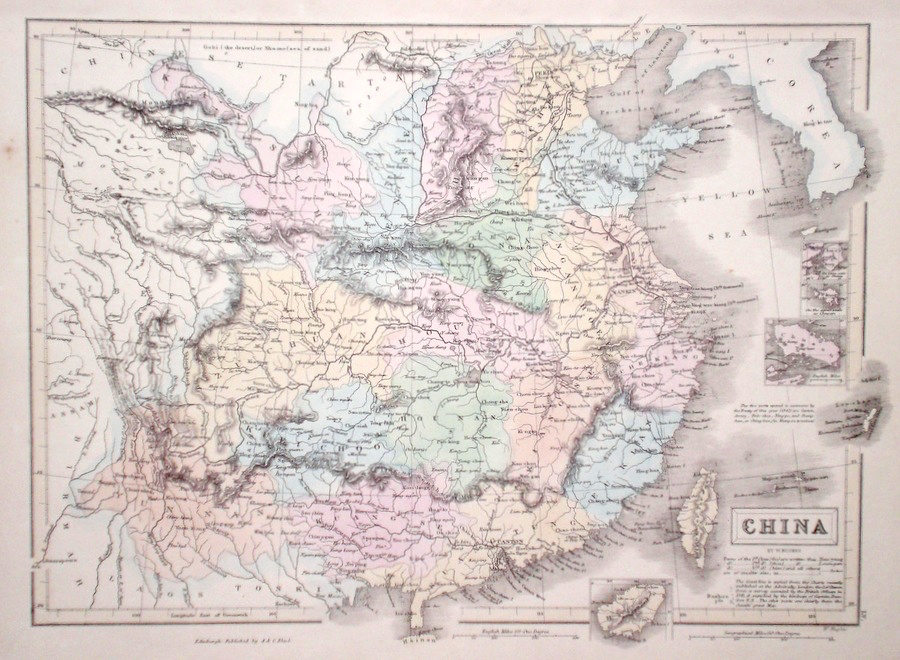
China 'China from the best Authorities' Russell, J. (1818) 22 x 19 China from Guthrie's Geography. Engraved by John Russell. Original hand colour. Excellent condition. 75.00 GBP |
|
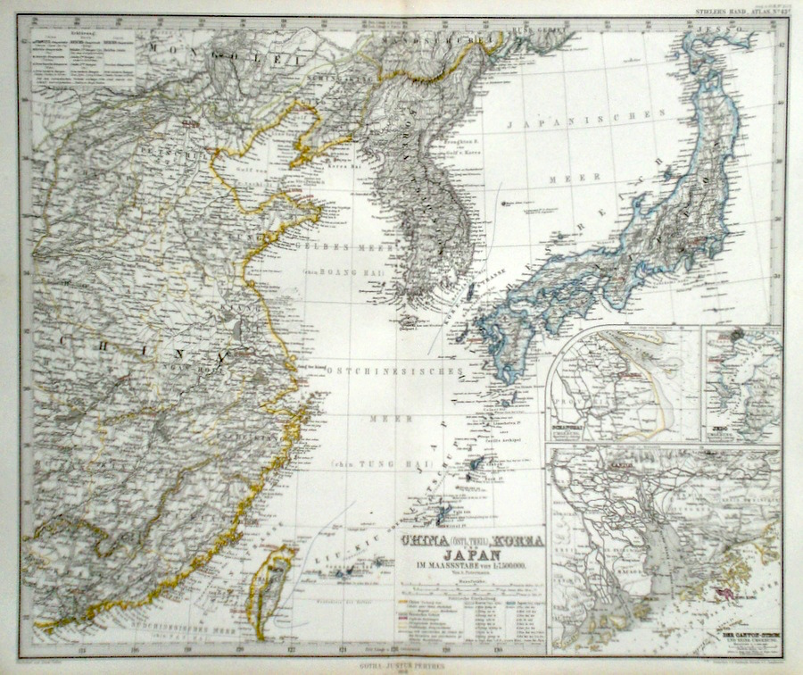
China & Japan 'Eastern China, Japan and Korea' Perthes, J. (1868) 41 x 35 Finely lithographed and detailed map covering Eastern China, Taiwan, Japan and Korea. Inset maps show Shanghai, Jedo, Canton and Macao with Hong Kong in detail. By Justus Perthes for Stieler's Hand-Atlas. Original colouring, excellent condition. 60.00 GBP |
|
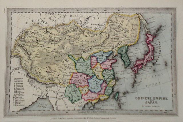
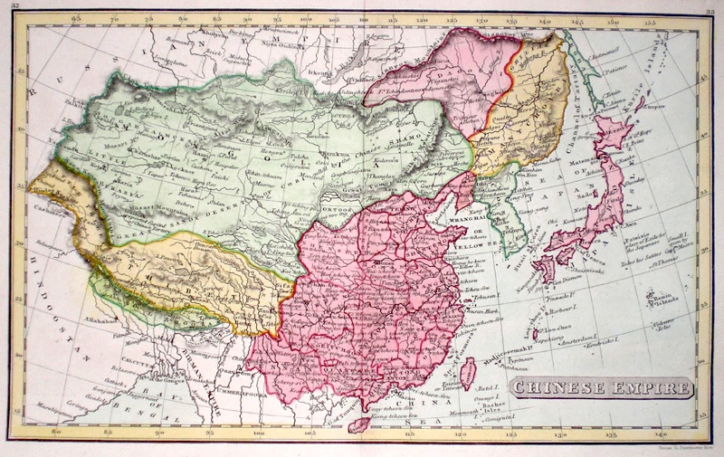
Asia 'Chinese Empire and Japan' Starling, T. (c. 1832) 15 x 9 Uncommon and finely engraved map of the two countries from The Royal Cabinet Atlas. Bright original colouring to the various countries. A numbered key identifies the various provinces of China 50.00 GBP |
|
China Hughes, W. (1854) 38 x 29 Finely engraved map of China, by William Hughes. Steel engraving published in the "General Atlas of The World". Inset maps of Hainan, Chusan, Islands. Condition excellent. 50.00 GBP |
|
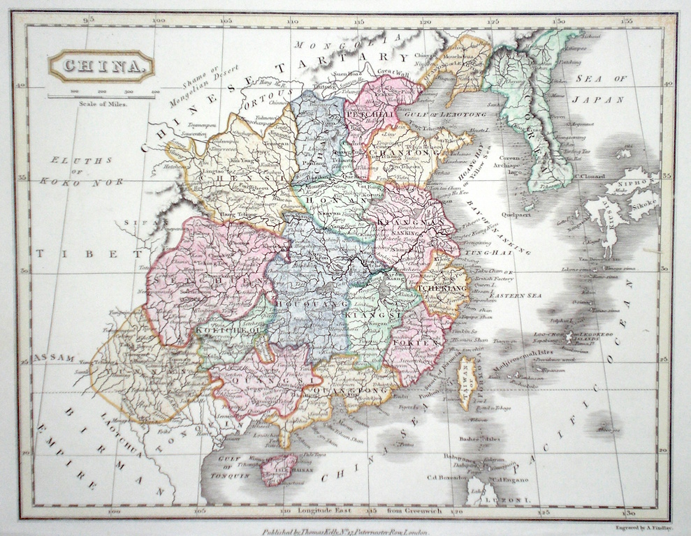
China & Japan Findlay, A. (c. 1820) 26 x 20 Attractive map of China engraved by Alexander Findlay. Later colour. 50.00 GBP |
|
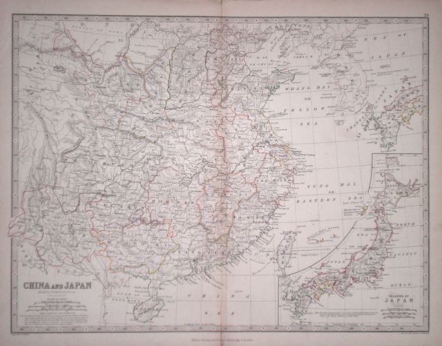
Asia 'China and Japan' Johnston, A. K. (1873) 44 x 33 Detailed map of China showing the provinces and noting Hong Kong, ceded to Britain in 1842. Inset map of Japan. Original colour 40.00 GBP |
|
China 'Chinese Empire' Fenner, R. (1828) 24 x 15 Highly detailed steel engraved map of Eastern Asia by Robert Fenner for “Fenner's Pocket Atlas”. Includes Mongolia, Tibet, Korea, Japan in addition to China. Central fold. Later full wash colour 30.00 GBP |
|
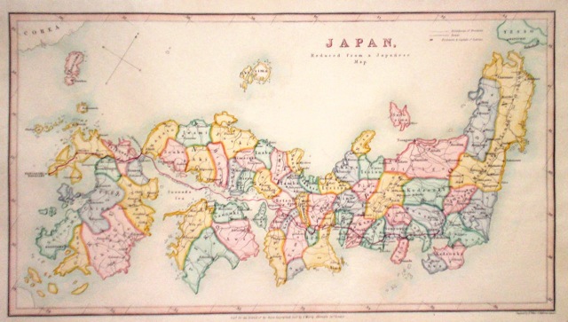
Japan Weller, E. (c. 1880) 37 x 21 Finely engraved map of the country showing the various provinces, by Edward Weller for the Journal of the Royal geographical Society, published by John Murray. Later colour 75.00 GBP |
|
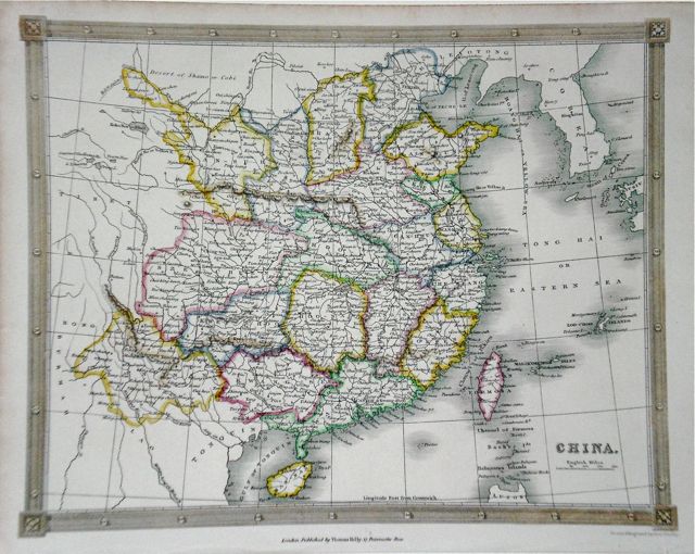
China Kelly, T. (c. 1850) 25 x 20 Detailed steel engraved map with later outline colour to the regions 30.00 GBP |