Derbyshire
Including Derby, Chesterfield, Glossop, Ilkeston, Long Eaton, Swadlincote, Buxton, Matlock, Ashbourne
|
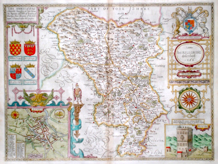
Derbyshire 'Anno Darbieshire described' Speed, J. (c. 1676) 51 x 39 Superb map of the county by John Speed, Bassett and Chiswell edition. Published in 1676 the plate carries the unaltered date of the preceeding Roger Rea edition, 1666. Features include arms of the Earls of Derby and a fine town plan of Derby. A fine copy with generous margins on thick paper. English text verso. Later colour 500.00 GBP |


|
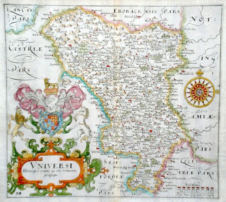
Derbyshire 'Universi Derbiensis Comitatus qui olim Coritanorum fuit descriptio' Saxton/Hole (1637) 32 x 29 Finely engraved early map of Derbyshire by William Hole after Christopher Saxton. Later colour, fine condition. 180.00 GBP |
|
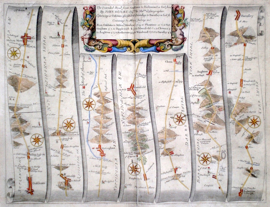
Derbyshire 'The Extended Road from Oakham to Richmond in Yorkshire' Ogilby, J. (c. 1698) 44 x 34 The road from Oakham to Melton Mowbray, Plumtree, Nottingham, Mansfield, Aughton, Rotherham, Barnsley. From John Ogilby's Britannia, generally considered one of the most important cartographical works of the seventeenth century. Features include town plans of Nottingham, Oakham, Mansfield and a fine cartouche depicting mythical beings. Later colour. Plate number 48. Excellent condition 160.00 GBP |
|
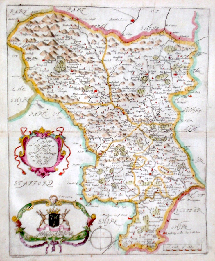
Derbyshire 'A Mapp of the County of Darbye...' Hollar, W. (1673) 26 x 32 Decorative map of the County by Richard Blome for his publication "Britannia". The largest series of county maps published by Blome, and generally based on those of Speed. Maps by Blome are characteristic and attractive. Fine condition, later colour. 140.00 GBP |
|
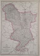
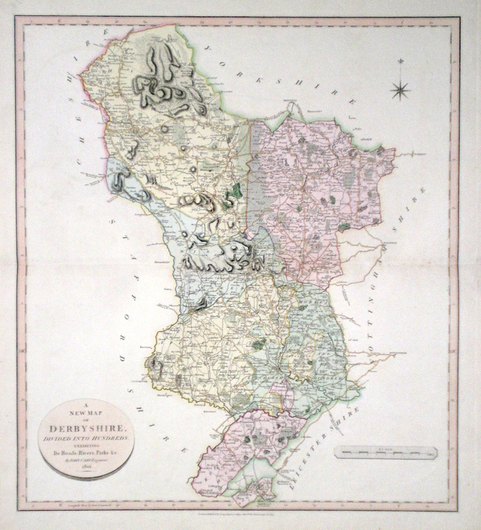
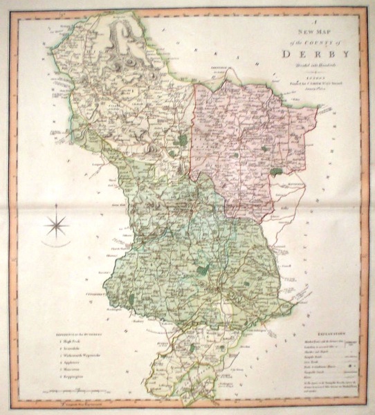
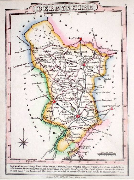
Derbyshire 'A New Map of Derbyshire divided into Hundreds exhibiting its Roads, Rivers, Parks...' Cary, J. (1809) 49 x 54 Superbly engraved map of the county by John Cary. From "Cary's New English Atlas". The atlas was issued in parts from 1801 to 1809 and published as a complete work in 1809. Very fine original hand colour. 90.00 GBP |
|
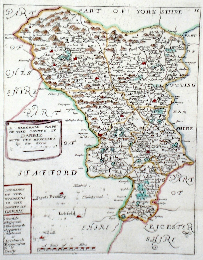
Derbyshire 'A Generall mapp of the County Of Darbie with its Hundreds by Ric Blome' Blome, R. (c. 1731) 19 x 24 Finely engraved map of the county by Richard Blome from the atlas "England Exactly Described or a Guide to Travellers…" first published by Thomas Taylor, but herewith from the later edition published by Thomas Bakewell. A major addition to the earlier plates is that roads and distances between towns are now included, after the road surveys of John Ogilby. Here Bakewell has not removed the name of Blome from the plate as is usually the case. Fine condition. Later colour 80.00 GBP |
|
Derbyshire 'Darbyshire by Robt. Morden' Morden, R. (1722) 42 x 36 Finely engraved Map of the county by Robert Morden. From the 1722 edition of Camden's Britannia. Excellent condition with later colour. 75.00 GBP |
|
Derbyshire 'A New Map of the County of Derby divided into hundreds' Smith, C. (1804) 45 x 50 Large size and decorative map of the County by Jones, Smith & Co. for Smith's New English Atlas. The first map of the County to show longitudes measured from the meridian of Greenwich. Very fine original hand colouring. 70.00 GBP |
|
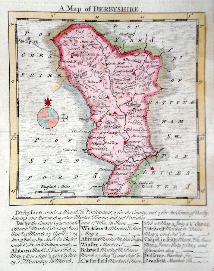
Derbyshire 'A Map of Derbyshire' Kitchin/Jefferys (1751) 13.5 x 18 Finely engraved map of the county by Thomas Kitchin and Thomas Jefferys from their publication "The Small English Atlas". This rare series of maps are distinctive by featuring considerable county information below the map. Later colour 60.00 GBP |
|
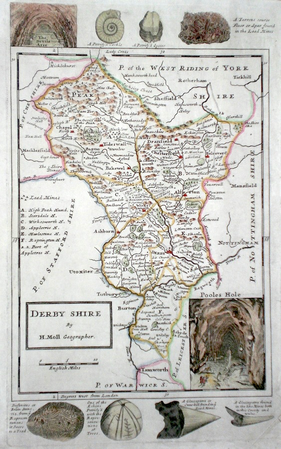
Derbyshire Moll, H. (c. 1724) 20 x 32 Finely engraved map of the county by Herman Moll for the publication "A New Description of England and Wales…" The maps in this series include engraved borders of local architectural and antiquarian interest. A unique feature. On this map various fossils, mineral formations and local caverns including Pooles Hole. Later colour, fine condition. 60.00 GBP |
|
Derbyshire Rocque, J. (c. 1769) 16 x 21 Finely engraved map of the county by John Rocque for the publication "England Displayed". Later colour. 50.00 GBP |
|
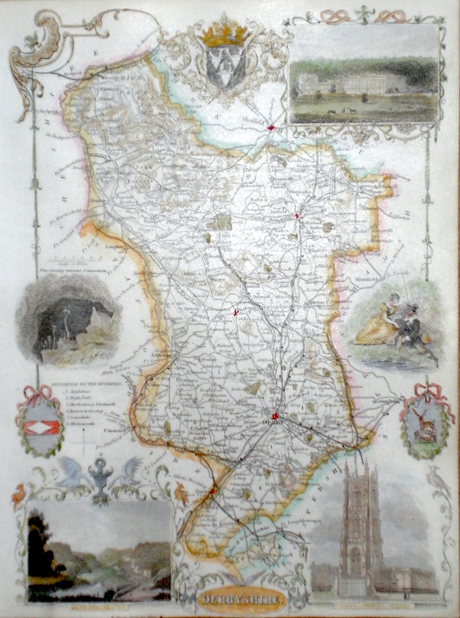
Derbyshire Moule, T. (c. 1850) 20 x 27 Attractive steel engraved map by Thomas Moule. Moule was a heraldry expert and antiquarian and the attractive embellishments on his maps make them amongst the last of the decorative maps to be published. Later colour. Good condition with margins. 45.00 GBP |
|
Derbyshire Becker, F. (c. 1842) 28 x 35.5 Detailed steel engraved map of the county with original colour. Published in Fisher's County Atlas, the only cartographical work from this company. 40.00 GBP |
|
Derbyshire 'A Map of Derbyshire from the Authorities' Cary, J. Camden's Britannia (1798) 38 x 52 Double page finely engraved map showing the hundreds. Good condition and good margins. 50.00 GBP |
|
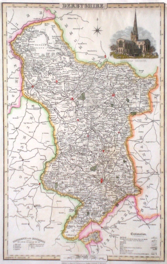
Derbyshire Pigot, J. (c. 1826) 23 x 36 Finely engraved map of the county by James Pigot and Co. An early edition ca.1826. A particular feature of this series of county maps is the attractive accompanying vignette. In this case a view of Ashbourn Church. Re-margined to the top, generally good condition. Later colour 50.00 GBP |
|
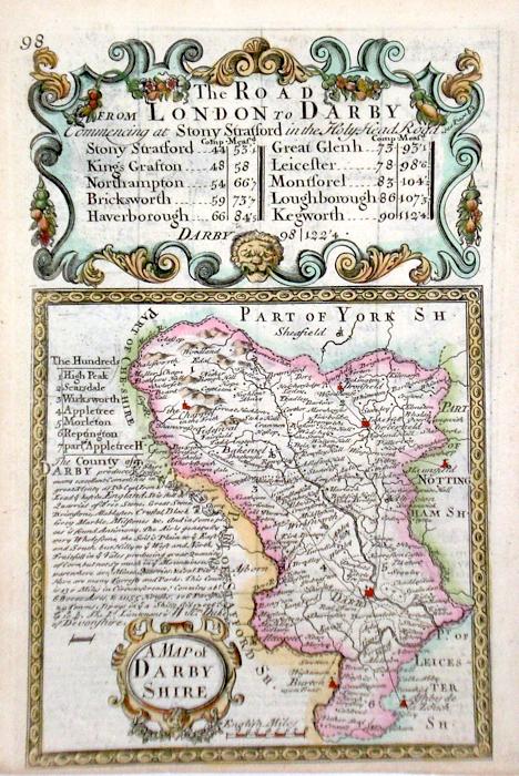
Derbyshire 'A Map of Darbyshire' Bowen, E. (c. 1724) 12 x 19 Finely engraved map of the County by Emanuel Bowen and John Owen for the publication "Britannia Depicta". To the top are given details of the Road from London to Darby and verso the road from Midchurch to Winchester in Hampshire is featured. After John Ogilby. Later colour 40.00 GBP |
|
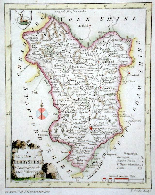
Derbyshire 'A New Map of Derbyshire Drawn from the latest Authorities' Conder, T. (c. 1784) 16 x 21 Finely engraved map of the county by Thomas Conder for the publication 'The New British Traveller' Features include a Coat of Arms, and decorative title cartouche. Later colour 40.00 GBP |
|
Derbyshire Lewis, W. (c. 1835) 10 x 14 Detailed and attractive miniature map of the Region by William Lewis for his "Lewis's New Traveller's Guide". A particular feature of this charming series of maps is the clear and precise engraving of the roads. Adjacent numbers indicating the distances from London. Also included with the map is the accompanying page of text giving the county information relevant to travellers,- principal towns and inns are listed, distances between towns, principal fair dates, and even sites for the best views of the county. Later colour. 35.00 GBP |
|
Derbyshire Dispatch Atlas (1863) 31 x 44 Early outline colour. 20.00 GBP |