Dorset
Including Dorchester, Poole, Weymouth, Sherborne, Wimborne Minster, Shaftesbury
|
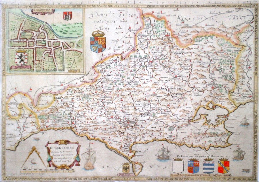
Dorset 'Dorsetshire, Described by C. Saxton. Corrected and amended with many additions as Roads &c, by P. Lea.' Saxton, C. (c. 1693) 54 x 38 Superb map of the County by Christopher Saxton. This edition published by Philip Lea. The plate differs from Saxton's original mainly by removal of some embellishments and addition of a town plan (Dorchester) after John Speed and roads after Ogilby. Saxton's atlas, with in many cases the first maps of single English counties set the standard for English cartography until the mid eighteenth century. Later colour. Fine condition 595.00 GBP |
||||||||||||||


|
Hampshire & Dorset
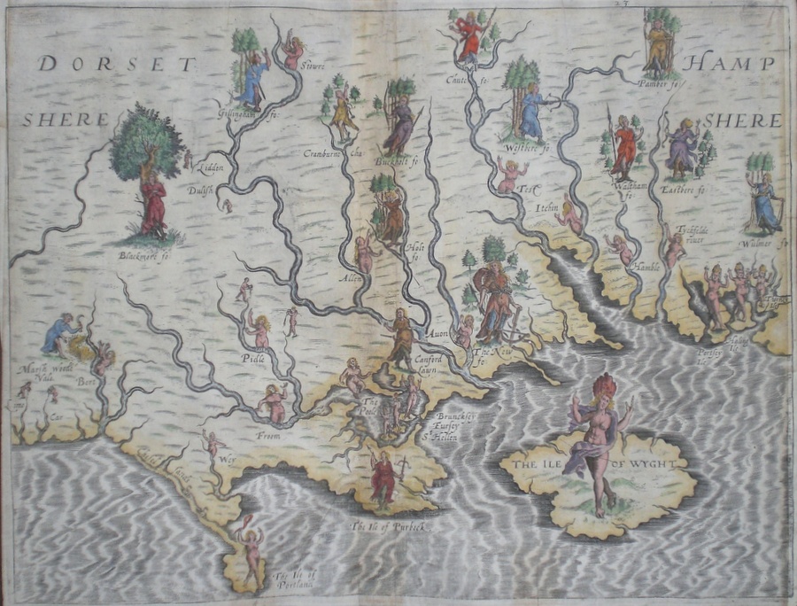
'Hampshere Dorsetshere' Hole, W. (1613) 33.5 x 25 Decorative and rare engraving representing the Hampshire and Dorset counties and Isle of Wight by William Hole for Michael Drayton’s Polyolbion. Richly decorated with many water nymphs, huntsmen, farmworkers, and allegorical figures to illustrate the main topographical features, river system, towns etc. Later colour. This copy with reinstated neat lines to the left and right otherwise in excellent condition. Michael Drayton (1563-1631) was an important poet and literary figure. A contemporary of Shakespeare and Spenser, the Polyolbion is considered to be his masterpiece. He is buried in Westminster Abbey 365.00 GBP |
||||||||||||||
|
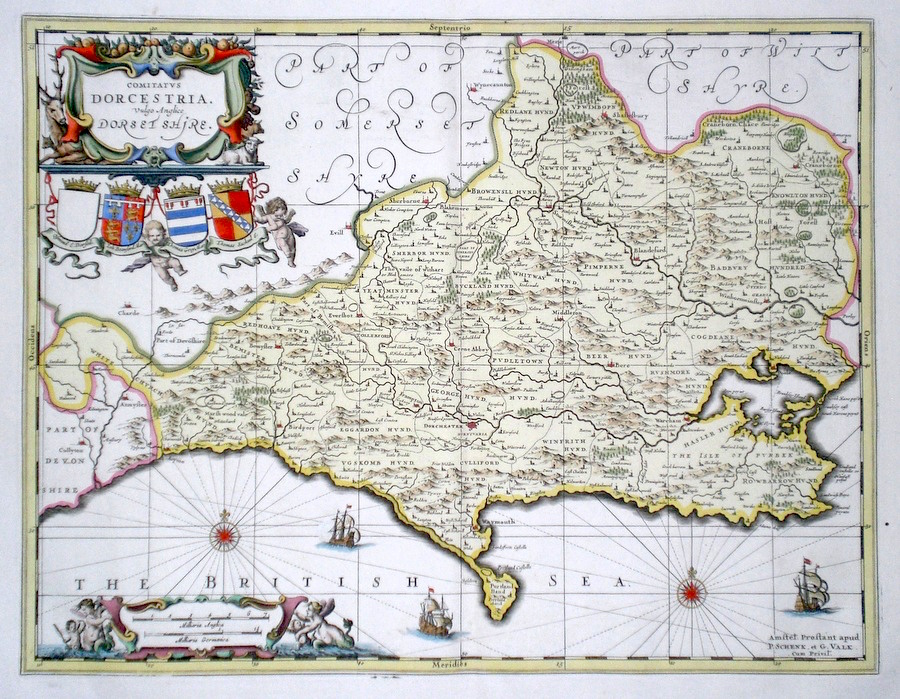
Dorset 'Comitatus Dorcestrie: vulgo Anglice Dorset Shire' Schenk, P & Valk, G (c. 1715) 49 x 38 Finely engraved map. Early body colour to county, hand-coloured cartouche and embellishments. Full margins. 320.00 GBP |
|
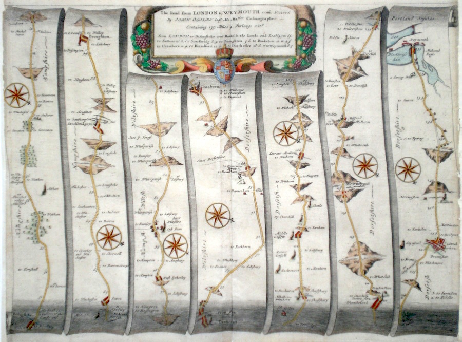
Dorset 'The Road from London to Weymouth com. Dorset' Ogilby, J. (1698) 46 x 34 The Road from Basingstoke to Sutton, Stockbridge Broughton, Dunketon, Cranborne, Blandford, Dorchester, Weymouth. From John Ogilby's Britannia, generally considered one of the most important cartographical works of the seventeenth century. Features include town plans of Dorchester and Weymouth, and a fine cartouche. Later colour. Plate number 53. Slight Trimming to the right and left margin, remargined but otherwise Excellent condition. 180.00 GBP |
||||||||||||||
|
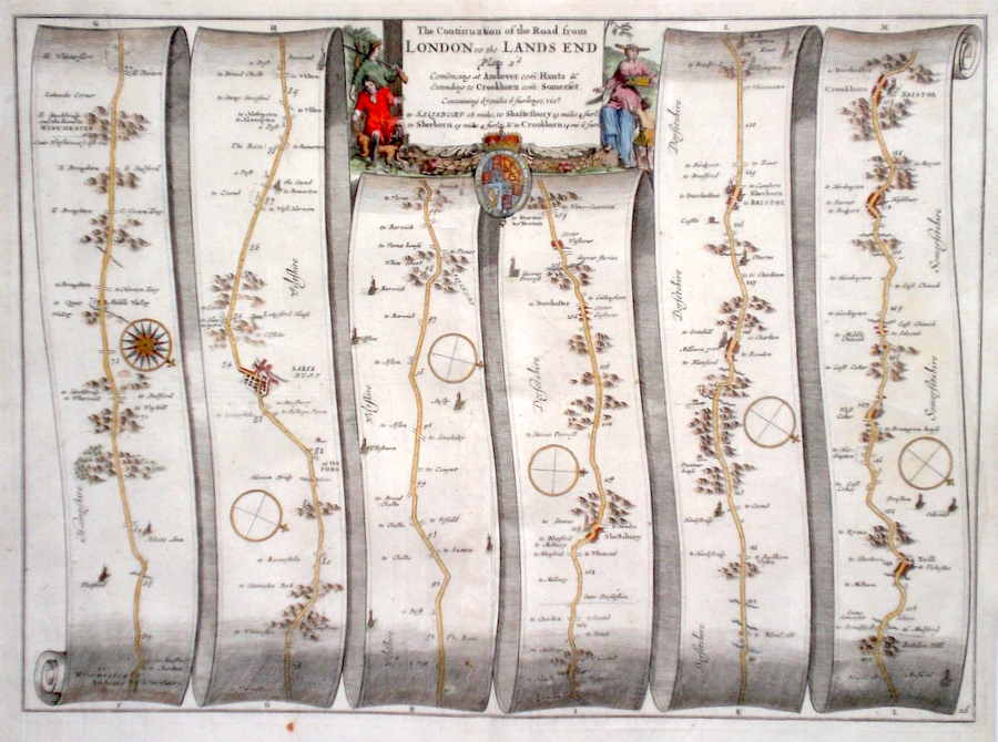
Dorset 'The Continuation of the Road from London to the Lands End' Ogilby, J. (1698) 44 x 32 The Continuation of the Road to Lands End from Andover, Salisbury, Shaftesbury, Sherborne, Crewkerne. From John Ogilby's Britannia, generally considered one of the most important cartographical works of the seventeenth century. Features include town plan of Salisbury, and a fine cartouche depicting local aristocratic gentlemen and lady in a rural scene. Later colour. Plate number 26. Excellent condition. 180.00 GBP |
||||||||||||||
|
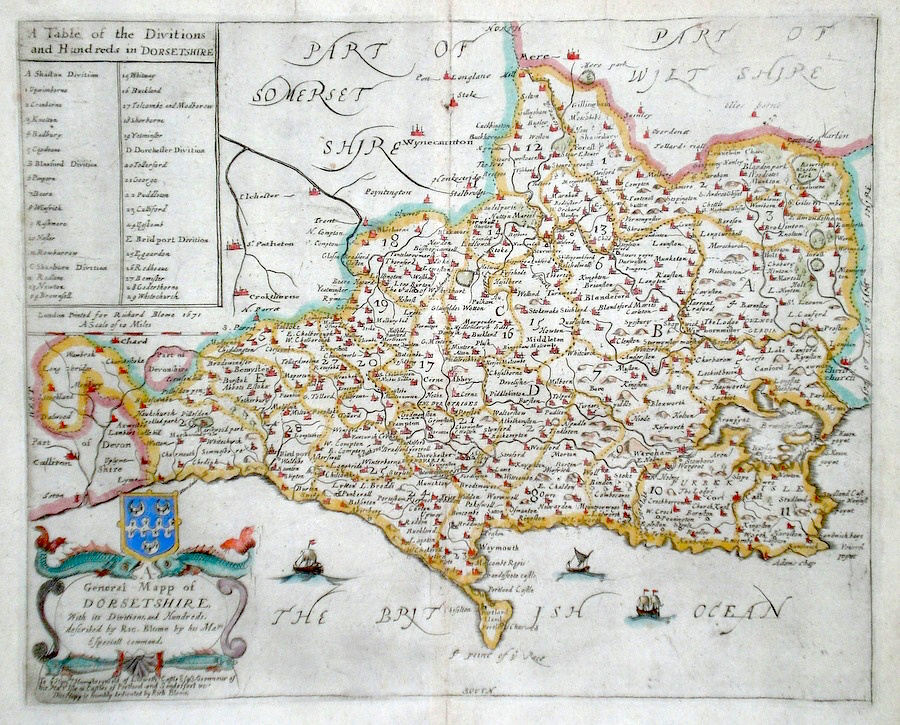
Dorset 'A General Mapp of Dorsetshire...' Blome, R. (1673) 32 x 26 Decorative map of the County by Richard Blome for his publication "Britannia". The largest series of county maps published by Blome, and generally based on those of Speed. Maps by Blome are characteristic and attractive. Fine condition, later colour. 180.00 GBP |
||||||||||||||
|
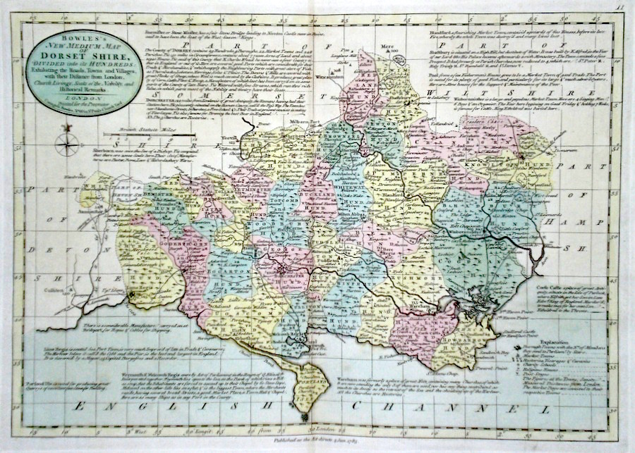
Dorset 'Bowles's New Medium Map of Dorset shire...' Bowen, E. & T. (1785) 33 x 23 Finely engraved and detailed map of the county from "Bowles's New Medium English Atlas". The maps in this series are based on those in Emanuel and Thomas Bowen's Atlas Anglicanus, and feature extensive county information on the map. They are distinguished primarily by having newly engraved cartouches, distances from London added to towns, and different imprints at the bottom. Full original colour. Fine condition. 150.00 GBP |
||||||||||||||
|
Dorset 'Dorsetshire by Robt. Morden' Morden, R. (1722) 42.5 x 37 Superbly engraved and decorative map of the county by Robert Morden. From the 1722 edition of Camden's Britannia. Excellent condition with good margins. Later colour. 140.00 GBP |
|
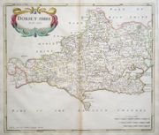
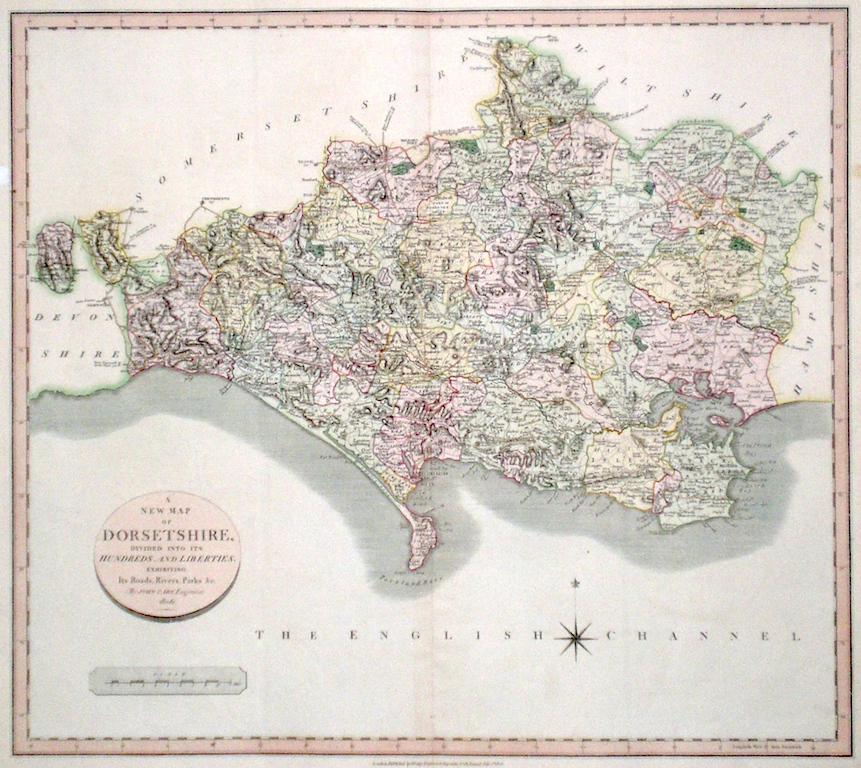
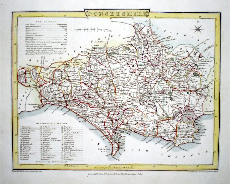
Dorset 'A New Map of Dorsetshire divided into Hundreds exhibiting its Roads, Rivers, Parks...' Cary, J. (1809) 54 x 49 Superbly engraved map of the county by John Cary. From "Cary's New English Atlas". The atlas was issued in parts from 1801 to 1809 and published as a complete work in 1809. Very fine original hand colour. 120.00 GBP |
|
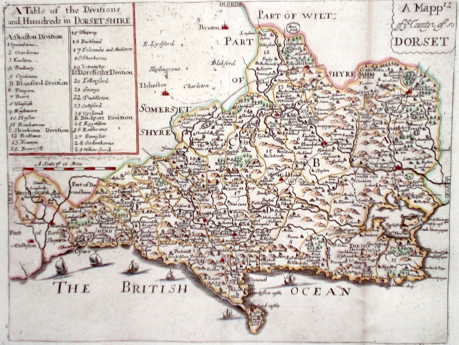
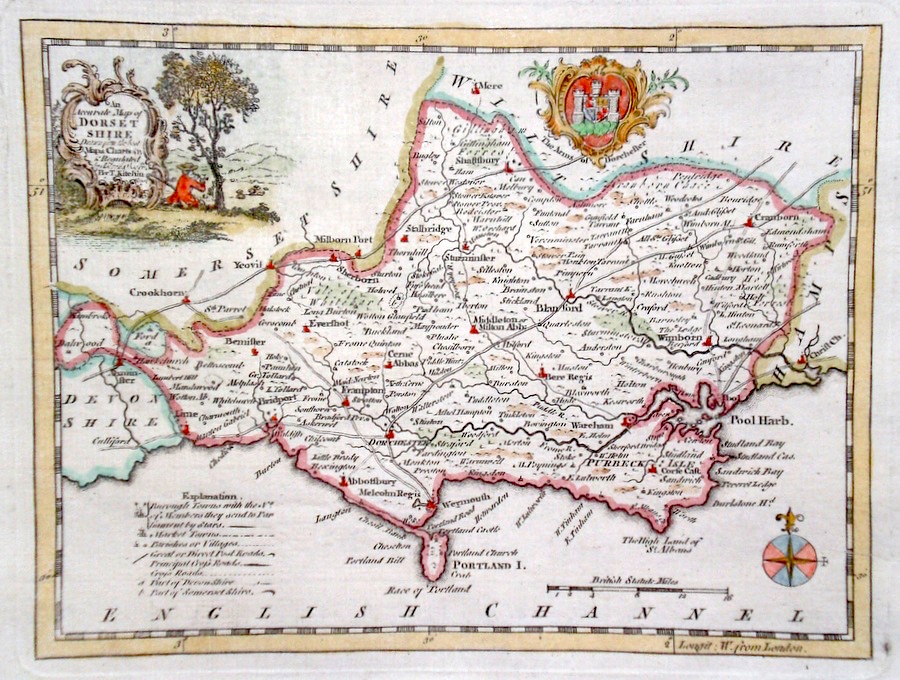
Dorset 'A Mapp of ye County of Dorset' Blome, R. (c. 1731) 25 x 19 Finely engraved map of the county unsigned but probably by Blome from the atlas "England Exactly Described or a Guide to Travellers…" first published by Thomas Taylor, but herewith from the later edition published by Thomas Bakewell. A major addition to the earlier plates is that roads and distances between towns are now included, after the road surveys of John Ogilby. Bakewell has erased the name of Blome. Fine condition. Later colour 120.00 GBP |
|
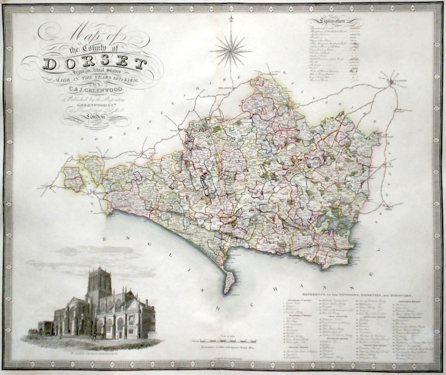
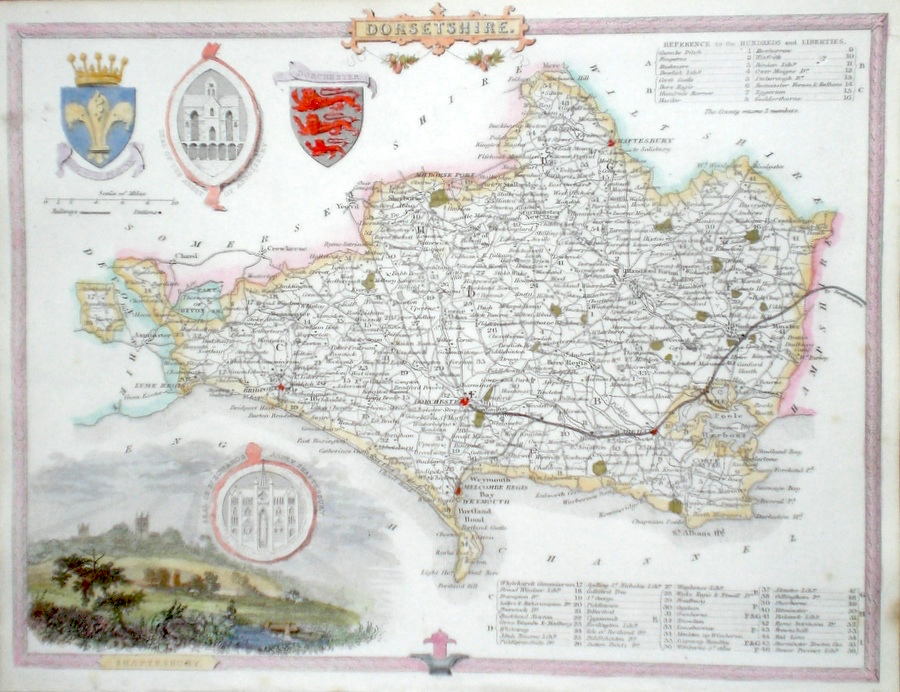
Dorset 'Map of the County of Dorset, from an Actual Survey made in the years 1825 and 1826' Frost, H. (1829) 69 x 58 Finely engraved and detailed map of the county by Christopher and John Greenwood. The brothers published their county maps from their original surveys over the period 1817 until 1833, and then in 1834 as an atlas. With their large size, accuracy and decorative vignettes the maps are generally recognised as being amongst the finest published in England in the nineteenth century. On this map the vignette is of St. Mary's Church, Sherborne. Original hand colouring. 120.00 GBP |
|
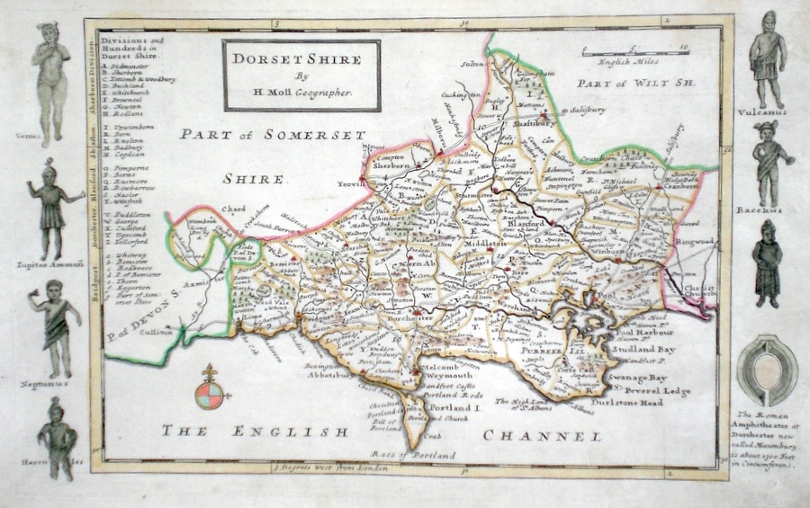
Dorset Moll, H. (c. 1724) 32 x 20 Finely engraved map of the county by Herman Moll for the publication "A New Description of England and Wales…" The maps in this series include engraved borders of local architechtural and antiquarian interest. A unique feature. On this map effigies of Roman gods and a diagram of the ampitheatre at Dorchester. Later colour, fine condition. 70.00 GBP |
|
Dorset 'A Map of Dorsetshire' Kitchin/Jefferys (1751) 13.5 x 18 Finely engraved map of the county by Thomas Kitchin and Thomas Jefferys from their publication "The Small English Atlas". This rare series of maps are distinctive by featuring considerable county information below the map. Later colour 60.00 GBP |

|
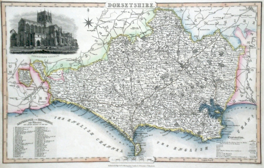
Dorset Pigot, J. (c. 1826) 36 x 23 Attractive and detailed steel engraved map by James Pigot from his publication Pigot & Co.'s British Atlas. Features include a fine vignette engraving of Sherborne Church. Original hand colour. Excellent condition 60.00 GBP |
|
Dorset 'A Map of Dorsetshire from the Best Authorities' Cary, J. Camden's Britannia (1789) 52.5 x 38 Finely engraved map of the county by John Cary from the 1789 edition of Camden's Britannia. Later colour. 55.00 GBP |
|
Dorset 'An Accurate Map of Dorsetshire….' Kitchen, T. (c. 1769) 22 x 17 Finely engraved map of the county by Thomas Kitchen for the publication "England Displayed". The cartouche, shows a local rural scene, and the Coat of Arms are of Dorchester. Later colour 55.00 GBP |
|
Dorset Moule, T. (c. 1850) 27 x 20 Attractive steel engraved map by Thomas Moule. Moule was a heraldry expert and antiquarian and the attractive embellishments on his maps make them amongst the last of the decorative maps to be published. Later colour. Good condition with margins. 50.00 GBP |
|
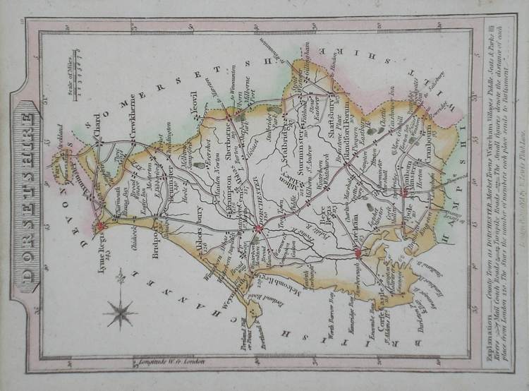
Dorset Lewis, W. (c. 1835) 14 x 10 Detailed and attractive miniature map of the County by William Lewis for his "Lewis's New Traveller's Guide". A particular feature of this charming series of maps is the clear and precise engraving of the roads. Adjacent numbers indicating the distances from London. Also included with the map is the accompanying page of text giving the county information relevant to travellers - principal towns and inns are listed, distances between towns, principal fair dates, and even sites for the best views of the county. Later colour. 38.00 GBP |
|
Dorset Becker, F. (c. 1842) 35 x 28.5 Detailed steel engraved map of the county with original colour. Published in Fisher's County Atlas, the only cartographical work from this company. 38.00 GBP |
|
Dorset Roper, J. (1810) 24 x 18 Detailed and decorative map of the county by Cole and Roper for The British Atlas. Original hand colouring. Excellent condition. 35.00 GBP |
|
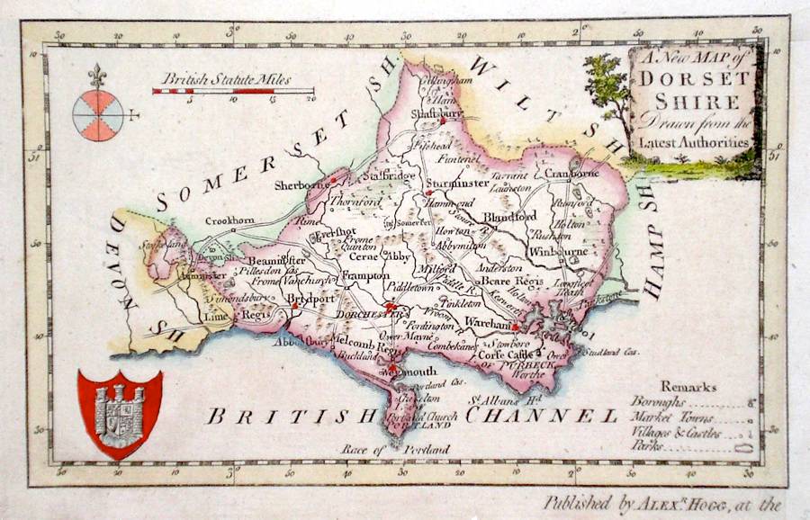
Dorset 'A New Map of Dorsetshire Drawn from the Latest Authorities' Conder, T. (c. 1784) 18 x 12 Finely engraved map of the county by Thomas Conder for the publication "The New British Traveller" Features include a Coat of Arms, and decorative title cartouche. Later colour 30.00 GBP |