Essex
Including Chelmsford, Basildon, Romford, Southend, Colchester, Harlow, Brentwood, West Ham
|
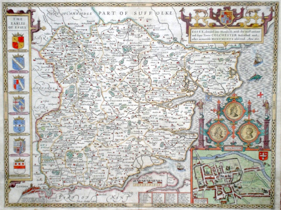
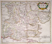
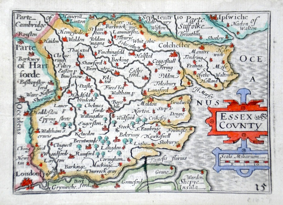
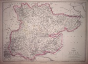
Essex 'Essex, devided into Hundreds,with the most antient and fayre Towne Colchester...' Speed, J. (c. 1627) 51 x 39 Attractive copy of John Speed's map of Essex after Norden. Engraved by Hondius and published by Humble. Incorporates a town plan of Colchester and miniature view of London. English text verso. Excellent condition. Later colour 425.00 GBP |


|
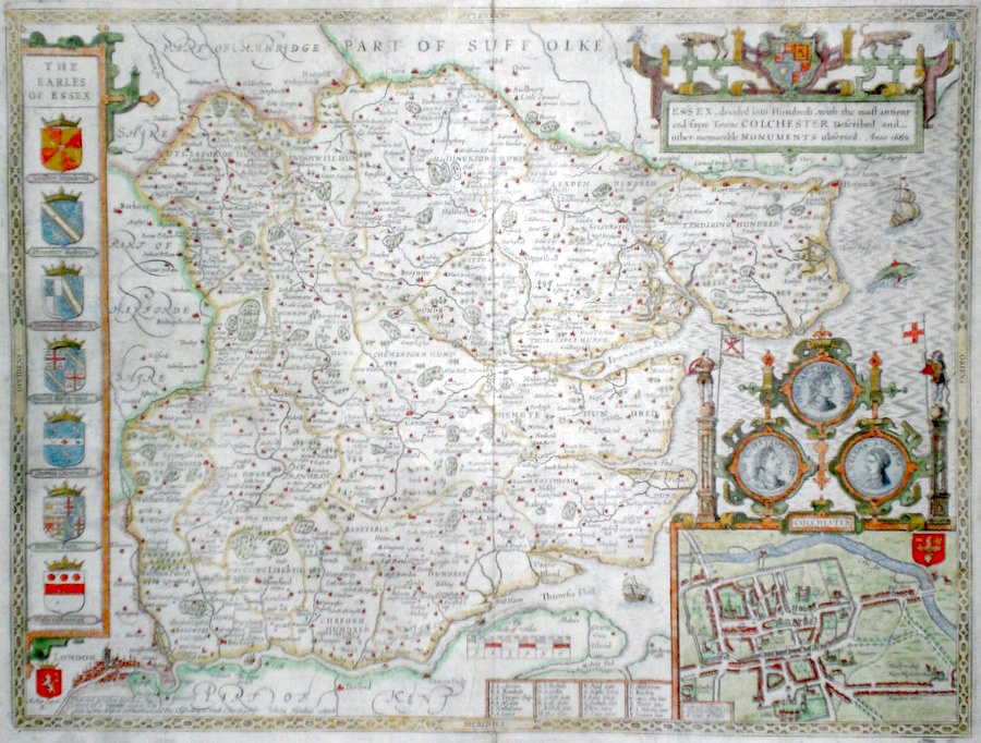
Essex 'Essex devided into Hundreds...' Speed, J. (c. 1676) 51 x 39 Attractive copy of John Speed's map of Essex after Norden. Engraved by Hondius and published by Basset and Chiswell. Incorporates a town plan of Colchester and miniature view of London. English text verso. Excellent condition. Later colour 385.00 GBP |
|
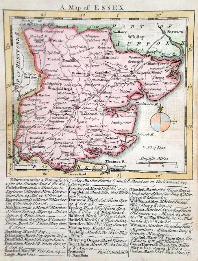
Essex 'An Accurate Map of the County of Essex' Bowen, E. & Kitchen, T. (c. 1749/56) 66 x 53 From the Large English Atlas, generally considered the most important English cartographical achievement of the Eighteenth century. Original colouring to the map and later colour to the cartouches. Good condition 395.00 GBP |

|
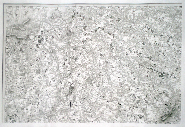
Essex Ordnance Survey of Great Britain. Part the Ist. Containing the county of Essex. Ordnance Survey, The Tower (1805) 90 x 63 Sheet XLVII of the four sheet map of Essex engraved for the first series of the Ordnance Survey. This series produced under the direction of Lt. Col. W Mudge, Shows the northern county from the extreme western boundary eastwards to the towns of Sudbury and Coggeshall. Includes Saffron Walden, Thaxted, Braintree etc, and also shows the eastern areas of Hertfordshire with southern areas of Suffolk. A detailed and crisp engraving in excellent unmarked condition. 250.00 GBP |
|
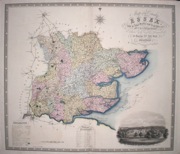
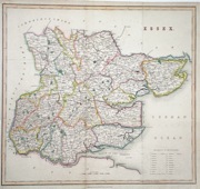
Essex 'A Map of the County of Essex' Greenwood, C & J (1831) 70.5 x 61 Fine original wash colour, vignette of Audley End, good margins, minimal offsetting. 200.00 GBP |
|
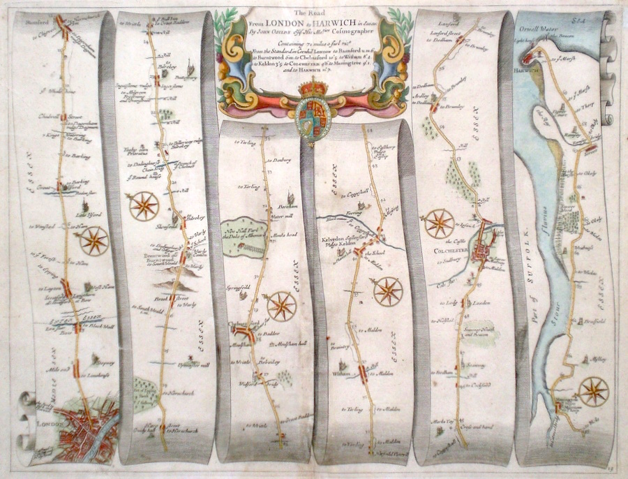
Essex 'The Road from London to Harwich in Essex' Ogilby, J. (1698) 45 x 34 The Road from London to Mile End, Leyton, Romford, Brentwood, Chelmsford, Witham, Colchester, Manningtree, Harwich. From John Ogilby's Britannia, generally considered one of the most important cartographical works of the seventeenth century. Features include town plans of London (east), Chelmsford, Colchester and a fine cartouche. Later colour. Plate number 19. Excellent condition. 200.00 GBP |
|
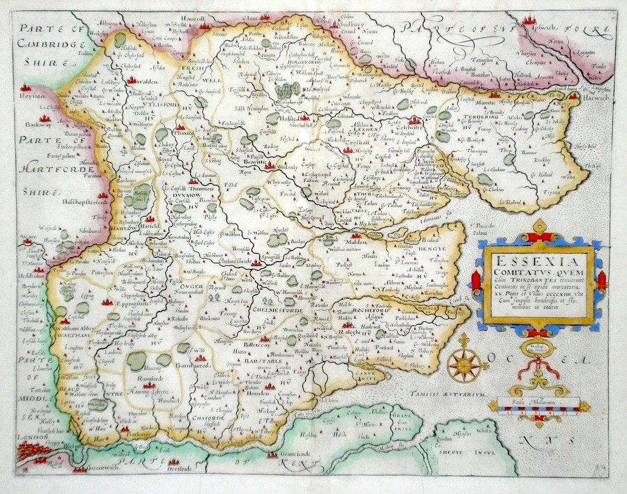
Essex 'Essexiae Comitatus...' Kip, W. (c. 1637) 36.5 x 28.5 Fine early map of the County by William Kip after Christopher saxton and others. From the third edition of Camden's Britannia to contain county maps and one of the earliest maps of the single county. No text verso.This copy with fine later colour. Condition excellent with good margins 195.00 GBP |
|
Essex 'A Mapp Of Ye County Of Essex' Blome, R. (1673) 32 x 26 Decorative map of the County by Richard Blome for his publication "Britannia". The largest series of county maps published by Blome, and generally based on those of Speed. Maps by Blome are characteristic and attractive. Fine condition, later colour. 195.00 GBP |

|
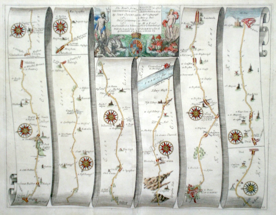
Essex 'The Road from Chelmsford to Maldon, to Rayleigh, to Gravesend. The Road from Canterbury to Deal and Dover.' Ogilby, J. (1698) 43 x 33 The Road from Chelmsford to Malden. From Chelmsford to Rayleigh. The Road from Chelmsford to Billericay, to Gravesend. The Road from Canterbury to Deal, and Dover. Five road systems on one engraving. From John Ogilby's Britannia, generally considered one of the most important cartographical works of the seventeenth century. Features include town plans of Chelmsford, Gravesend, Dover. Includes a fine cartouche depicting a mythical sea scene with sea horses, sea monsters and sea gods. Later colour. Plate number 93. Excellent condition. 185.00 GBP |
|
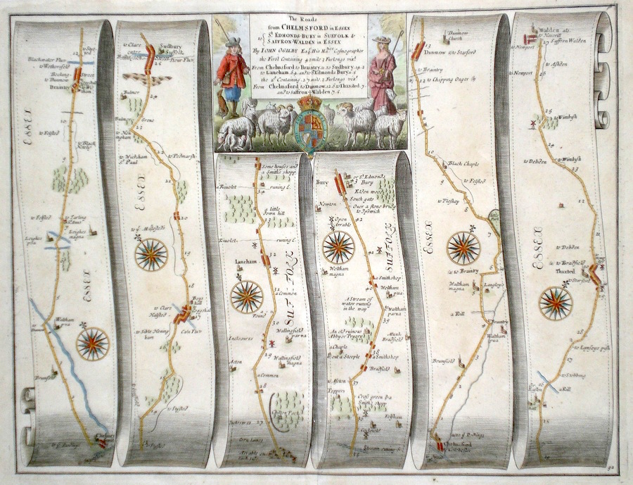
Essex 'The Roads from Chelmsford in Essex to St. Edmonds-Bury in Suffolk and to Saffron Walden in Essex' Ogilby, J. (1698) 43 x 33 The Road from Chelmsford to Braintree, Halstead, Sudbury, Laneham, Bury St. Edmunds. And from Chelmsford to Dunmow, Thaxted, Saffron Walden. From John Ogilby's Britannia, generally considered one of the most important cartographical works of the seventeenth century. Features include town plans of Bury, Chelmsford and a fine cartouche depicting a rural scene. Later colour. Plate number 92. Excellent condition. 180.00 GBP |
|
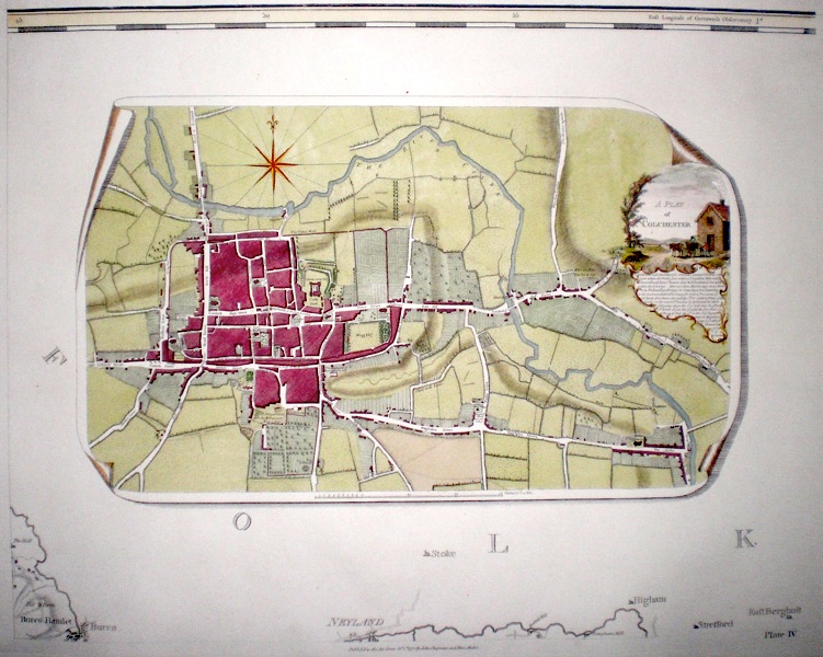
Essex 'A Map of the county of Essex from an actual survey.' (1833) Key map to John Chapman and Peter Andre's large scale map of Essex. First published in 1777 this edition published in 1833. The map covers the whole county on a scale of two inches to five miles. Inset miniature town plan of Colchester, miniature plan of Harwich harbour, compass rose, and miniature copy of the frontispiece for the whole map which gives the title. Later wash colour to the hundreds. Excellent condition 170.00 GBP |
|
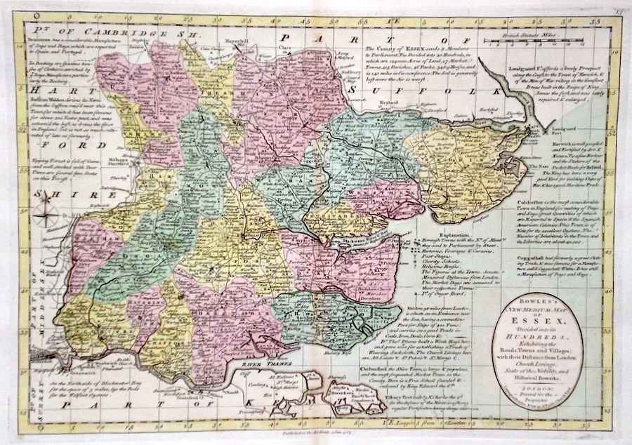
Essex 'Bowles's New Medium Map of Essex….. Bowen, E. & T. (1785) 33 x 23 Finely engraved and detailed map of the county from "Bowles's New Medium English Atlas". The maps in this series are based on those in Emanuel and Thomas Bowen's Atlas Anglicanus, and feature extensive county information on the map. They are distinguished primarily by having newly engraved cartouches, distances from London added to towns, and different imprints at the bottom. Full original colour. Some slight offsetting to the left hand side, othewise Fine condition 150.00 GBP |
||||||||||||||
|
Essex Ordnance Survey of Great Britain. Part the Ist. Containing the county of Essex. Ordnance Survey, The Tower (1805) 90 x 63 Sheet XLVIII of the four sheet map of Essex engraved for the first series of the Ordnance Survey. This series produced under the direction of Lt. Col. W Mudge, shows the North eastern county and coast with southern and coastal areas of Suffolk. Includes Colchester, Ipswich. A detailed and crisp engraving in excellent unmarked condition 150.00 GBP |
|
Essex 'A Plan of Colchester' 1833 Fine large scale town plan of Colchester included in Chapman and Andre's twenty-five sheet map of Essex. First published in 1777, this edition published in 1833. Later colour. 150.00 GBP |
|
Essex 'Essex by Robt. Morden' Morden, R. (1722) 42 x 35 Finely engraved map of the county by Robert Morden. From the 1722 edition of Camden's Britannia. Excellent condition. Later colour 145.00 GBP |
|
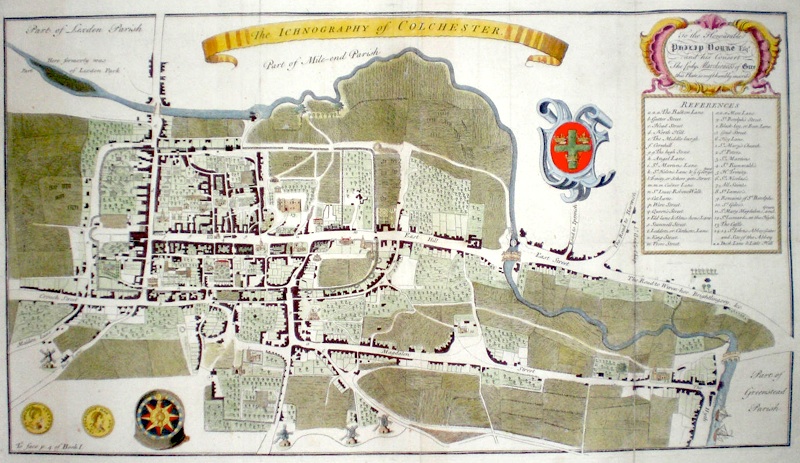
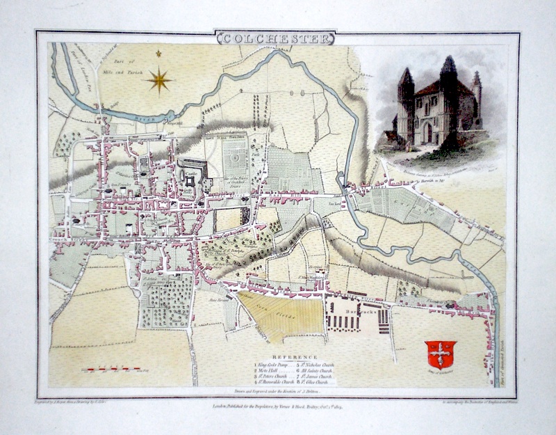
Essex 'The Ichnography of Colchester' (c. 1768) 55 x 31 Fine town plan of Colchester published by T. Osborne for 'The History and Antiquities of the County of Essex' by Phillip Morant. Some old folds and associated strengthening verso, but generally in very good condition. Later colour. 150.00 GBP |
|
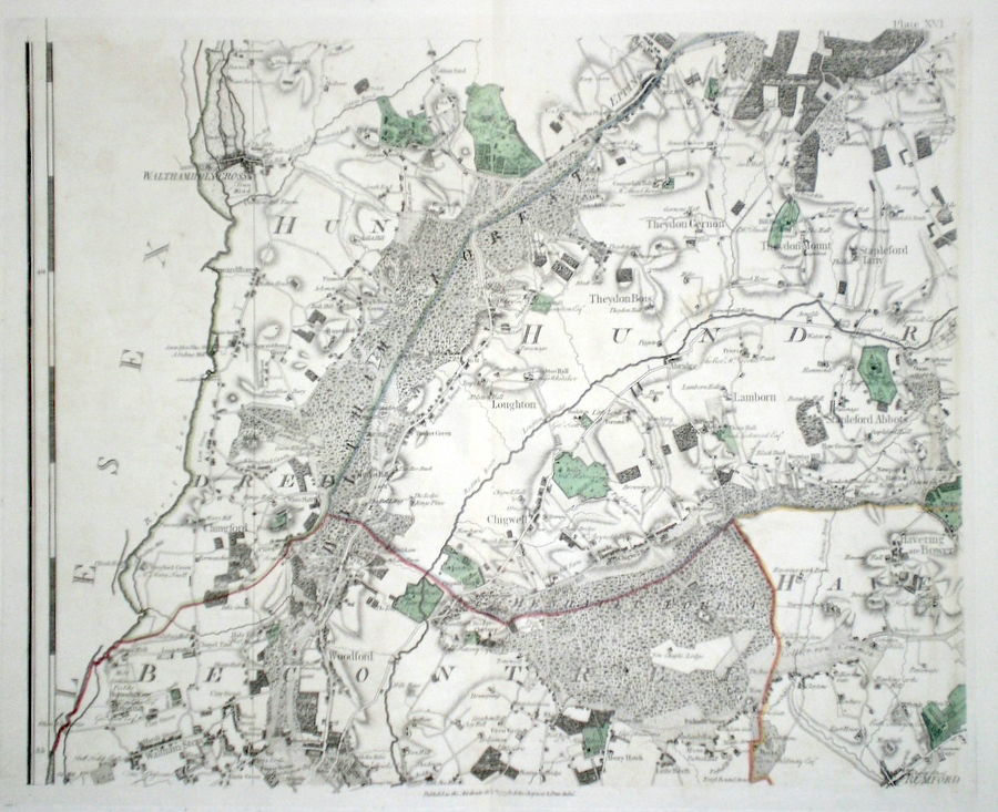
Essex 'A Map of the County of Essex from an Original Survey….. Sheet 16' Chapman & Andre (1833) 59 x 46 Plate 16 of John Chapman and Peter Andre's twenty-five sheet map of Essex. Covers the area, on a scale of two inches to one mile, and includes, Waltham Cross, Chingford, Woodford, Epping, Chigwell, Romford etc. Map bears the date 1777. Later colour 150.00 GBP |
|
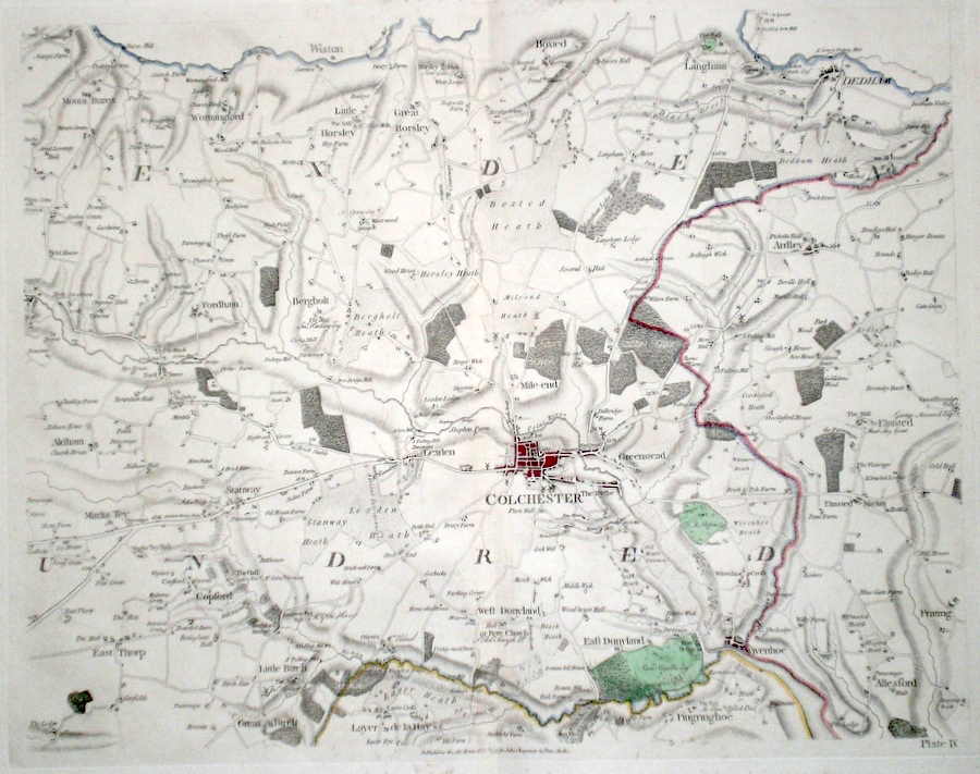
Essex 'A Map of the County of Essex from an Original Survey….. Sheet 9' Chapman & Andre (1833) 59 x 46 Plate 9 of John Chapman and Peter Andre's twenty-five sheet map of Essex. Covers the area, on a scale of two inches to one mile, and includes, Mark's Tey Colchester, Dedham etc. Map bears the date 1777. Later colour 140.00 GBP |
|
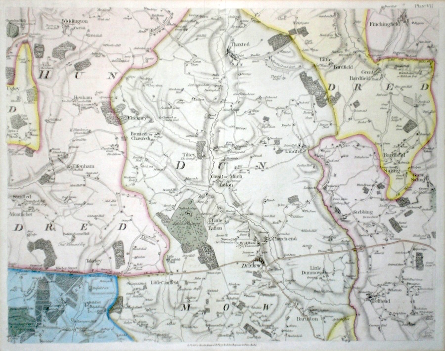
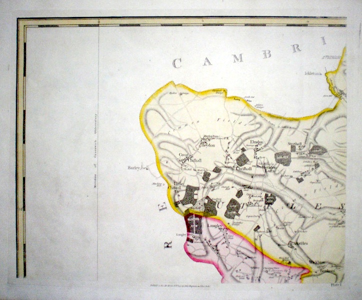
Essex 'A Map of the County of Essex from an Original Survey….. Sheet 7' Chapman & Andre (1833) 59 x 46 Plate 7 of John Chapman and Peter Andre's twenty-five sheet map of Essex. Covers the area, on a scale of two inches to one mile, and includes Thaxted, Takely, Dunmow, Finchingfield etc. Map bears the date 1777. Early colour 130.00 GBP |
|
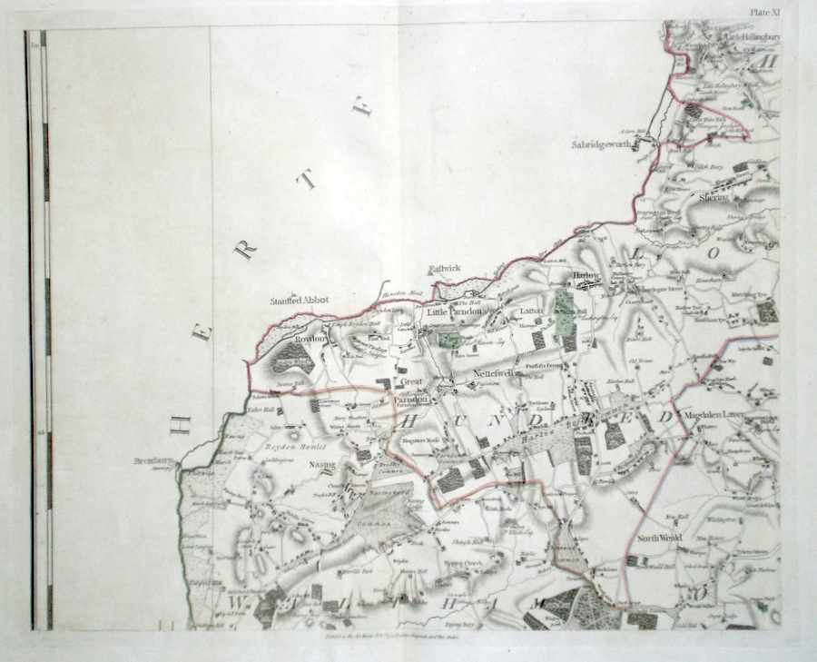
Essex 'A Map of the County of Essex from an Original Survey….. Sheet 11' Chapman & Andre (1833) 59 x 46 Plate 11 of John Chapman and Peter Andre's twenty-five sheet map of Essex. Covers the area, on a scale of two inches to one mile, and includes, Roydon, Harlow, Nazing, North Weald etc. Map bears the date 1777. Later colour 125.00 GBP |
|
Essex 'A Map of the County of Essex from an Original Survey….. Sheet 12' Chapman & Andre (1833) 59 x 46 Plate 12 of John Chapman and Peter Andre's twenty-five sheet map of Essex. Covers the area, on a scale of two inches to one mile, and includes, The Rodings, Fifield, Writtle, western Chelmsford etc. Map bears the date 1777. Later colour 125.00 GBP |

|
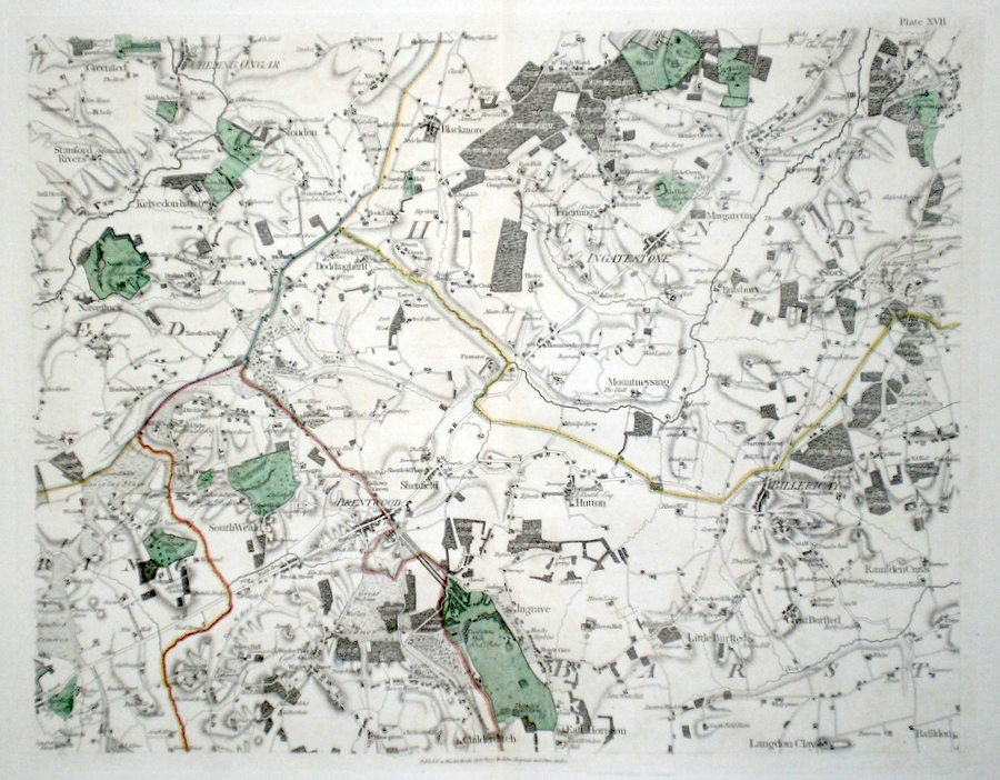
Essex 'A Map of the County of Essex from an Original Survey….. Sheet 17' Chapman & Andre (1833) 59 x 46 Plate 17 of John Chapman and Peter Andre's twenty-five sheet map of Essex. Covers the area, on a scale of two inches to one mile, and includes, Ingatestone, Brentwood, Billericay, etc. Map bears the date 1777. Later colour 120.00 GBP |
|
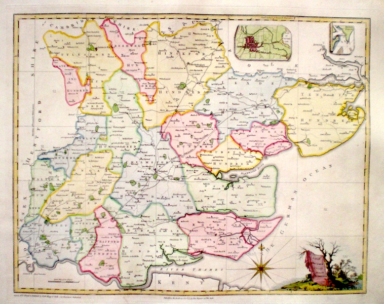
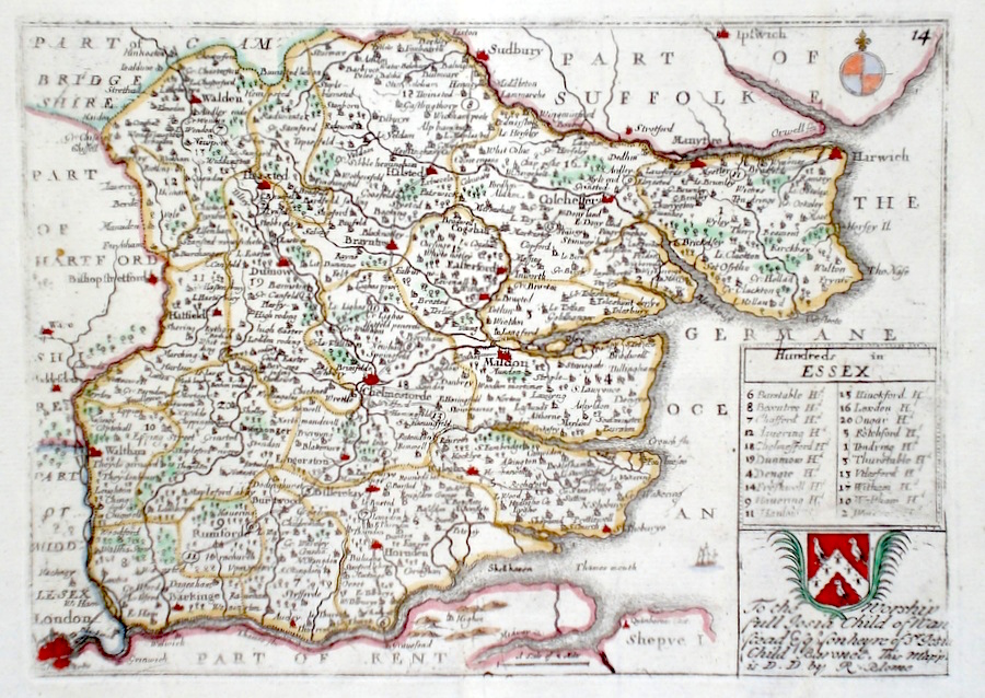
Essex 'Hundreds in Essex' Blome, R. (c. 1731) 21 x 15 Finely engraved map of the county by Richard Blome from the atlas "England Exactly Described or a Guide to Travellers…" first published by Thomas Taylor, but herewith from the later edition published by Thomas Bakewell. A major addition to the earlier plates is that roads and distances between towns are now included, after the road surveys of John Ogilby. Here Bakewell has not removed the name of Blome from the plate as is usually the case. Fine condition. Later colour 120.00 GBP |
|
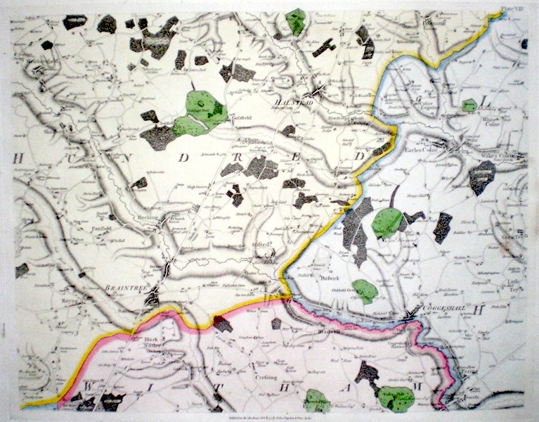
Essex A Map of the county of Essex from an actual survey…..plate VIII (1833) 59 x 46 Plate 8 of John Chapman and Peter Andre's twenty-five sheet map of Essex. First published in 1777 this edition published in 1833. Covers a central area of the county on a scale of two inches to the mile including, Braintree, Halstead, and Coggeshall. Later colour 100.00 GBP |
|
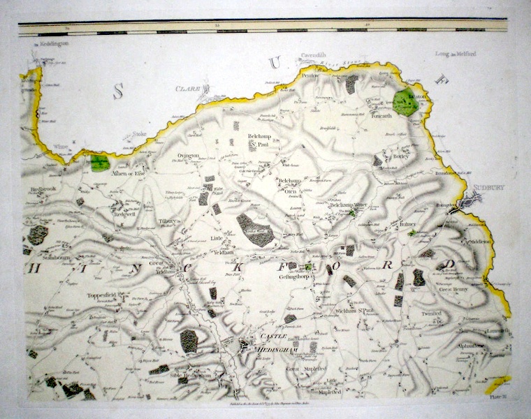
Essex A Map of the county of Essex from an actual survey…..plate III (1833) 59 x 46 Plate 3 of John Chapman and Peter Andre's twenty five sheet map of Essex. First published in 1777 this edition published 1833. Covers the northern area of Essex bordering Suffolk, on a scale of two inches to one mile. Includes The Yeldhams, Castle Hedingham etc. Later colour. 100.00 GBP |
|
Essex A Map of the county of Essex from an actual survey…..plate XXI (1833) 59 x 46 Plate 21 of John Chapman and Peter Andre's twenty-five sheet map of Essex. First published in 1777 this edition published in 1833. Covers the south-westerley area of Essex bordering Middlesex (London), on a scale of two inches to one mile. Includes, Leyton, Wanstead, Barking. This plate also shows the scale for the whole map. Later colour 90.00 GBP |
|
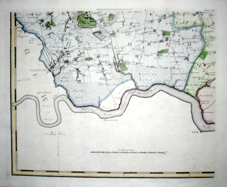
Essex A Map of the county of Essex from an actual survey…..plate XXII (1833) 59 x 46 Plate 22 of John Chapman and Peter Andre's twenty-five sheet map of Essex. First published in 1777 this edition published in 1833. Covers an area of the county on a scale of two inches to the mile bordered by the Thames estuary including, Hornchurch, Upminster, Tilbury etc. Later colour 90.00 GBP |
|
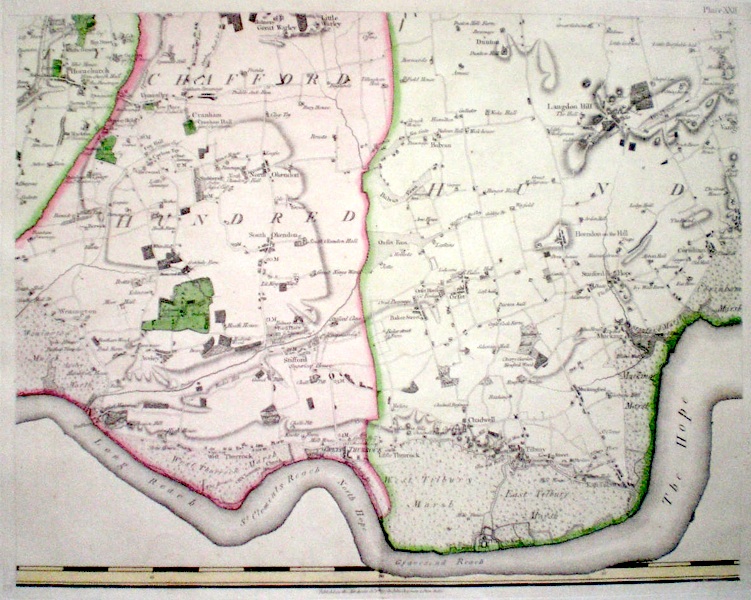
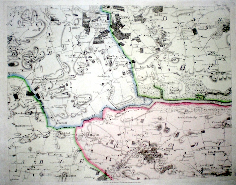
Essex A Map of the county of Essex from an actual survey…..plate XVIII (1833) 59 x 46 Plate 18 of John Chapman and Peter Andre's twenty-five sheet map of Essex. First published in 1777 this edition published in 1833. Covers a central area of the county on a scale of two inches to the mile, including The Hanningfields, Wickford and Rochford. Later colour 90.00 GBP |
|
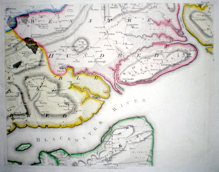
Essex 'A Map of the county of Essex from an actual survey…. plate XIV' (1833) 59 x 46 Plate 14 of John Chapman and Peter Andre's twenty-five sheet map of Essex. First published in 1777 this edition published in 1833. Covers the area of the Blackwater river estuary including the Tolleshunts, Mersea Island, Bradwell etc. Later colour 90.00 GBP |
|
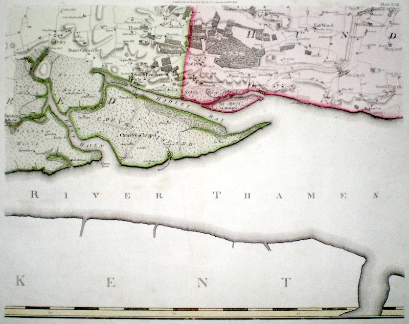
Essex 'A Map of the county of Essex from an actual survey…..plate XXIII' 1833 59 x 46 Plate 23 of John Chapman and Peter Andre's twenty five sheet map of Essex. First published in 1777, this edition published in 1833. Covers the Thames estuary and includes Canvey Island, South Benfleet, Lee, and the village of Southend. Later colour. 90.00 GBP |
|
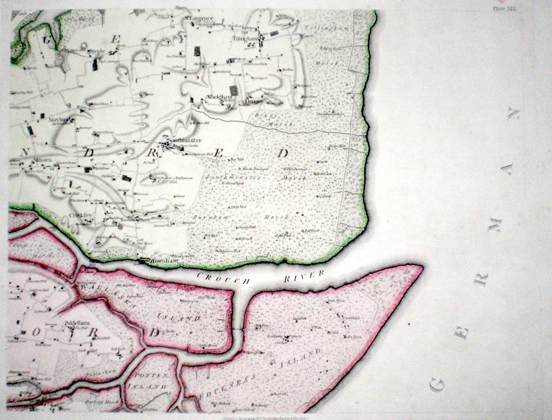
Essex 'A Map of the county of Essex from an actual survey…..plate XIX' 1833 59 x 46 Plate 19 of John Chapman and Peter Andre's twenty-five sheet map of Essex. First published in 1777, this edition published in 1833. Covers the area around the River Crouch estuary and includes Wallasey and Foulness Islands, Burnham etc. Later colour 90.00 GBP |
|
Essex 'A Map of the county of Essex from an actual survey…..Plate I' 1833 57 x 46 Plate 1 of John Chapman and Peter Andre's twenty-five sheet map of Essex. First published in 1777 this edition published in 1833. Covers the north-western corner of Essex bordering Hertfordshire and Cambrigdeshire, on a scale of two inches to one mile. Later colour 80.00 GBP |
|
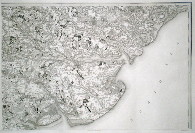
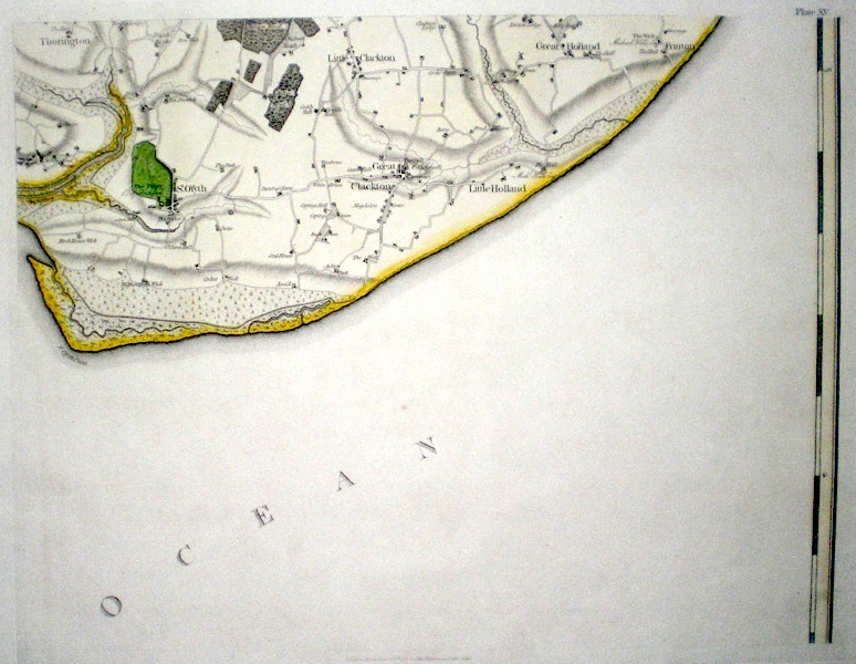
Essex 'A Map of the county of Essex from an actual survey…..plate XV' 1833 59 x 46 Plate 15 of John Chapman and Peter Andre's twenty-five sheet map of Essex. First published in 1777 this edition published in 1833. Covers the coastal area of Essex around the villages of St. Osyth, Clacton, the Hollands and Frinton. Later colour. 70.00 GBP |
|
Essex 'Essex County' Keere P. van den (c. 1627) 12.5 x 9 Finely engraved early map of the county by Pieter van den Keere. The map comes from a series engraved by van den Keere and published by Sudbury and Humbel, sometimes referred to as miniature speeds. Later colour 100.00 GBP |
|
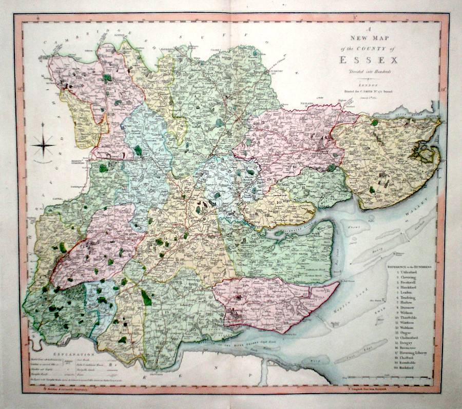
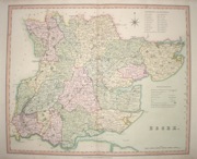
Essex 'A New Map of the county of Essex Divided into hundreds' Smith, C. (c. 1804) 51 x 45 Very fine county map by Charles Smith from the first edition of his "New English Atlas". One of the first atlases to use the meridian of Greenwich. Original colour with full margins. 100.00 GBP |
|
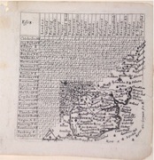
Essex van Langeren, J. (1643 or later) 10.3 x 10.5 Rare Engraving from Jenner's 'A Direction for the English Traviller'. Includes a distance table (originated by John Norden) and finely engraved small scale map. 100.00 GBP |
|
Essex Virtue & Co. (c. 1836) 40 x 38 Map of the county published to accompany 'The History of Essex' by Thomas Wright. Old folds, later hand colour. 65.00 GBP |
|
Essex Teesdale, H (1829) 42 x 35 Early wash colour, good condition. 60.00 GBP |
|
Essex 'A Map of Essex' Kitchen/Jefferys (1751) 14 x 18.5 Finely engraved map of the county by Thomas Kitchin and Thomas Jefferys from their publication "The Smal English Atlas". This rare series of maps are distinctive by featuring considerable county information below the map. Later colour 60.00 GBP |
|
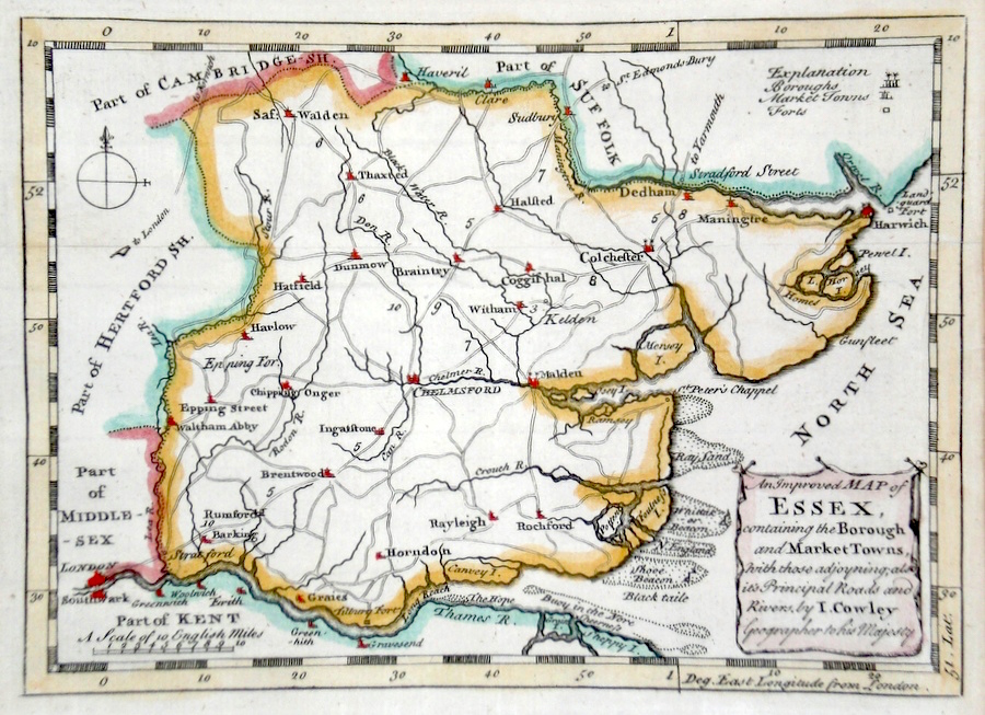
Essex 'An Improved Map of Essex containing the Borough and Market towns...' Cowley, J. (c. 1744) 19 x 14 Finely engraved and uncommon map of the county by John Cowley from the publication "The Geography of England". Later colour 55.00 GBP |
|
Essex Rocque, J. (c. 1769) 20 x 16 Finely engraved map of the county by John Rocque for the publication "England Displayed". Later colour 50.00 GBP |
|
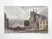
Colchester Roper, J. (1810) 24 x 18 Detailed and decorative plan of the city by John Roper after the drawing of George Cole, from “The British Atlas”. Later colour. The vignette view is of the entrance gateway to St. Johns Abbey, drawn by Prout. 50.00 GBP |
|
Essex Dispatch Atlas (1863) 43 x 31 Early outline colour. 25.00 GBP |
|
Essex 'View of Billericay' from Wright's History of Essex Wallis, H. (c. 1836) 16 x 10 Steel engraved view of Billericay from a drawing by Bartlett, published in Wright's History of Essex. Many other views are available. Please e-mail for a price list. 25.00 GBP |