Europe
|
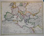
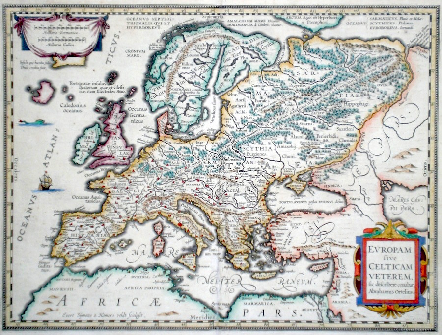
Europe 'Europam sive Celtican Veterem sic describere conabar Abrahamus Ortelius' Hammersveldt, E. (c. 1618) 47 x 36 Superb map of classical Europe after Abraham Ortelius, a rare variant engraved by Evert Symons Hamersveldt. Published by Petrus Bertius in the Atlas "Theatrum Geographiae Veteris". This rare atlas compiled by Bertius used purchased Ortelius copperplates and other plates from Mercator to publish a classical atlas similar to the Ortelius Parergon. Features include two fine cartouches, a sea monster and a galleon in the Atlantic ocean. Latin text to verso. Later hand colour. Condition fine. 735.00 GBP |


|
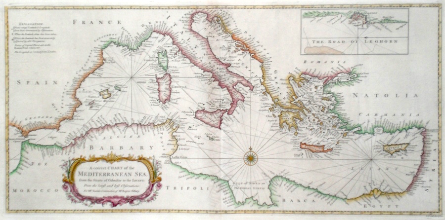
Europe 'A Correct Chart of The Mediterranean Sea from the Straits of Gibraltar to The Levant...' Seale, R. (c. 1740) 72 x 35 A finely engraved and detailed chart of The Mediterranean Sea by Richard Seale. Published in Tindal's translation of Paul Rapin De Toras's History of England. The map features extensive coastal detail on Southern Europe and North Africa. The inset map is of the town of Leghorn and its surroundings in Italy. Old folds, as issued. Excellent condition. Later colour. 345.00 GBP |
|
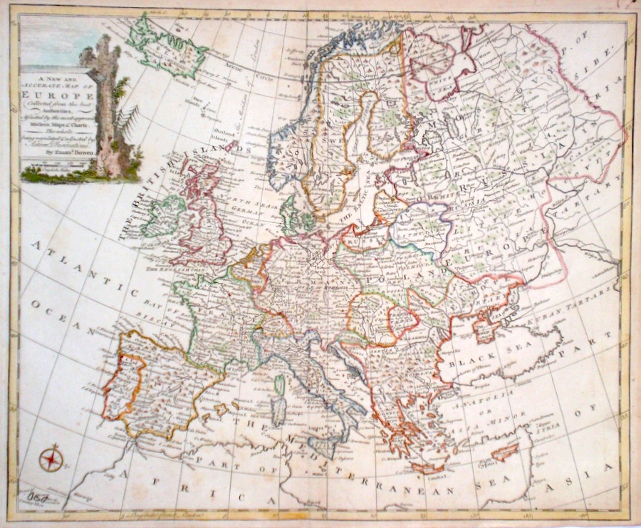
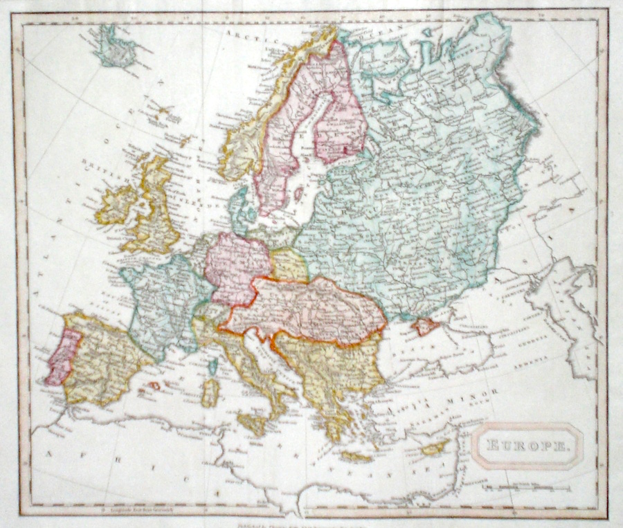
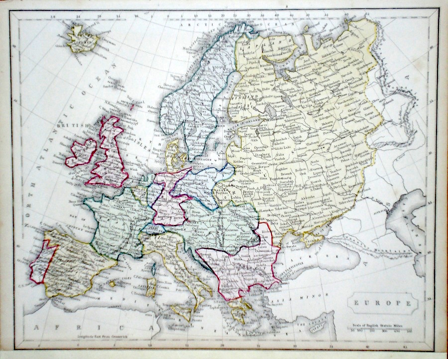
Europe 'A New and Accurate Map of Europe' Bowen, E. (1766) 43 x 35 Finely engraved and detailed map of Europe by Emanuel Bowen. Features include a cartouche depicting a mountainous scene. Condition excellent, a dark impression on thick paper. Later hand colour 240.00 GBP |
|
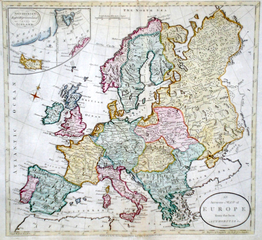
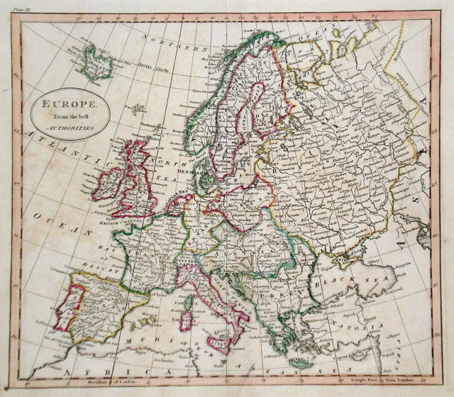
Europe 'An Accurate Map of Europe from the best Authorities' Darton, W. (c. 1785) 37 x 35 Finely engraved map of Europe by John Russell for The Universal History. Later colour. Condition excellent. 180.00 GBP |
|
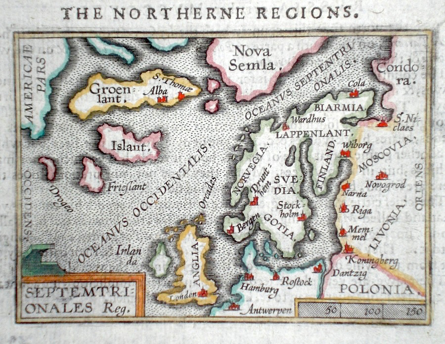
Europe 'Septemtrionales Reg.' Ortelius, A. (c. 1603) 10 x 8.5 Fine early map of Northern and polar regions of Europe, by Abraham Ortelius , engraved in small format by Philippe Galle, and published in the Epitome, or pocket- edition of the "Theatrum Orbis Terrarum". This map from an English text edition of c. 1603 published in London and thus one of the first world atlases published in England. A very interesting map, features include the mythical island of Frieslant, possibly the Faroe Islands, and the island of Drogeo - a land which had been described by earlier mariners from Europe and could possibly have been the northern coast of America. Fine condition. Later colour 160.00 GBP |
|
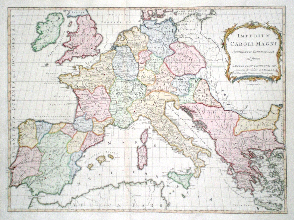
Europe 'Imperium Caroli Magni Occidentis Imperatoris ad finem Saeculi Post Christum VIII' Kitchen, T. (1768) 57 x 43 Finely engraved map of Europe and the extent of the Empire of Charlemagne. Engraved by Thomas Kitchen for John Blair's "The Chronology and History of The World". In the early Middle Ages Charles I (Charles The Great, or Charlemagne) had united most of Western Europe into one great Christian Empire. Fine condition. Later colour 145.00 GBP |
|
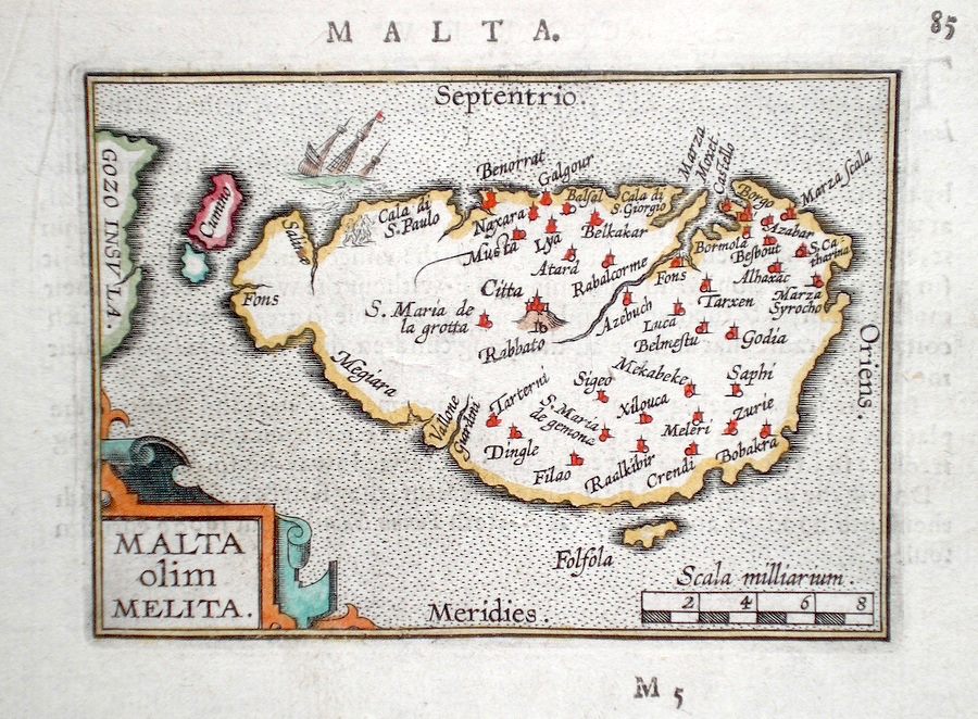
Europe 'Malta olim Melita' Ortelius, A. (c. 1603) 10 x 8.5 Fine early map of Malta by Abraham Ortelius, engraved in small format by Philippe Galle, and published in the Epitome, or pocket-edition of the "Theatrum Orbis Terrarum". This map from an English text edition of c. 1603 published in London and thus one of the first world atlases published in England. Fine condition. Later colour 140.00 GBP |
|
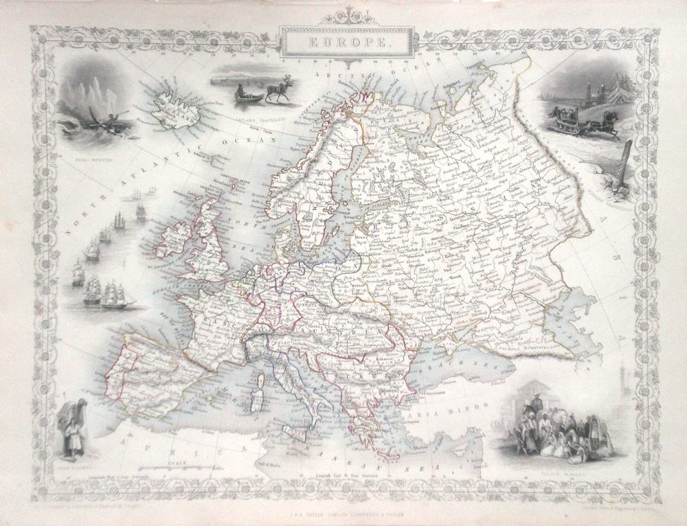
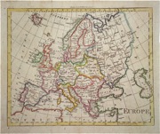
Europe Rapkin, J. (1851) 32 x 26 Fine map of The Continent engraved by John Rapkin, for John Tallis's highly decorative "The Illustrated Atlas". The vignettes show; Seal hunting in the Arctic, Laplanders, Russian Travellers, Sailing ships in battle formation etc. Single page map, (no central fold). Original colour as published. Condition fine. 100.00 GBP |
|
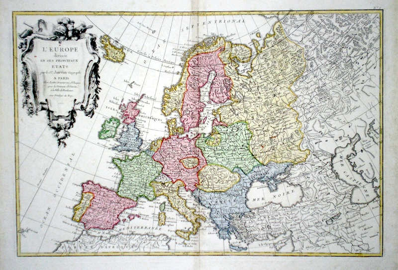
Europe 'L'Europe divisee en ses Principaux Etats' Janvier, Sieur J. (c. 1762) 48 x 31 Fine map of the continent by the French Cartographer Jean Janvier. A large and decorative cartouche shows floral decorations alongside military aspects. Later colour 90.00 GBP |
|
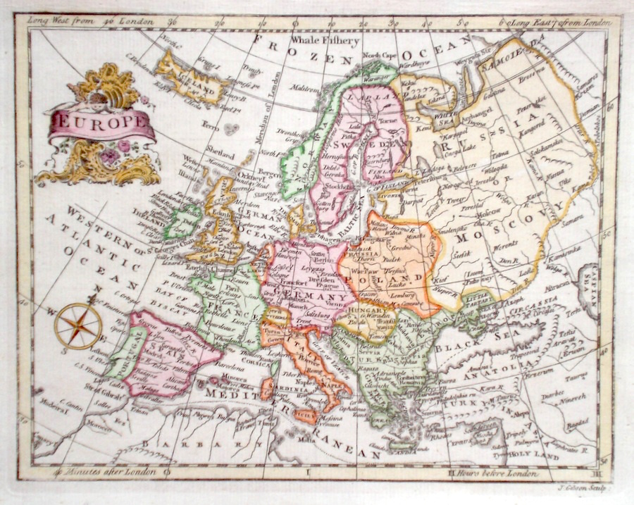
Europe Gibson, J. (c. 1787) 22 x 17 Finely engraved map of Europe by John Gibson, published in Turner's View of the Earth 1787. Features include an attractive cartouche and the arctic ocean labeled as a "whale fishery" Later colour 75.00 GBP |
|
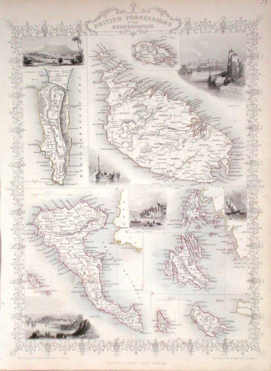
Europe 'British Possessions in the Mediterranean' Rapkin, J. (1851) 26 x 36 Unusual map showing the Islands of Malta, Gozo, Corfu, Cephalonia, Ithaca, Zante etc, and also Gibraltar by John Rapkin, for John Tallis's highly decorative "The Illustrated Atlas". The vignettes show; Gibraltar, Valetta, Corfu, Ithaca, Five maps on a Single page, (no central fold). Original colour as published. Condition fine. 60.00 GBP |
|
Europe 'Europe from the best Authorities' Russell, J. (1818) 22.5 x 19.5 Europe from Guthrie's Geography. Engraved by John Russell. Original hand colour. Excellent condition. 70.00 GBP |
|
Europe Findlay, A. (c. 1820) 29 x 25 Fine map of the Continent engraved by Alexander Findlay and published by Thomas Kelly. Condition excellent. Later colour 65.00 GBP |
|
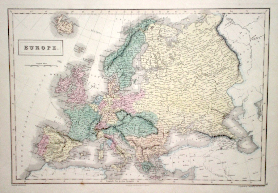
Europe Hall, S. (1854) 37 x 28 Finely engraved map of Europe, by Sidney Hall. Steel engraving published in the "General Atlas of The World". Condition excellent. 50.00 GBP |
|
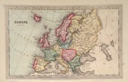
Europe Starling, T. (c. 1832) 15 x 9 Finely engraved and uncommon map from The Royal Cabinet Atlas. Bright original colouring. 45.00 GBP |
|
Europe Walker's Gazeteer (1801) 23 x 19 Later hand colour to the countries. Traces of old folds but generally excellent condition. 40.00 GBP |
|
Europe Becker & Co. (c. 1850) 27 x 20 Attractive steel engraved map of the continent by Becker and Co. for Barclays Dictionary. Original colour with some later colour 40.00 GBP |
|
Europe 'Orbis Romanus' Neele, J. Adam's Geography (1824 Ed.) 25.5 x 20 Map of the Roman World, later hand colour. 25.00 GBP |