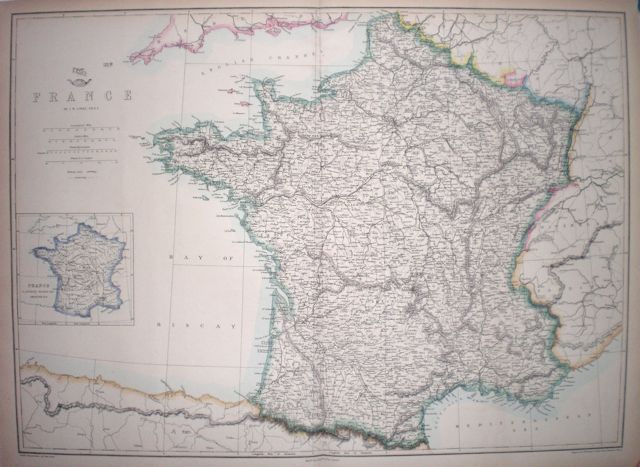
France
|
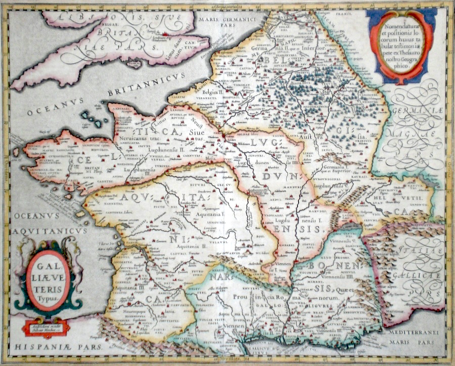
France 'Galliae Veteris Typus' Hondius, J. (c. 1618) 49 x 40 Superb map of classical France engraved by Hondius after Abraham Ortelius. Published by Petrus Bertius in the Atlas "Theatrum Geographiae Veteris". This rare atlas compiled by Bertius used purchased Ortelius copperplates and other plates from Mercator to publish a classical atlas similar to the Ortelius Parergon. The area covered, known to the Romans as Gaul, extends into what is now Belgium, Switzerland and part of Germany. Latin text to verso. Later hand colour. Condition fine. 495.00 GBP |


|
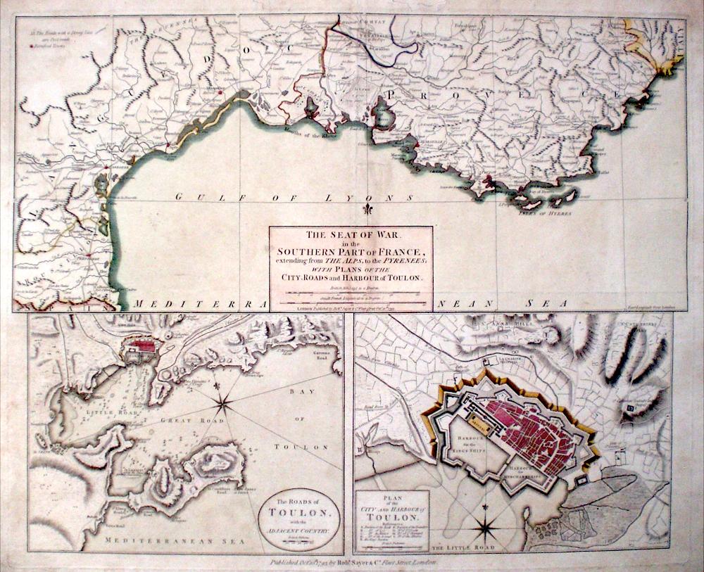
France 'The Seat of War in the Southern Part of France extending from The Alps, to the Pyrenees….' Sayer, R. (1793) 57 x 46 Three fine engravings on one sheet. The top map shows the coastline of Southern France from the border with Italy to the border with Spain. Fortified towns and post roads are delineated. Bottom left map is "The Roads of Toulon with the adjacent Country" showing the position of Toulon at much greater scale,and extensive maritime information regarding the Bay of Toulon. The third map, bottom right, is "Plan of the City and Harbour of Toulon". A detailed plan showing the city with references to the various bastions. A little worming to the border outside the platemark and a few surface marks but generally a good copy on thick paper of this historically important chart. 350.00 GBP |
|
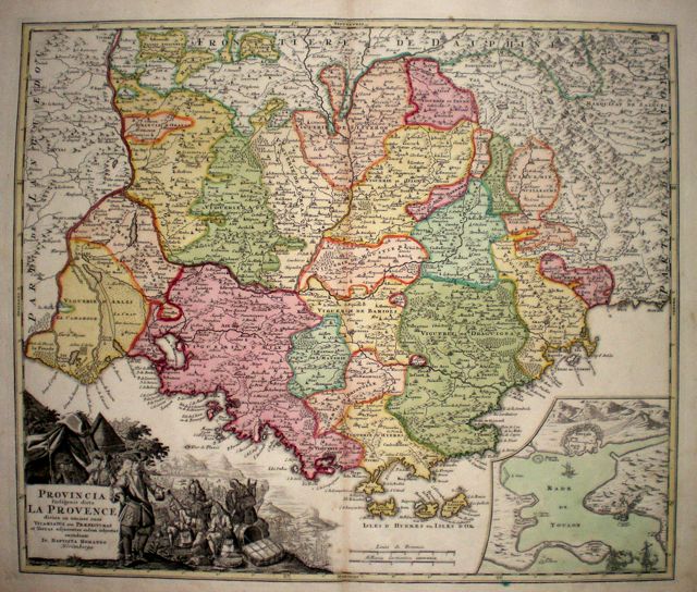
Provence 'Provincia Indigenis dicta La Provence' Homann, J.B. (c. 1730) 57 x 48 Fine early colouring, uncoloured cartouche, good margins. 300.00 GBP |
|
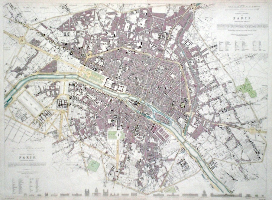
France 'Paris' Shury, J. (c. 1836) 53 x 40 Finely detailed map of the city by Shury for The Society for the Diffusion of Useful Knowledge. Original and additional later colour. 260.00 GBP |
|
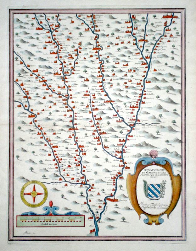
France 'Potamographie De Garonne et des Fleuves… (Course of the Garonne and Dordogne rivers)' Tarde, J. (c. 1628) 35 x 46 Early map showing the extent of the Garonne and Dordogne rivers in South West France. By Jean Tarde and engraved by Jean Blanchin. North is to the left. The rivers and their tributaries are shown with a very comprehensive detailing of the many towns and villages of the region. Jean Tarde (1561-1636) in addition to being a mathematician and cartographer was also Canon of Sarlat. Original colour, excellent condition. 195.00 GBP |
|
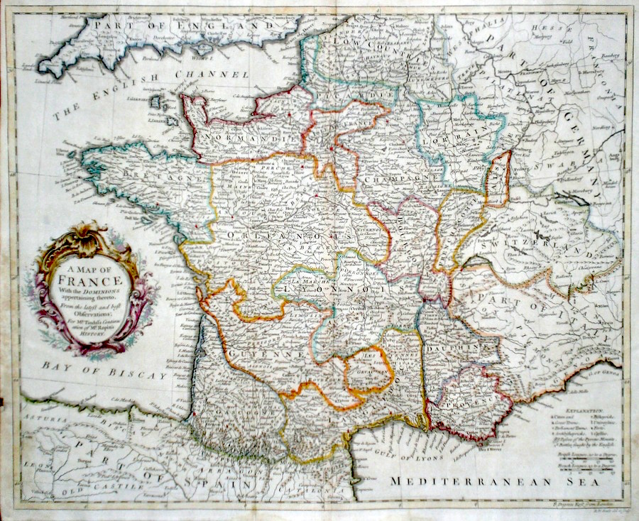
France 'A Map of France with the Dominions appertaining thereto...' Seale, R. (c. 1745) 47 x 38 A finely engraved and detailed map of France by Richard Seale. Published in Tindal's translation of Paul Rapin De Toras's History of England. The map features extensive detail on the Kingdom and has a particularly fine title cartouche. Excellent condition. Later colour. 180.00 GBP |
|
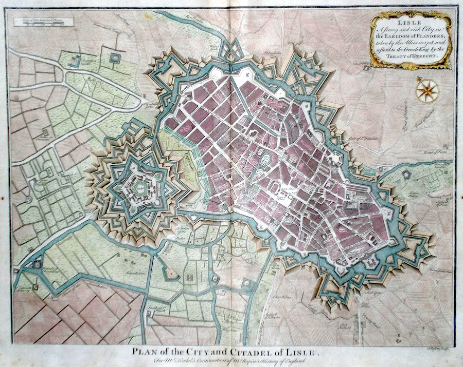
France 'Plan of the City and Citadel of Lisle' Basire, I. (c. 1740) 48 x 38 A finely engraved Plan of the City of Lille by Isaac Basire. Published in Tindal's translation of Paul Rapin De Toras's History of England. Features include extensive detail and a cartouche top right stating that "Lisle is a strong and rich city in the Earldom of Flanders taken by the allies in 1708 and restored to the French King by the Treaty of Utrecht." An interesting item in excellent condition. Later colour. 150.00 GBP |
|
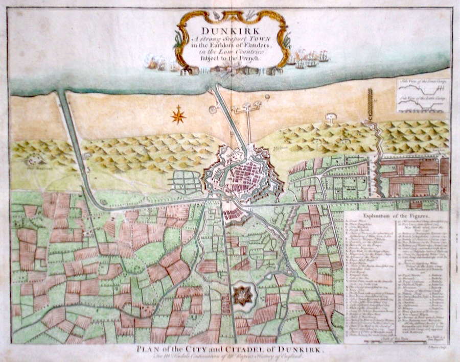
France 'Dunkirk. A strong seaport town in the Earldom of Flanders in the Low Countries subject to the French' Basire, I. (c. 1740) 48 x 39 A finely engraved Plan of the City by Isaac Basire. Published in Tindal's translation of Paul Rapin De Toras's History of England. Features include extensive detail and a table, bottom right explains the main areas of the City. An interesting item in excellent condition. Later colour. 150.00 GBP |
|
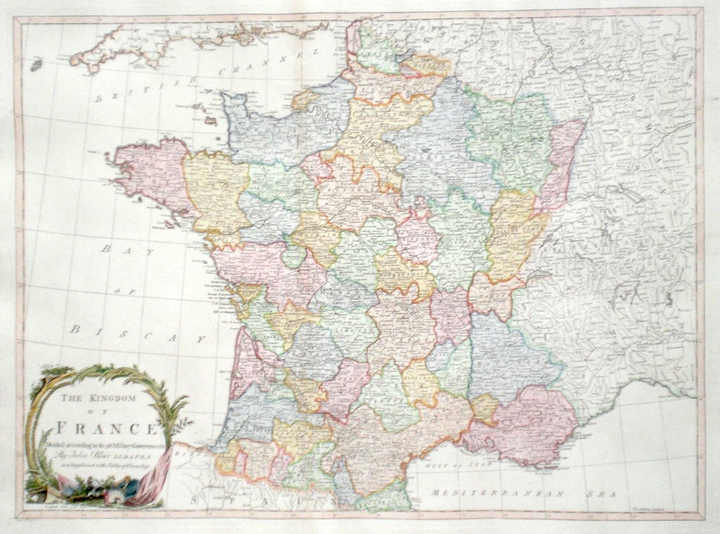
France 'The Kingdom of France Divided according to its 38 Military Governments' Kitchen, T. (1768) 57 x 43 Superb map of France by Thomas Kitchen for John Blair's "The Chronology and History of The World". Comprehensive detail is given on the various departments of the Country. Fine condition. Later colour 140.00 GBP |
|
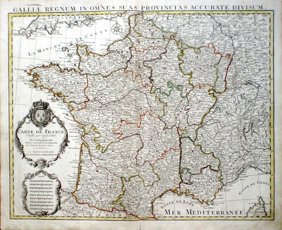
France 'Carte de France...' De Lisle, G. (c. 1750) 61 x 49 Fine map of the whole of France by Guillaume De L'Isle issued by the publisher Covens and Mortier. Superbly engraved on thick paper with original outline colour. Feature include a very elegant cartouche and scale. 125.00 GBP |
|
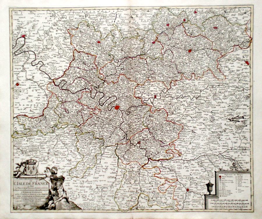
France 'L'Isle de France' De Wit, F. (c. 1750) 59 x 50 Finely engraved and detailed map of the Isle de France region (Paris area) by the Amsterdam cartographer Frederick de Wit. Published by Covens and Mortier. Features include a fine cartouche depicting mythological figures and an elegant panel explaining the symbols used throughout the map. A dark engraving on thick paper with original outline colouring. 125.00 GBP |
|
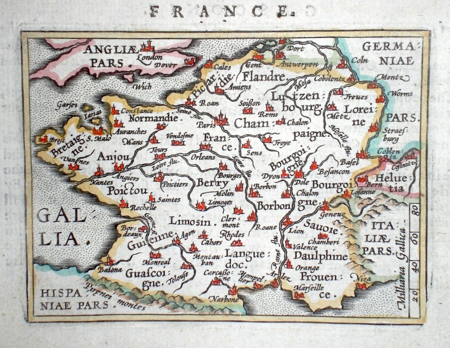
France 'Gallia Regnum' Ortelius, A. (c. 1603) 10 x 8.5 Fine early map of France by Abraham Ortelius, engraved in small format by Philippe Galle, and published in the Epitome, or pocket-edition of the "Theatrum Orbis Terrarum". This map from an English text edition of c. 1603 published in London and thus one of the first world atlases published in England. Fine condition. Later colour 98.00 GBP |
|
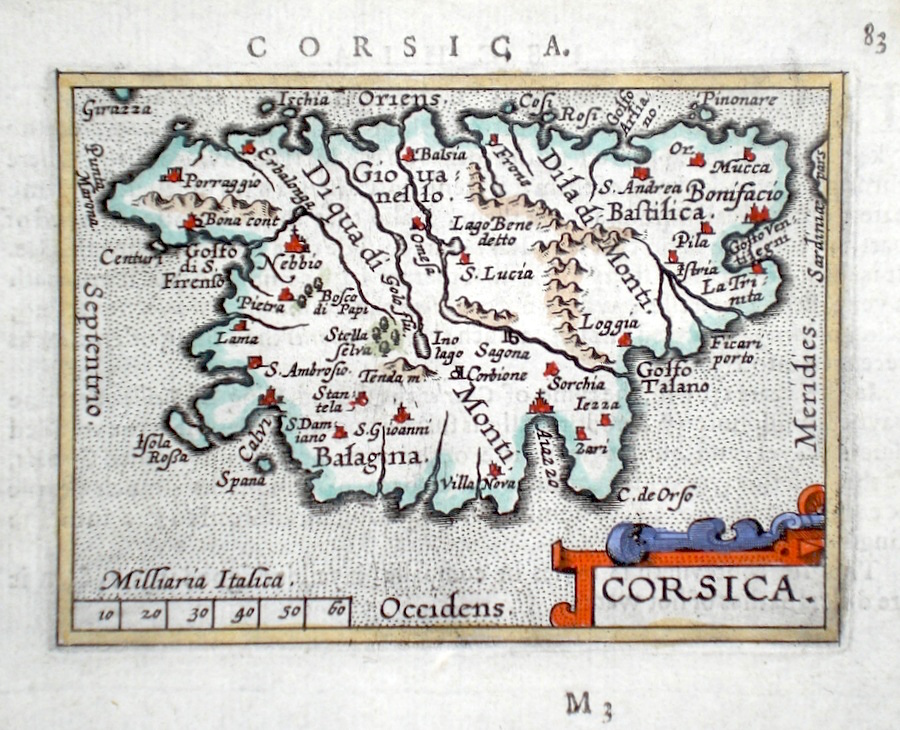
France 'Corsica' Ortelius, A. (c. 1603) 10 x 8.5 Fine early map of the Island of Corsica by Abraham Ortelius, engraved in small format by Philippe Galle, and published in the Epitome, or pocket-edition of the "Theatrum Orbis Terrarum". This map from an English text edition of c. 1603 published in London and thus one of the first world atlases published in England. Fine condition. Later colour 80.00 GBP |
|
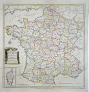
France 'A New and Accurate Map of France, divided into Departments, Districts....' Conder, T. (c. 1790) 36 x 37 Fine map of France from Spencer's History of England. Later colour. Traces of old folds but a crisp copy in excellent condition. 75.00 GBP |
|
Bordeaux Henshall, J. (c. 1832) 38 x 31 Finely executed plan of the city by J Henshall for The Society for the Diffusion of Useful Knowledge. Later colour. 75.00 GBP |

|
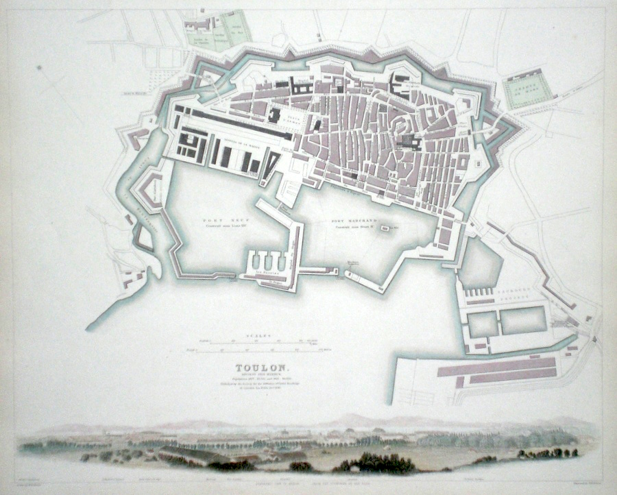
Toulon Davies, B.R. (c. 1836) 38 x 31 Finely engraved plan of the city by B. R. Davies for the Society for the Diffusion of Useful Knowledge. Features include panoramic view of the city from the east. Early colour with additional Later colour. 70.00 GBP |
|
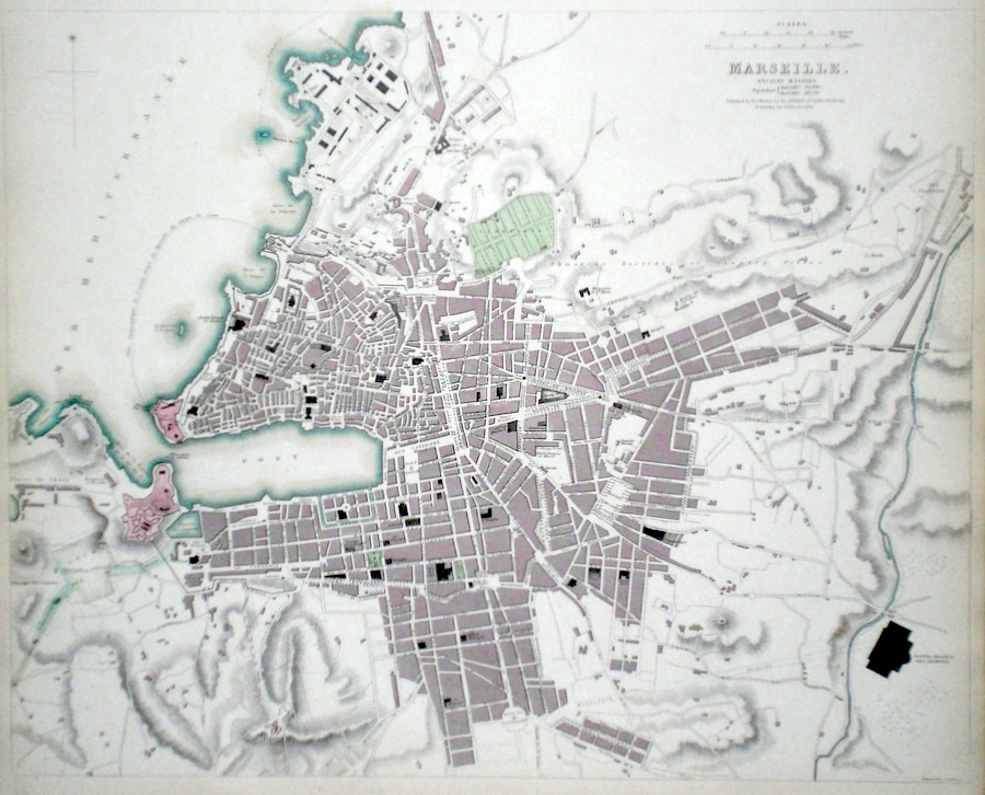
Marseille Davies, B.R. (c. 1840) 40 x 32 Finely engraved plan of the city by B. R. Davies for the Society for the Diffusion of Useful Knowledge. Early colour with additional Later colour. 70.00 GBP |
|
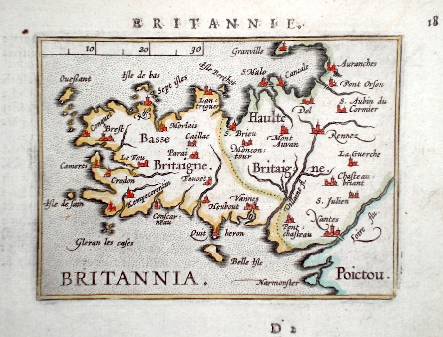
France 'Britannia' Ortelius, A. (c. 1603) 10 x 8.5 Fine early map of the Brittany region by Abraham Ortelius, engraved in small format by Philippe Galle, and published in the Epitome, or pocket-edition of the "Theatrum Orbis Terrarum". This map from an English text edition of c. 1603 published in London and thus one of the first world atlases published in England. Fine condition. Later colour 70.00 GBP |
|
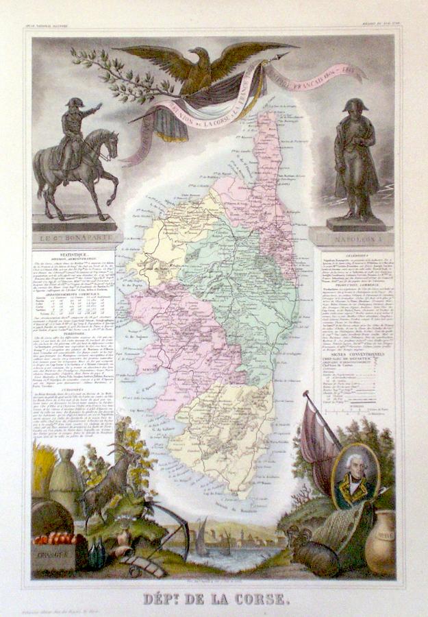
France 'Dept. de La Corse-Corsica' Levasseur (c. 1860) 29 x 44 Attractive map of the Island, a French Department in the Mediterranean famous as the birthplace of Napoleon Bonapart, published by Victor Levasseur. The map is surrounded by extensive vignettes showing the Island and aspects of its economy, Oranges, wine, Olive oil etc. Original colour to the map and later colour to the vignettes. 60.00 GBP |
|
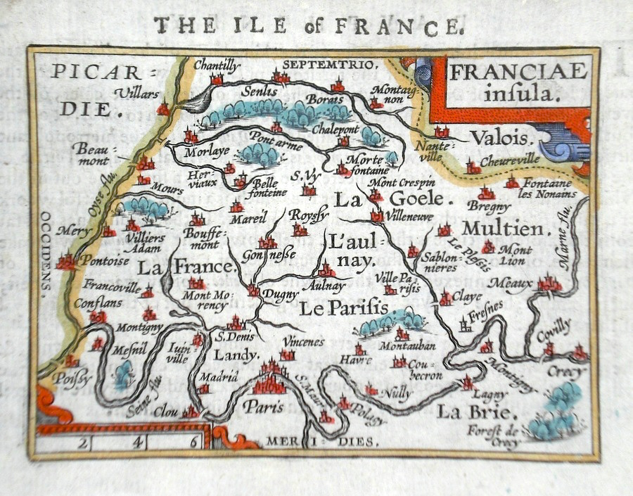
France 'Franciae Insula' Ortelius, A. (c. 1603) 10 x 8.5 Fine early map of Paris region, by Abraham Ortelius, engraved in small format by Philippe Galle, and published in the Epitome, or pocket-edition of the "Theatrum Orbis Terrarum". This map from an English text edition of c. 1603 published in London and thus one of the first world atlases published in England. Fine condition. Later colour 50.00 GBP |
|
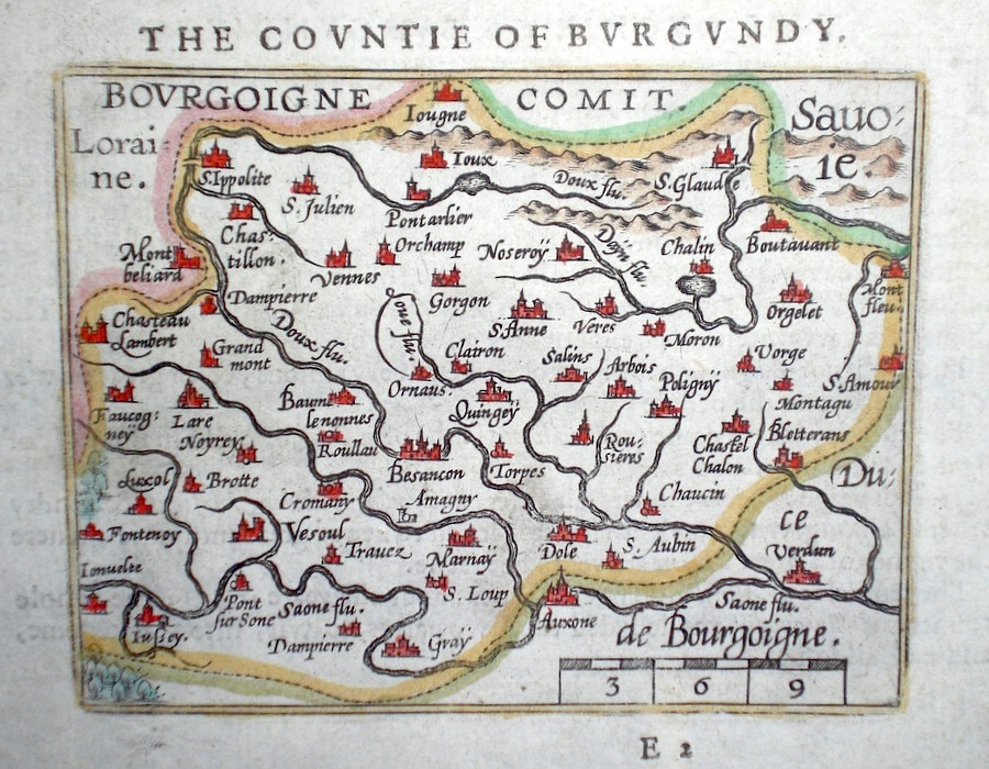
France 'Bourgoine Comit.' Ortelius, A. (c. 1603) 10 x 8.5 Fine early map of The Burgungy Region by Abraham Ortelius, engraved in small format by Philippe Galle, and published in the Epitome, or pocket-edition of the "Theatrum Orbis Terrarum". This map from an English text edition of c. 1603 published in London and thus one of the first world atlases published in England. Fine condition. Later colour 40.00 GBP |
|
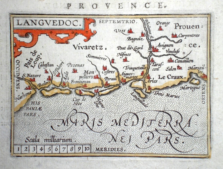
France 'Languedoc' Ortelius, A. (c. 1603) 10 x 8.5 Fine early map of The Languedoc region by Abraham Ortelius, engraved in small format by Philippe Galle, and published in the Epitome, or pocket-edition of the "Theatrum Orbis Terrarum". This map from an English text edition of c. 1603 published in London and thus one of the first world atlases published in England. Fine condition. Later colour 40.00 GBP |
|
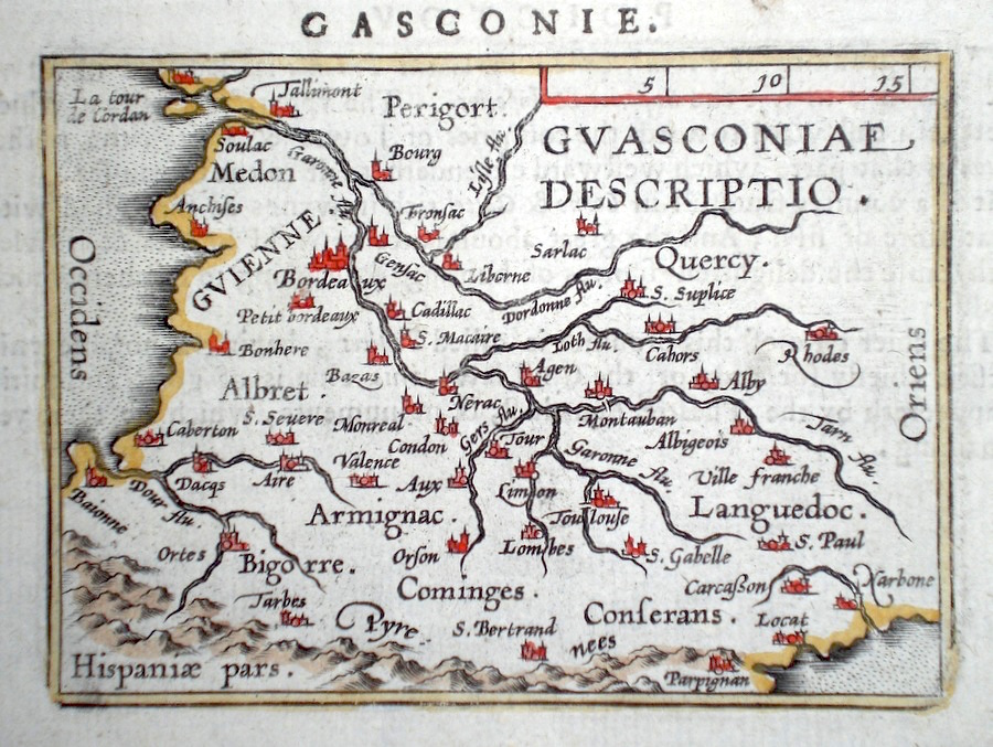
France 'Guasconiae Descriptio' Ortelius, A. (c. 1603) 10 x 8.5 Fine early map of the south western region of France below the Dordogne river, by Abraham Ortelius, engraved in small format by Philippe Galle, and published in the Epitome, or pocket-edition of the "Theatrum Orbis Terrarum". This map from an English text edition of c. 1603 published in London and thus one of the first world atlases published in England. Fine condition. Later colour 40.00 GBP |
|
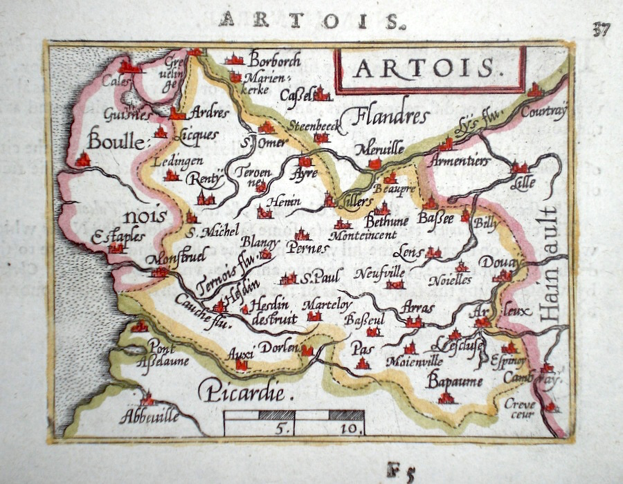
France 'Artois' Ortelius, A. (c. 1603) 10 x 8.5 Fine early map of the Artois region of France, by Abraham Ortelius, engraved in small format by Philippe Galle, and published in the Epitome, or pocket-edition of the "Theatrum Orbis Terrarum". This map from an English text edition of c. 1603 published in London and thus one of the first world atlases published in England. Fine condition. Later colour 40.00 GBP |
|
France 'Turonensis Ducatus' Ortelius, A. (c. 1603) 10 x 8.5 Fine early map of the area of the Dukedom of Touraine, by Abraham Ortelius, engraved in small format by Philippe Galle, and published in the Epitome, or pocket-edition of the "Theatrum Orbis Terrarum". This map from an English text edition of c. 1603 published in London and thus one of the first world atlases published in England. Fine condition. Later colour 40.00 GBP |
|
France Darton, W. (1805) 22 x 19 Copperplate engraving with later colour. Traces of old folds, good condition 30.00 GBP |
|
France 'France in Provinces' Lizars, W & D. (1821) 21 x 19 Map of France from Ewingís Atlas. Later hand colour. Fine condition 30.00 GBP |
|
France France - South Central Dispatch Atlas (1863) 30 x 44 Early outline colour to the various departments. Includes Dordogne, Lozere, Herault Etc. 25.00 GBP |
|
France Dispatch Atlas (1863) 60.5 x 43.5 Double page, early outline colour, good margins. 30.00 GBP |
|
France 'France North Centre' Dispatch Atlas (1863) 30 x 44 Map of Northern France from Pas de Calais down to Cherbourg. Bright original colour to the various departments. 25.00 GBP |