Hertfordshire
Including Hertford, Watford, St. Albans, Hemel Hempstead, Hatfield, Bishops Stortford, Royston
|
Hertfordshire 'Hartford shire Described...' Speed, J. (1612) 51.1 x 38.5 Superb copy of John Speed's map of Hertfordshire after Norden. Sudbury and Humble edition. From The Theatre of the empire of Great Britaine. Two small edge repairs to verso, otherwise a fine dark impression. Early colour. 775.00 GBP |


|
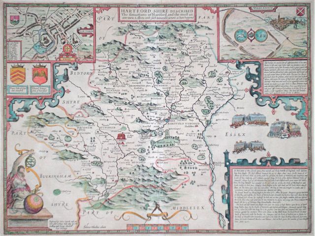
Hertfordshire 'Hartfordshire Described The Situations of Hartford and the most ancient towne St Albans...' Speed, J. (c. 1676) 51 x 39 Superb map of the county by John Speed, Bassett and Chiswell edition. Features include arms of the Earls of Hartford and fine town plans of Hertford and Verolamium with St Albans in the distance. Decorative features include three battle scenes. A good copy with some minor repairs and strengthened central fold. English text verso. Later colour 385.00 GBP |
|
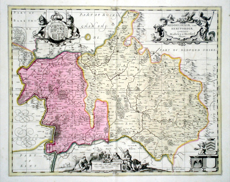
Hertfordshire (with Middlesex) 'Middelsexiae cum Hertfordiae comitatu Midlesex and Hertford Shire' Schenk, P. & Valk, G. (c. 1700) 55 x 44 Very finely engraved map of the two counties by the Dutch cartographers Pieter Schenk and Gerard Valk. Original colour. Verso blank. Particularly fine features of the map include a miniature plan of London and two extensive cartouches showing local activities such as barley growing and animal husbandry. The partnership of Schenk and Valk produced some of the best Dutch cartography, much of their output being based on the maps of Janssonius from whose business they had purchased many of the copper plates. 385.00 GBP |
|
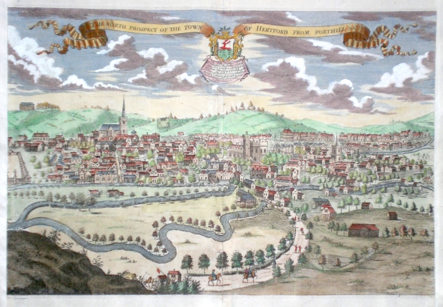
Hertfordshire 'The North Prospect of the Town of Hertford from Port Hill' Drapentier, J. (1700) 40 x 27 Fine copper engraved town view by Drapentier published in Sir Henry Chauncy's History of Hertfordshire. A rarely available item. Later colour 345.00 GBP |
|
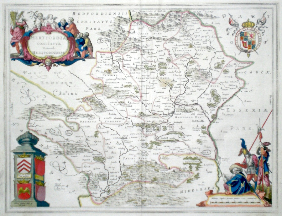
Hertfordshire 'Hertfordia Comitatus vernacule Hertfordshire' Blaeu, J. (c. 1646) 50 x 38 Very fine map of the County by Joan Blaeu. The map embodies the finest features of Dutch Cartography of the Seventeenth century. Superbly engraved and arranged, with shields, coats of arms, putti, and English civil war soldiers depicted. Dutch text verso and full margins. Original colour. 325.00 GBP |
|
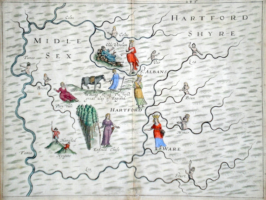
Hertfordshire Midlesex Hartfordshyre Hole, W. (c. 1613) 34 x25 Decorative and rare engraving representing the Hertfordshire and Middlesex counties by William Hole for Michael Drayton's Polyolbion. Richly decorated with many water nymphs, huntsmen, farmworkers, and allegorical figures to illustrate the main topographical features, river system, towns etc. Later colour. This copy in excellent condition. Michael Drayton (1563-1631) was an important poet and literary figure. A contemporary of Shakespeare and Spenser, the Polyolbion is considered to be his masterpiece. He is buried in Westminster Abbey 300.00 GBP |
|
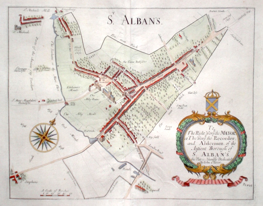
Hertfordshire 'St. Alban's' Oliver, J. (1700) 37 x 29 Superbly engraved Town Plan by John Oliver for Sir Henry Chauncy's History of Hertfordshire. A rare Item in fine condition. Later colour 300.00 GBP |
|
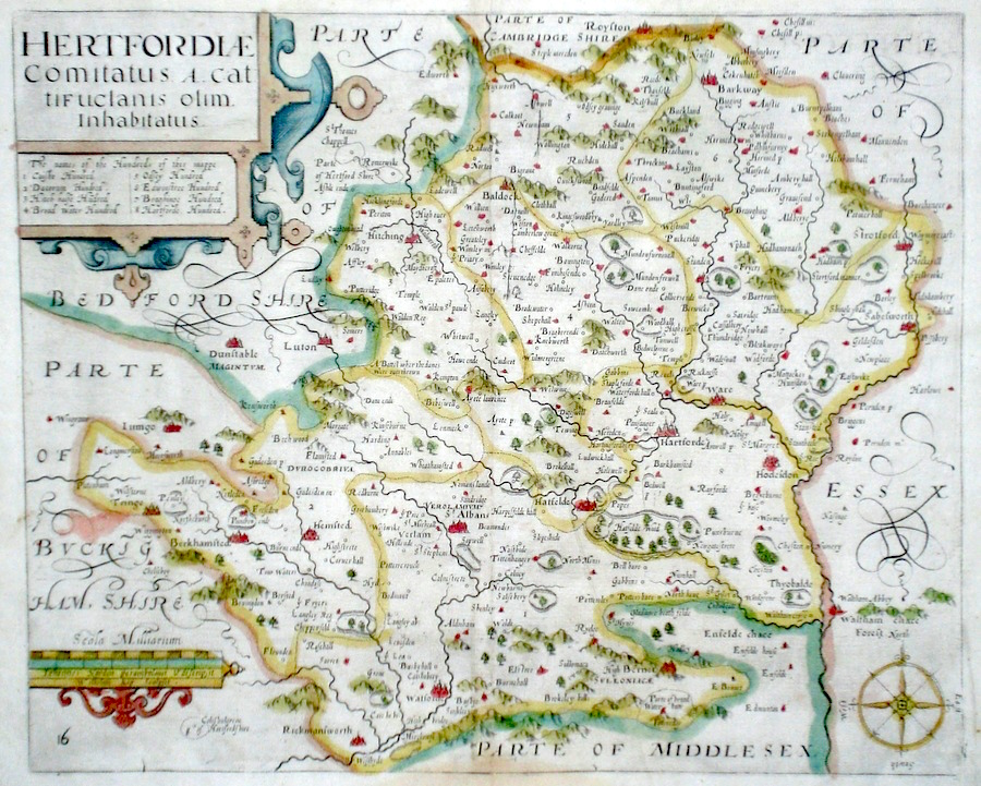
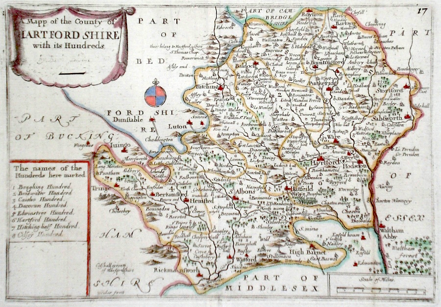
Hertfordshire 'Hertfordiae Comitatus A.Catifuclanis olim inhabitatus' Kip, W. (1637) 35 x 29 Early map of Hertfordshire showing Hundreds. Based on the survey of John Norden, Published in William Camden's "Britannia". No text verso. Plate number, lower left corner. A good copy with bright later colour. 235.00 GBP |
|
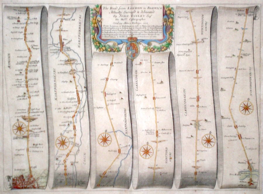
Hertfordshire 'The Road from London to Barwick...' Ogilby, J. (1698) 45 x 33 The Road from London to Hackney, Enfield, Hoddesdon, Ware, Buntingford, Royston, Huntingdon, Stilton. The first of the road maps from London to Berwick. From John Ogilby's Britannia, generally considered one of the most important cartographical works of the seventeenth century. Features include town plans of London (north), Huntingdon, and a fine cartouche. Later colour. Plate number 5. Excellent condition. 240.00 GBP |
|
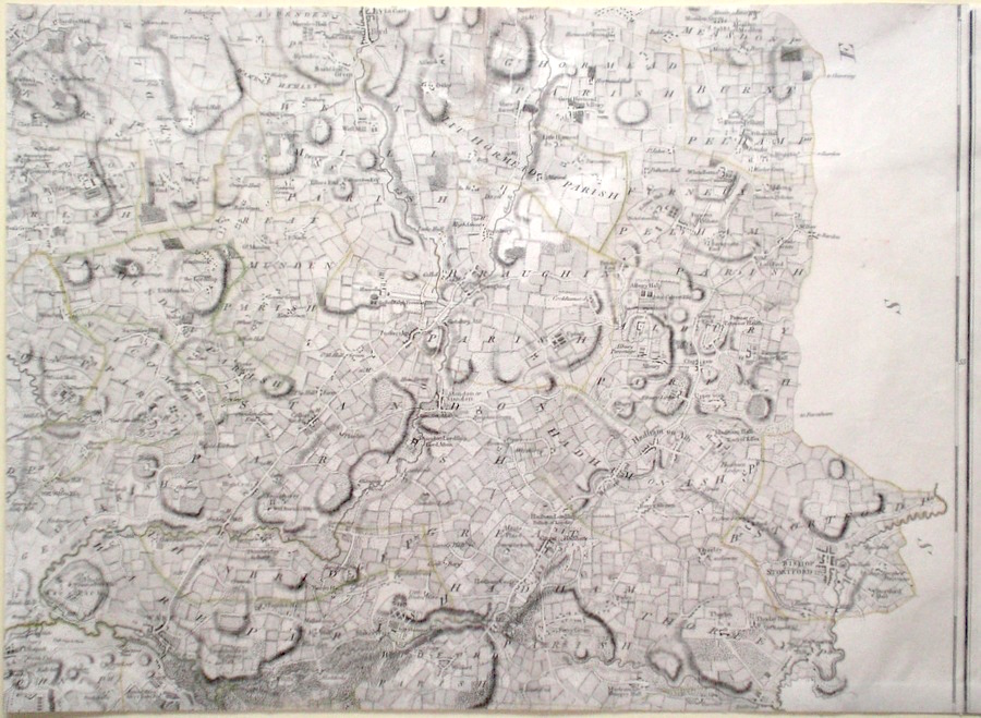
Hertfordshire 'A Topographical Map of Hartfordshire Taken From an Actual Survey. Sheet 4.' Andrews, J. & Dury, A. (1777) 70 x 53 Western central sheet of John Andrews and Andrew Dury's nine sheet map of Hertfordshire. An original survey, the map is the first to show parishes and the large scale allows significant detail to be shown. This sheet covers the towns of Tring, Berkhamsted, Hemel Hempsted, King's Langley. Later colour. 250.00 GBP |
|
Hertfordshire 'A Topographical Map of Hartfordshire Taken From an Actual Survey. Sheet 2' Andrews, J. & Dury, A. (1777) 70 x 53 North central sheet of John Andrews and Andrew Dury's nine sheet map of Hertfordshire. An original survey, the map is the first to show parishes and the large scale allows significant detail to be shown. This sheet covers the towns of Hitchin, Letchworth, Baldock. Later colour. 220.00 GBP |
|
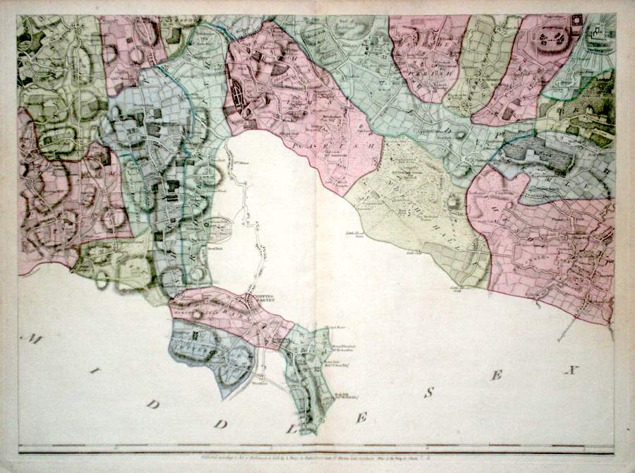
Hertfordshire 'A Topographical Map of Hartfordshire From an Actual Survey. Sheet 8' Andrews, J. & Dury, A. (1777) 70 x 53 South central sheet of John Andrews and Andrew Dury's nine sheet map of Hertfordshire. An original survey, the map is the first to show parishes and the large scale allows significant detail to be shown. This sheet covers the towns of Totteridge, Barnet, Essendon, Cheshunt. Later colour. 200.00 GBP |
|
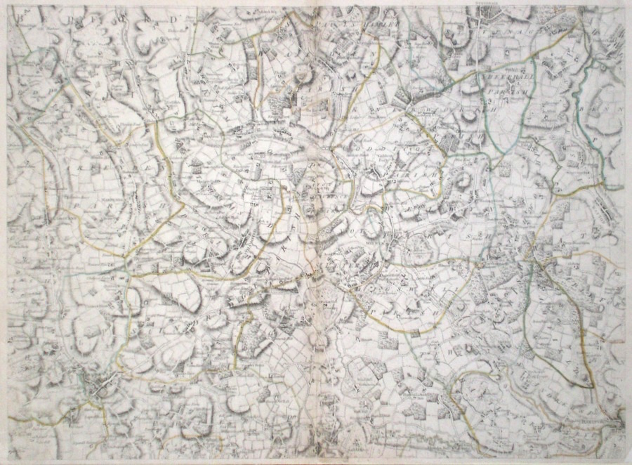
Hertfordshire 'A Topographical Map of Hartfordshire From an Actual Survey. Sheet 5 Andrews, J. & Dury, A. (1766) 70 x 53 Central sheet of John Andrews and Andrew Dury's nine sheet map of Hertfordshire. An original survey, the map is the first to show parishes and the large scale allows significant detail to be shown. This sheet covers the towns of St. Albans, Welwyn, Stevenage, Hatfield and western Hertford. Original colour. 200.00 GBP |
|
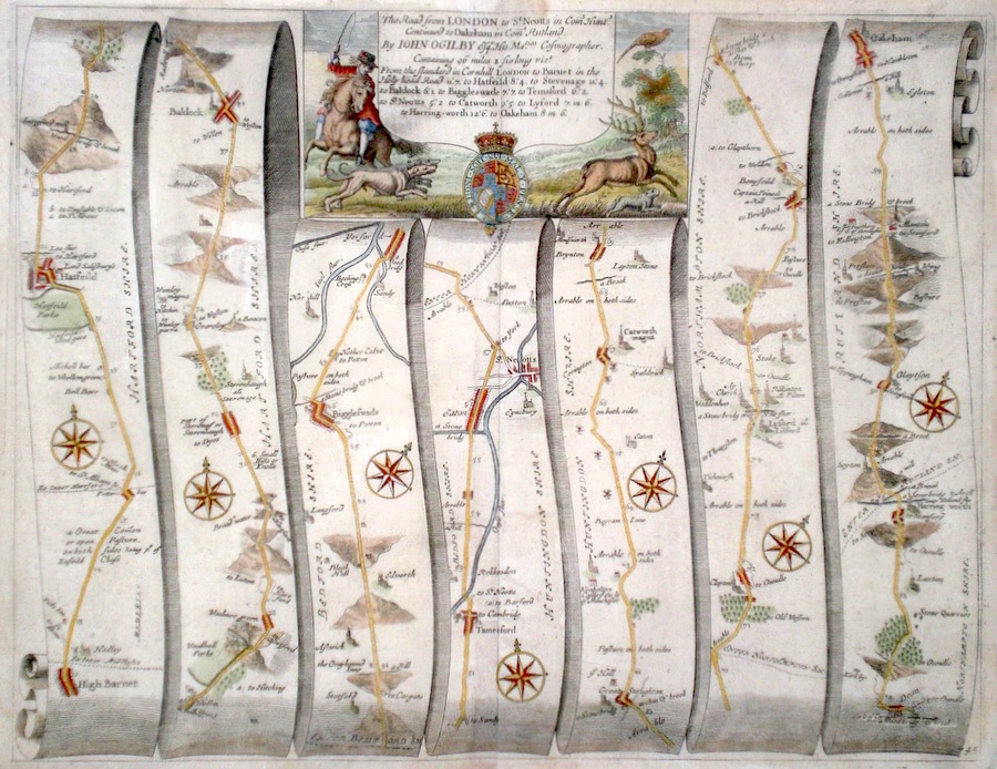
Hertfordshire 'The Road from London to St. Neotts in com' Hunt' Ogilby, J. (1698) 45 x 35 The road from High Barnet to Hatfield, Stevenage, Baldock, Biggleswade, Tempsford, St. Neots continuing to Catworth, Lilford, Oakeham. From John Ogilby's Britannia, generally considered one of the most important cartographical works of the seventeenth century. Features include town plans of Hatfield, St. Neots, Oakeham and a fine cartouche depicting a rural scene. Later colour. Plate number 45 200.00 GBP |
|
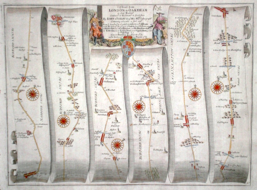
Hertfordshire 'The Road from London to Oakeham in com. Rutland' Ogilby, J. (c. 1675) 44 x 33 The road from London to Oakeham,- this section is from St. Albans through Luton, Bedford, Wellingborough, Kettering, Uppingham to Oakham. From John Ogilby's Britannia, generally considered one of the most important cartographical works of the seventeenth century. Features include a very fine cartouche depicting rural pursuits. Later colour. Plate number 47. Very good condition. 195.00 GBP |
|
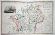
Hertfordshire 'A Map of the County of Hertford' Greenwood, C & J (1834) 73 x 58.5 Original hand colour, vignette of St. Albans Abbey, good margins, slight offsetting. 200.00 GBP |
|
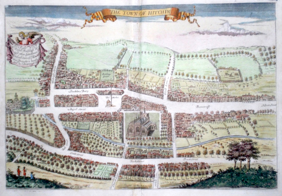
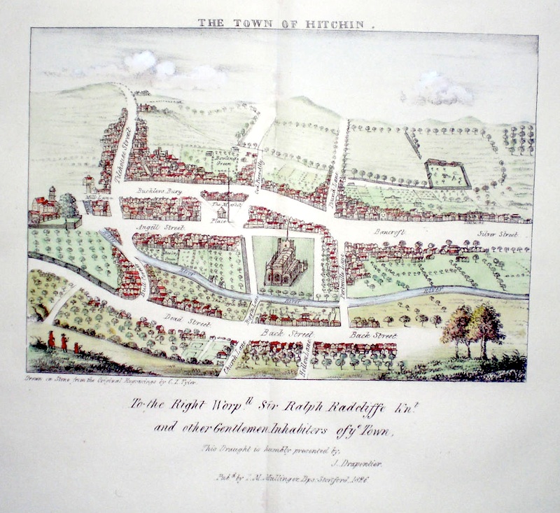
Hertfordshire 'The Town Of Hitchin' Drapentier, J. (c. 1700) 41 x 27 Very fine bird's-eye type engraving by J. Drapentier for Sir Henry Chauncy's History of Hertfordshire. A rare item, relatively few were printed. In the foreground it is believed Drapentier has drawn himself making the view (seated figure). Later colour. Excellent condition. 180.00 GBP |
|
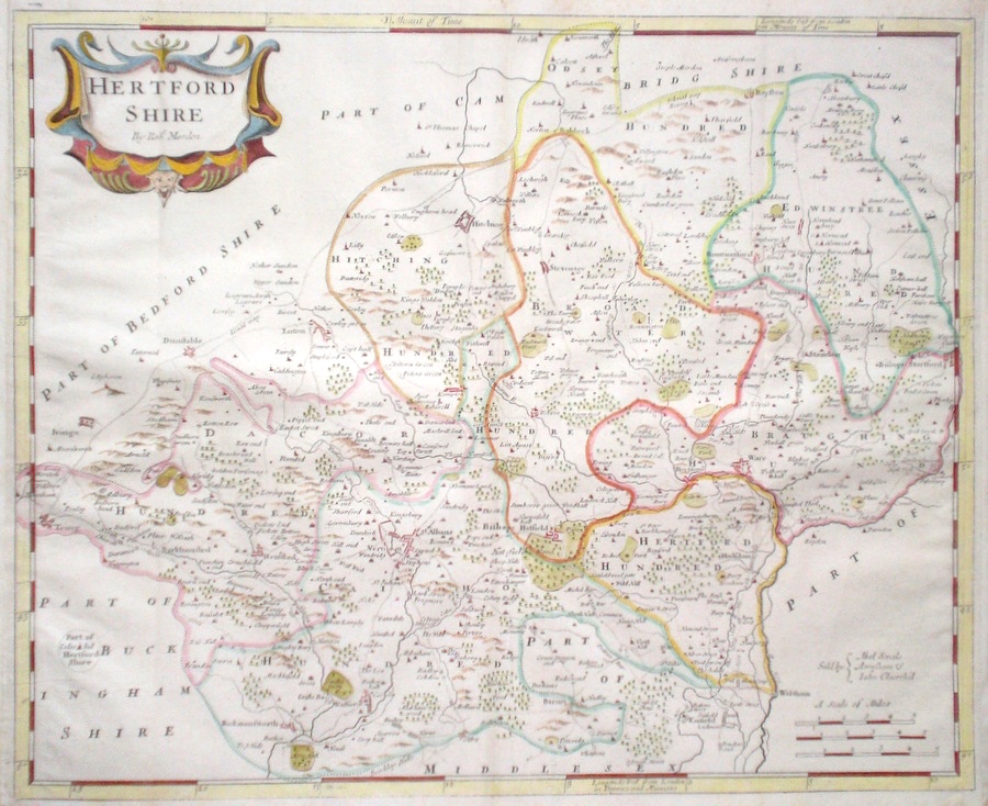
Hertfordshire Morden, R. (1722) 45 x 36.5 Finely engraved map of the County by Robert Morden. From the 1722 edition of Camden's Britannia. Later colour 160.00 GBP |
|
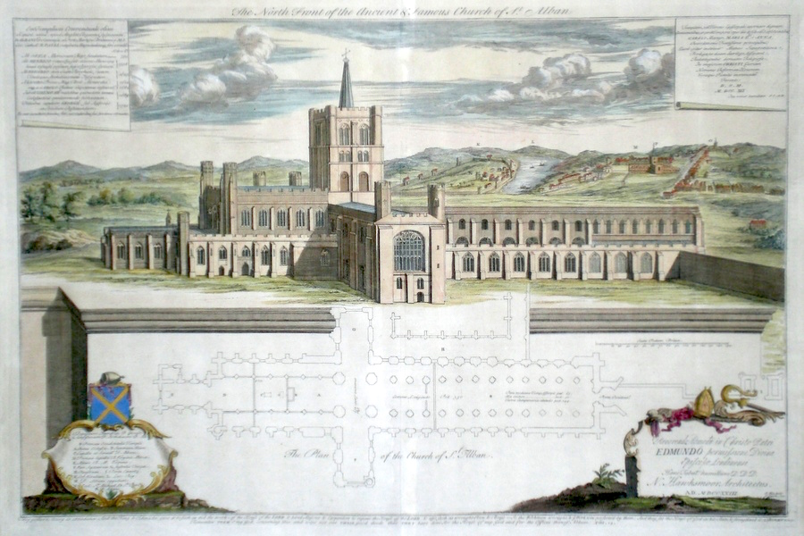
Hertfordshire 'The North Front of the Ancient and famous Church of St. Alban' Kip, J. (c. 1723) 59 x 40 Superb large engraving by John Kip of St Albans Abbey. Double page. Shows the Abbey as a view and a ground plan. In the distance the town of St. Albans and abbey including Verulamium. To the bottom left a key lists the main buildings and other churches in the area and displays the arms of St. Albans. A dedication bottom right acknowledges the architect, Nicholas Hawksmoor. Later colour. Condition excellent. Hawksmoor died in 1736 at his house in Westminster, but was buried at his request in Shenly, Hertfordshire. 150.00 GBP |
|
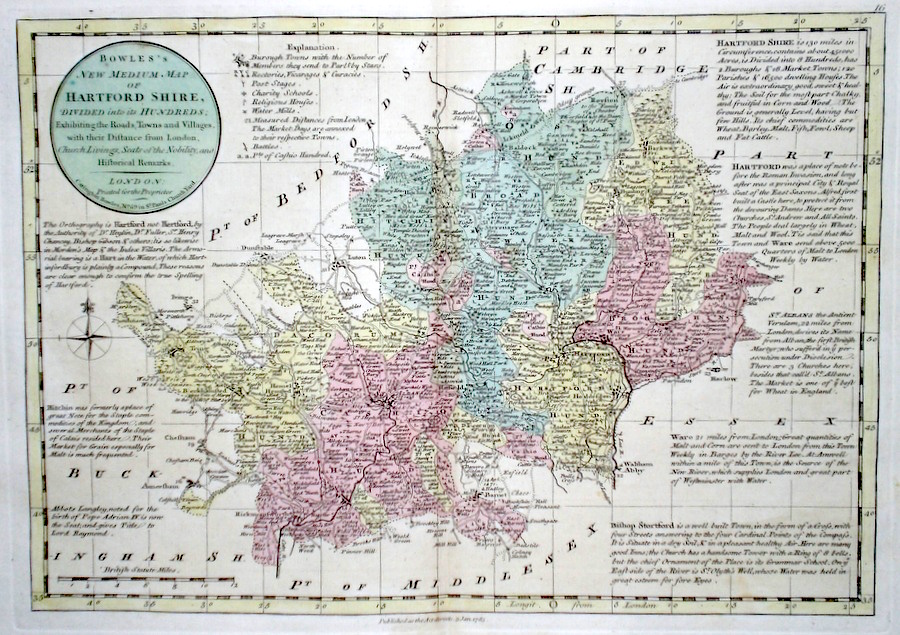
Hertfordshire 'Bowles's New Medium Map of Hertfordshire...' Bowen, E. & T. (1785) 33 x 23 Finely engraved and detailed map of the county from "Bowles's New Medium English Atlas". The maps in this series are based on those in Emanuel and Thomas Bowen's Atlas Anglicanus, and feature extensive county information on the map. They are distinguished primarily by having newly engraved cartouches, distances from London added to towns, and different imprints at the bottom. Full original colour. Fine condition. 150.00 GBP |
||||||||||||||
|
Hertfordshire Throcking Drapentier, J. (1700) 41 x 32 Throcking, Hertfordshire. Fine copperplate engraving by Drapentier published in Sir Henry Chauncy's History of Hertfordshire. Near Buntingford/Cottered Hertfordshire. Later colour 150.00 GBP |
|
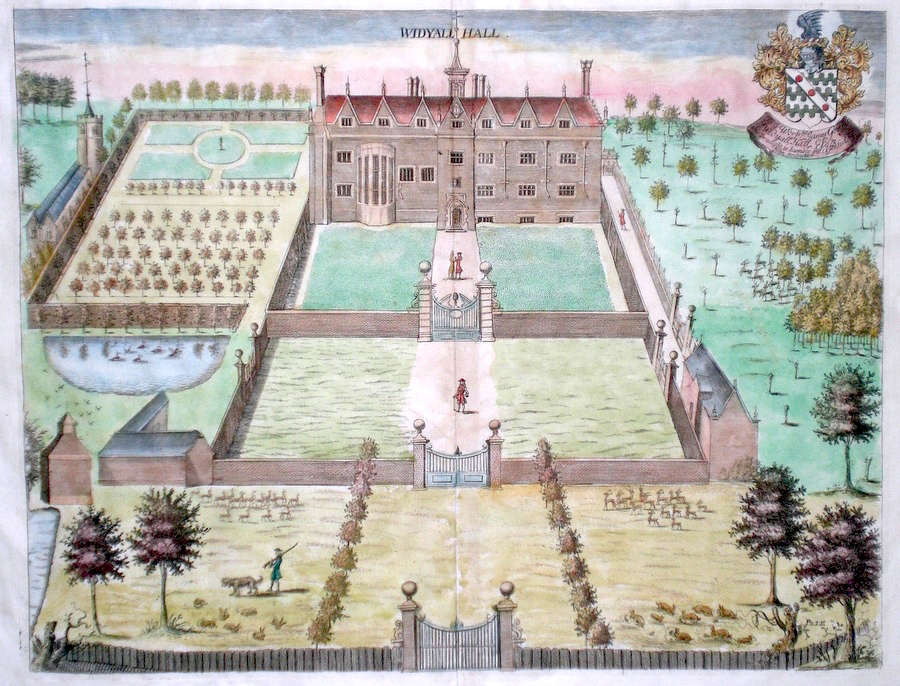
Hertfordshire Widyall Hall Drapentier, J. (1700) 37 x 29 Widdyall Hall, Hertfordshire. Fine copperplate engraving by Drapentier published in Sir Henry Chauncy's History of Hertfordshire. Near Buntingford Hertfordshire. Later colour 150.00 GBP |
|
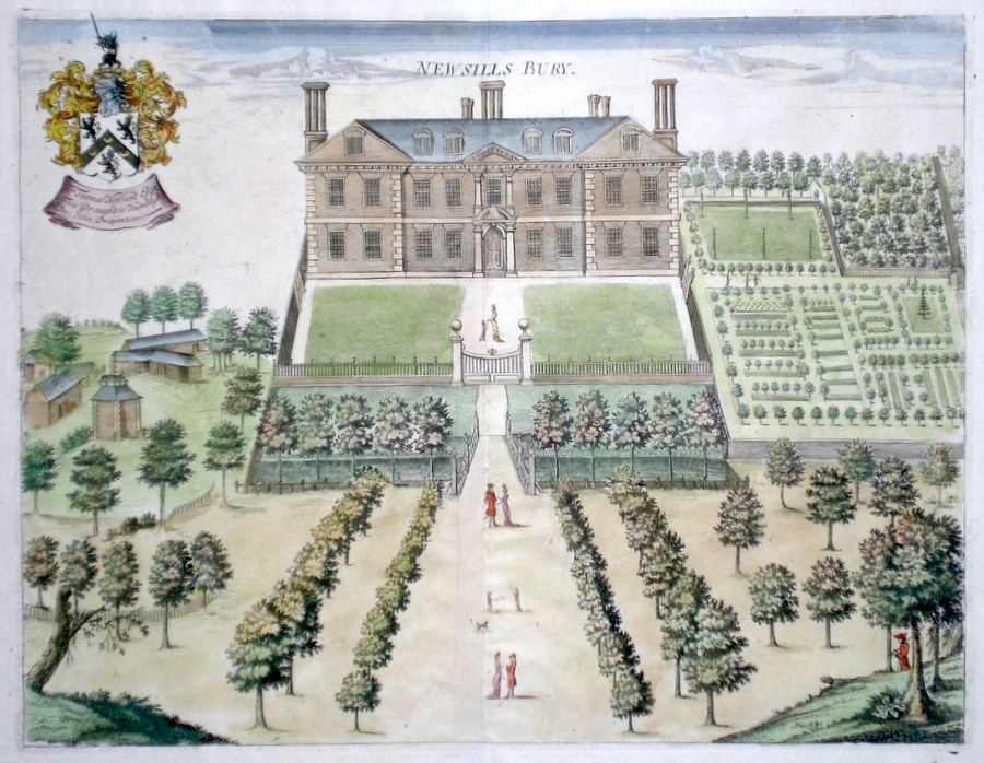
Hertfordshire Newsills Bury Drapentier, J. (1700) 37 x 29 Newsillsbury, Hertfordshire. Fine copperplate engraving by Drapentier published in Sir Henry Chauncy's History of Hertfordshire. Near Royston, Hertfordshire. Rare engraving often missing from copies of Chauncy's History. Later colour 150.00 GBP |
|
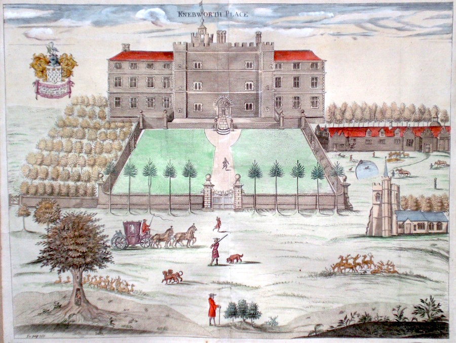
Hertfordshire Knebworth Park Drapentier, J. (1700) 42 x 32 Knebworth. Fine copperplate engraving by Drapentier published in Sir Henry Chauncy's History of Hertfordshire. Later colour 150.00 GBP |
|
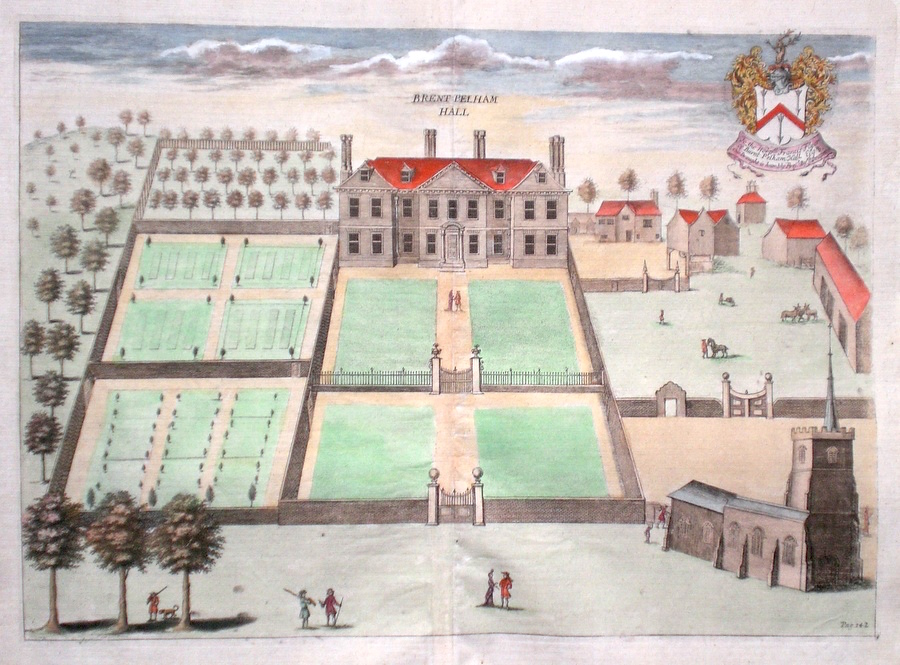
Hertfordshire Brent Pelham Hall Drapentier, J. (1700) 41 x 29 Brent Pelham Hall. Fine copperplate engraving by Drapentier published in Sir Henry Chauncy's History of Hertfordshire. The dedication (top right) is "To the Worshipful Francis Flyer of Burnt Pelham Hall". Later colour 150.00 GBP |
|
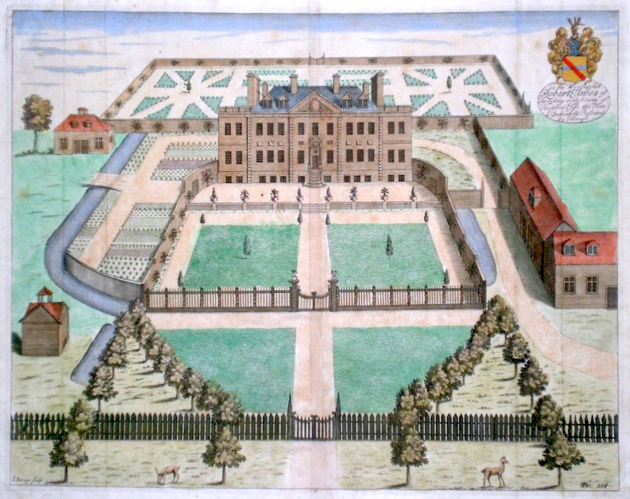
Hertfordshire Bedwell Parke Drapentier, J. (c. 1700) 37 x 28.5 Superbly decorative folio plate from Chauncy's History of Hertfordshire. Some minor strengthening to bottom right corner. Later colour. Other plates available please enquire. 150.00 GBP |
|
Hertfordshire Hyde Hall Drapentier, J. (c.1700) 37 x 29 Superbly decorative folio plate from Chauncy's History of Hertfordshire. Some minor strengthening to bottom of fold. Later colour. Other plates available. Please enquire. 150.00 GBP |
|
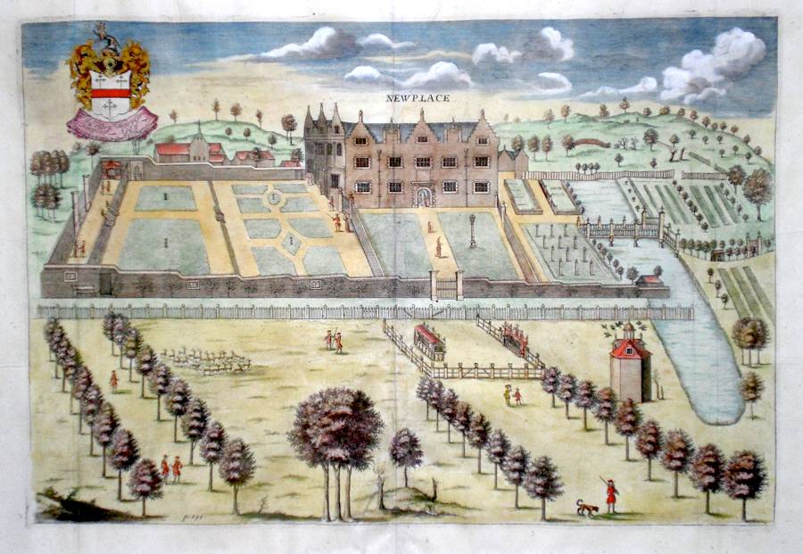
Hertfordshire New Place Drapentier, J. (1700) 44 x 30 New Place Hertfordshire. Fine copperplate engraving by Drapentier published in Sir Henry Chauncy's History of Hertfordshire. New Place is situated near Eastwick in Eastern Hertfordshire. Later colour 150.00 GBP |
|
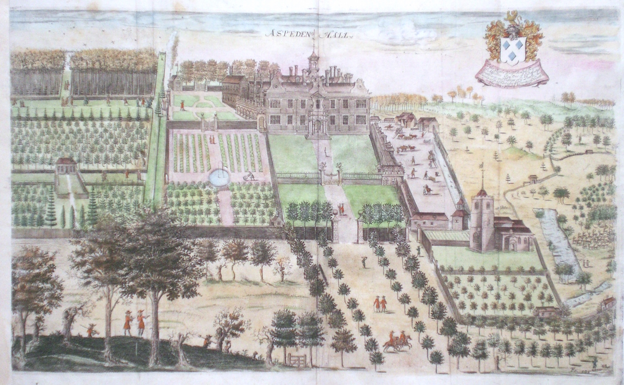
Hertfordshire Aspeden Drapentier, J. (1700) 50 x 30 Rare copperplate engraving of Aspeden Hall By John Drapentier. First published in Sir Henry Chauncy's History of Hertfordshire. Aspeden is situated near Buntingford in east Hertfordshire. Later colour 150.00 GBP |
|
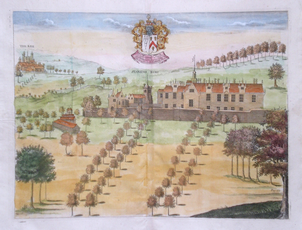
Hertfordshire Stansted Bury Drapentier, J. (1700) 38 x 29 Rare copperplate engraving of Stanstedbury By John Drapentier. First published in Sir Henry Chauncy's History of Hertfordshire. Stanstedbury is situated near Stansted Abbot's in east Hertfordshire. Top left is engraved the Rye House. Later colour 150.00 GBP |
|
Hertfordshire 'A Mapp of Hartfordshire with its Hundreds by Ric Blome'. Blome, R. (1673) 32 x 25 Very attractive and characteristic engraving by Richard Blome. Later hand colour and in very good condition. A small repaired split to the bottom of the fold. 140.00 GBP |
|
Hertfordshire 'A Topographical Map of Hartford-shire from an Actual Survey. Sheet 6' Andrews, J. & Dury, A. (1777) 70 x 53 Central Eastern sheet of John Andrews and Andrew Dury's nine sheet map of Hertfordshire. An original survey, the map is the first to show parishes and the large scale allows significant detail to be shown. This sheet covers the towns of Bishop's Stortford etc. This copy trimmed to the engraving on three sides with a margin on the right. Original colour. Some professional restoration to top areas 125.00 GBP |
|
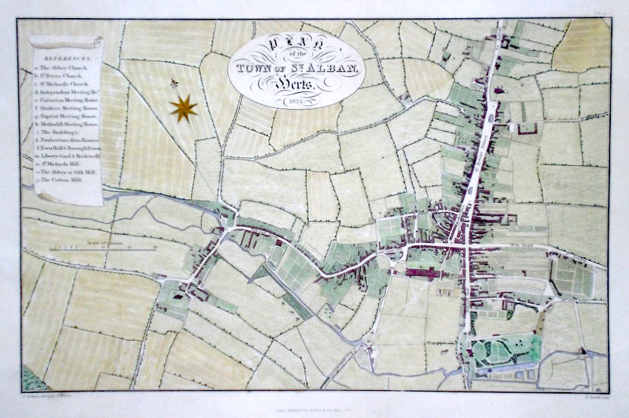
Hertfordshire 'Plan of the Town of St. Alban, Herts.' Turrell, E. (c. 1823) 36 x 24 Fine, detailed town plan engraved by Turrell after a survey by Goodman. A key to the left identifies the main buildings in the town, numbered on the engraving. Later colour. Condition excellent 120.00 GBP |
|
Hertfordshire 'A Mapp of the County of Hartfordshire with its Hundreds' Hollar, W. (c. 1731) 21 x 15 Finely engraved map of the county by Wenceslaus Hollar from the atlas "England Exactly Described or a Guide to Travellers…" first published by Thomas Taylor, but herewith from the later edition published by Thomas Bakewell. A major addition to the earlier plates is that roads and distances between towns are now included, after the road surveys of John Ogilby. Fine condition.Later colour 100.00 GBP |
|
Hertfordshire Slater, I. (c. 1857) 36 x 23 Later issue of the popular Pigot maps with updating of the railways. Steel engraving with later colour 80.00 GBP |
|
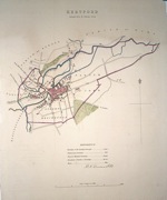
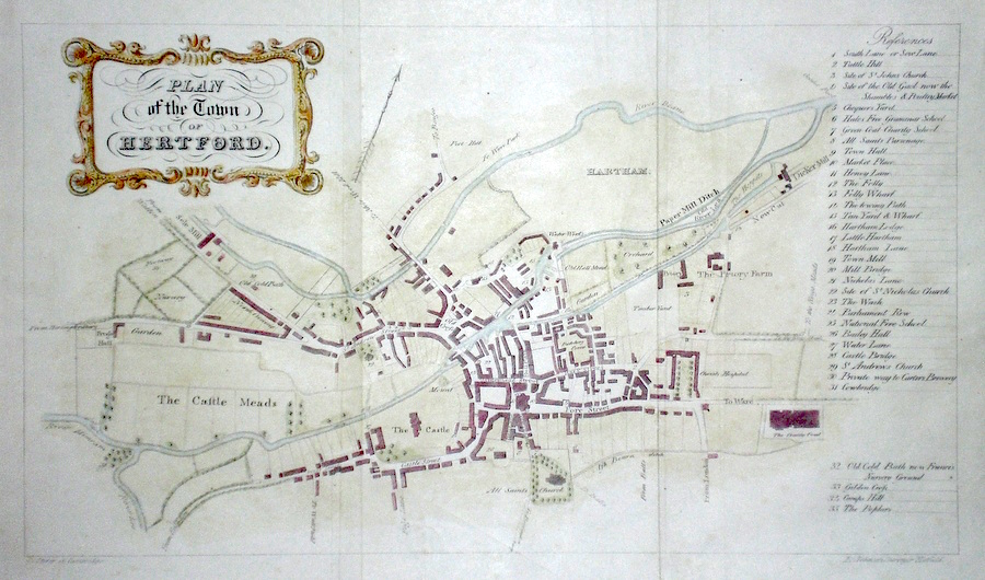
Hertfordshire 'Plan of the Town of Hertford' Storer (c. 1830) 33 x 20 Attractive plan of the Town by Storer after the Survey of E Johnson of Hatfield. To the right a key lists all the important buildings etc of the town with numbers to be found on the plan. Later colour. 75.00 GBP |
|
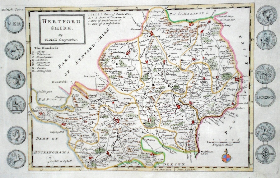
Hertfordshire Moll, H. (c. 1724) 32 x 20 Finely engraved map of the county by Herman Moll for the publication "A New Description of England and Wales…" The maps in this series include engraved borders of local architectural and antiquarian interest. A unique feature. On this map early British coins. Later colour, fine condition. 70.00 GBP |
|
Hertfordshire 'The Town of Hitchin' Drapentier, J. (1826) Attractive bird's eye view of Hitchin originally produced for Sir Henry Chauncy's History of Hertfordshire. Lithograph published in 1826 by Mullinger of Bishop's Stortford. Later colour 70.00 GBP |
|
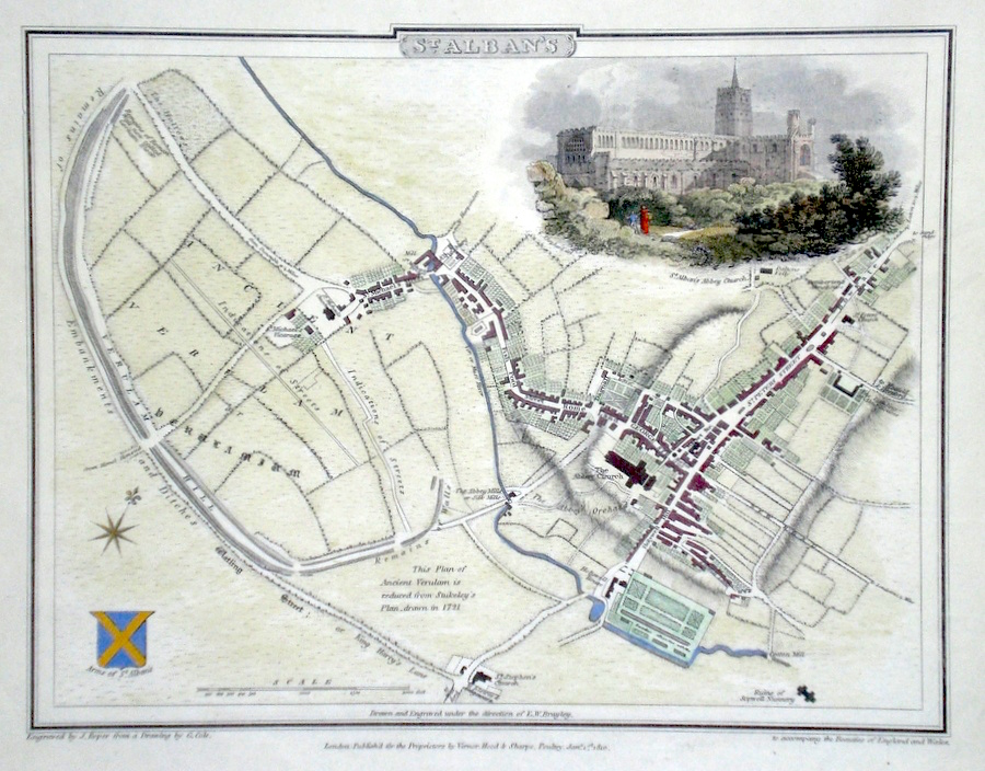
Hertfordshire St. Albans Cole, G. (c. 1810) 23 x 18 Attractive and detailed town plan drawn by George Cole and engraved by J. Roper. Later colour 65.00 GBP |
|
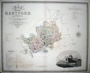
Hertfordshire Moule, T (c. 1845) 20 x 24 Steel engraved map by Thomas Moule. Moule was a Heraldry expert and antiquarian and the attractive embellishments on his maps make them amoungst the last of the decorative maps to be published. The engraver of the Hertfordshire map was Schmollinger. Later colour. Good condition with margins. 60.00 GBP |
|
Hertfordshire Rocque, J. (c. 1769) 20 x 16 Finely engraved map of the county by John Rocque for the publication "England Displayed". Later colour 50.00 GBP |
|
Hertfordshire Hertford Dawson (1837) 25 x 31 Hand coloured town plan, four inches to a mile. Vertical fold. Light toning to top. 50.00 GBP |