Huntingdonshire
Including Huntingdon, St. Ives, St. Neots, Ramsey, Yaxley
|
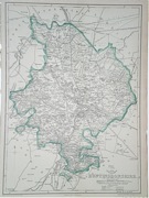
Huntingdonshire 'Huntingdonensis Comitatus Huntington Shire' Blaeu, J. (c. 1646) 51 x 40 Very finely engraved map of Huntingdonshire by J. Blaeu. The map features a substantial cartouche featuring a rural scene with hawking and hounds, a further extensive cartouche of four putti with a collection of ten decorative shields, and three other extensive heraldic embellishments. Dutch text verso. Full margins with early hand colour. 220.00 GBP |


|
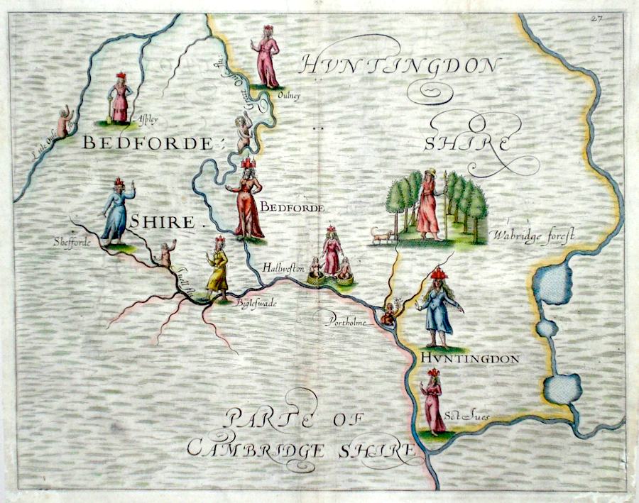
Huntingdonshire Bedfordeshire and Huntingdonshire Hole, W. (1622) 31 x 25 Decorative and rare engraving representing Bedfordshire and Huntingdonshire counties by William Hole for Michael Drayton's Polyolbion. Decorated with water nymphs, and allegorical figures to illustrate the main topographical features, rivers, towns etc. Michael Drayton (1563 - 1631) was an important poet and literary figure. A contemporary of Shakespeare and Spenser, the Polyolbion is considered to be his masterpiece. He is buried in Westminster Abbey. Later colour. Traces of worm to lower corners faintly affecting the engraving. Otherwise excellent 180.00 GBP |
|
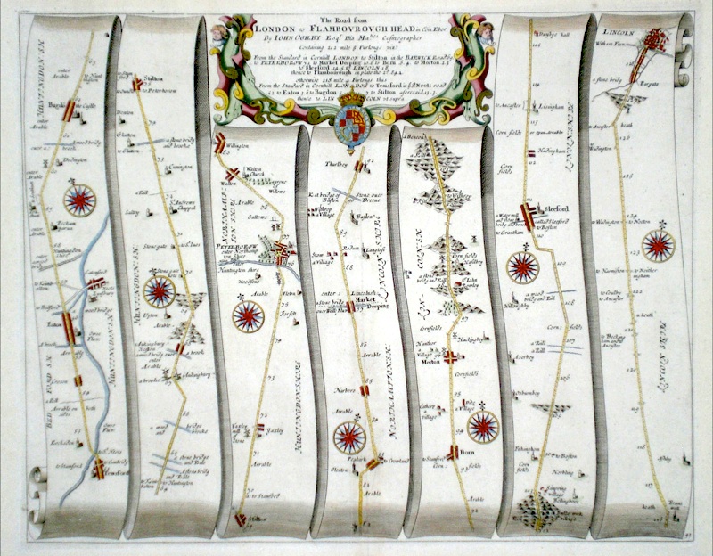
Huntingdonshire 'The Road from London to Flambourough Head….' Ogilby, J. (1698) 43 x 35 The road from London to Flamborough Head. From John Ogilby's Britannia, generally considered one of the most important cartographical works of the seventeenth century. This section is from Temsford through to Stilton, then Peterborough, Market Deeping, Morton, Sleaford, and on to Lincoln. Features include miniature town plans of Peterborough and Lincoln. Fine cartouche. Plate mark 41. Fine dark engraving in excellent unmarked condition with good margins. Later colour 140.00 GBP |
|
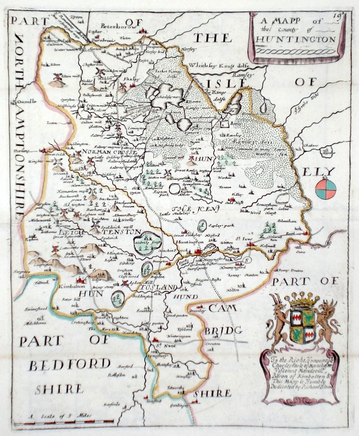
Huntingdonshire 'A Mapp of the county of Huntington' Blome, R. (c. 1731) 19 x 24 Finely engraved map of the county by Richard Blome from the atlas "England Exactly Described or a Guide to Travellers…" first published by Thomas Taylor, but herewith from the later edition published by Thomas Bakewell. A major addition to the earlier plates is that roads and distances between towns are now included, after the road surveys of John Ogilby. Here Bakewell has not removed the name of Blome from the plate as is usually the case. Fine condition. Later colour 70.00 GBP |
|
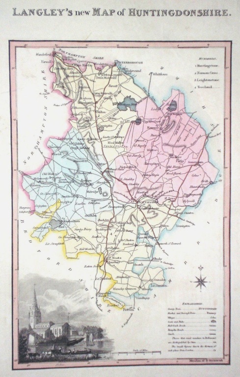
Huntingdonshire 'Langley's new Map of Huntingdonshire' Langley, E. (c. 1818) 18 x 26 Attractive and uncommon map of the county by the partnership of Edward Langley and William Belch from their publication Langley's New County Atlas of England and Wales. The vignette shows a view of St. Ives. Fine original hand colouring. 60.00 GBP |
|
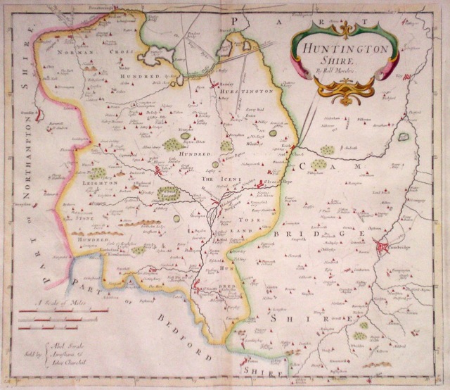
Huntingdonshire 'Huntingtonshire By Robt. Morden' Morden, R. (1722) 42.5 x 36.5 Finely engraved and decorative map of the county by Robert Morden. From the 1722 edition of Camden's Britannia. Later colour 50.00 GBP |
|
Huntingdonshire 'Map of England and Wales' Cary, J. (c. 1790) 21 x 27 Sheet 34 of John Cary's Map of England and Wales published in 81 sheets. Covers the area of Huntingdonshire and much of Cambridgeshire includes Cambridge, Ely Wisbeach, Oundle, Peterborough etc. Original colour. 40.00 GBP |
|
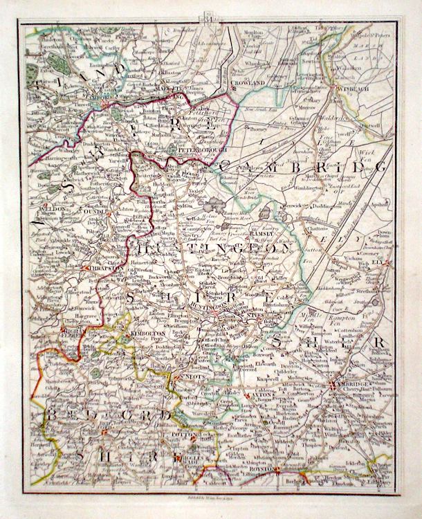
Huntingdonshire 'A Map of Huntingdonshire from the Best Authorities' Cary, J. Camden's Britannia (1789) 41 x 53 Double page finely engraved map. Good impression and good condition. 40.00 GBP |
|
Huntingdonshire 'A New Map of Huntingdonshire Drawn from the Best Authorities' Kitchen, T. (1764) 20 x 26 Detailed and finely engraved map giving a wealth of county information. Engraved by Thomas Kitchen. Later colour 35.00 GBP |

|
Huntingdonshire Laurie & Whittle. (c. 1807) 18 x 23 Scarce map of the county, originally engraved by Benjamin Baker. Subsequently used by Laurie and Whittle for the New and Improved English Atlas. 35.00 GBP |

|
Huntingdonshire Dispatch Atlas (1863) 31 x 43 Early outline colour. 20.00 GBP |