India
|
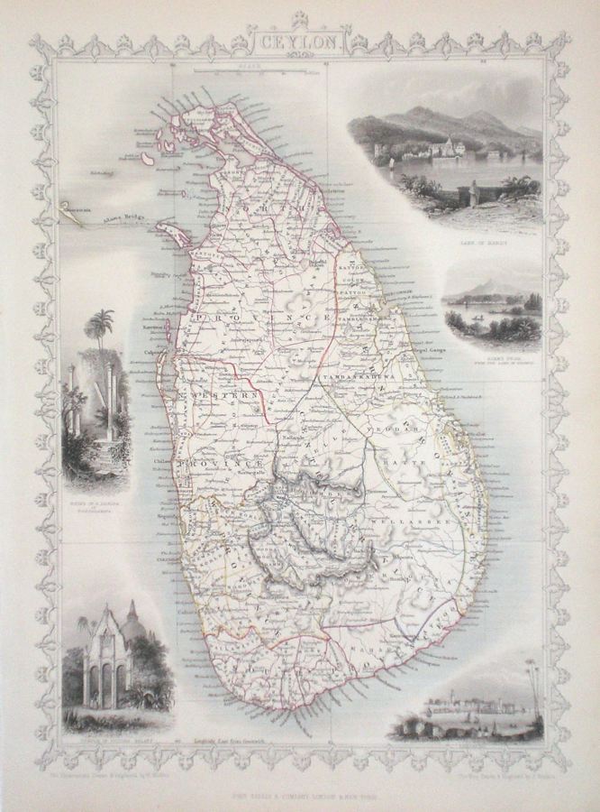
India 'Ceylon' Rapkin, J. (1851) 26 x 34 Superb map of the Island of Ceylon, (now Sri Lanka), engraved by John Rapkin, for John Tallis's highly decorative "The Illustrated Atlas". The vignettes show; Lake of Kandy, Adam's Peak, Colombo, Temple of Buddah Kalany, and Ruins of a Dagora at Toopharamay'. Single page map, (no central fold). Original colour as published. Condition fine. 120.00 GBP |


|
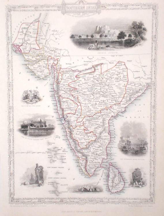
India 'Southern India' Rapkin, J. (1851) 26 x 34 Fine map of the area by John Rapkin, for John Tallis's highly decorative "The Illustrated Atlas". The vignettes show; Shuhur Jeypur, Government House Calcutta, Tomb of Mahomed Shah Bejapoor, Seal of The East India Company. Single page (no central fold). Original colour as published. Condition fine. 100.00 GBP |
|
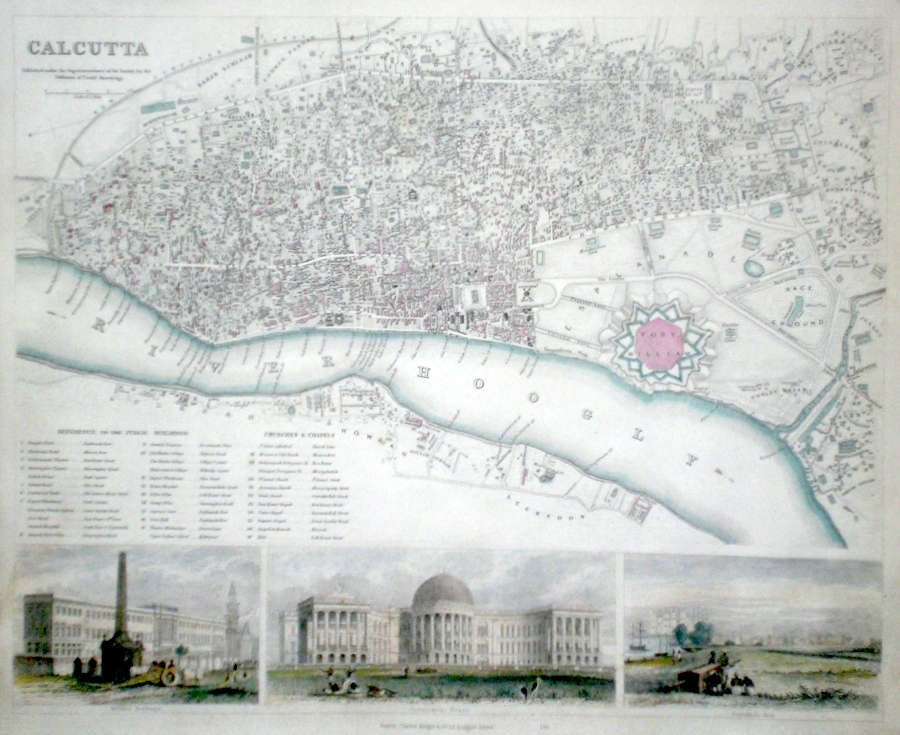
India 'Calcutta' anon. (c. 1840) 40 x 33 Finely engraved plan of the city (unattributed) by the Society for the Diffusion of Useful Knowledge. Features include engraved views of Writers Buildings, Government House, Esplanade Row. Original colour and additional later colour. 75.00 GBP |
|
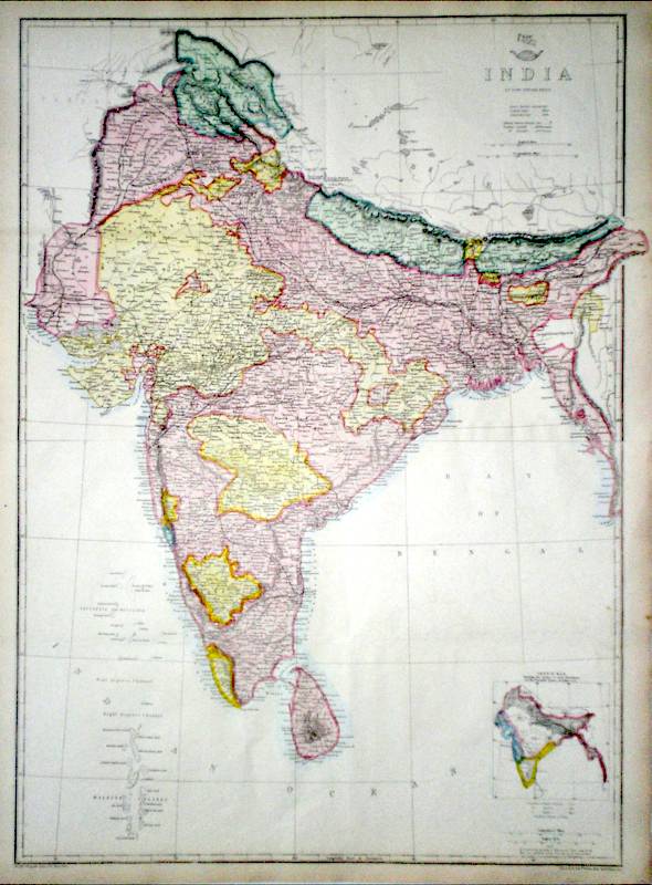
India Weller, E. (1863) 43 x 60 Large size and highly detailed map of the sub-continent by Weller for the Dispatch Atlas. Full later colour. Two sheets joined. 70.00 GBP |
|
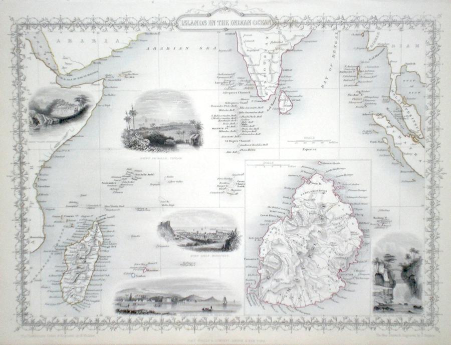
India 'Islands in the Indian Ocean' Rapkin, J. (1851) 36 x 26 Fine map of the area by John Rapkin, for John Tallis's highly decorative "The Illustrated Atlas". The vignettes show; Native Village Madagascar, Pointe De Galle Ceylon, Port Louis Mauritius, North Beach Prince of Wales Island, Falls of the River Roche Isle de Bourbon. Single page map (no central fold). Original colour as published. Condition fine. 60.00 GBP |
|
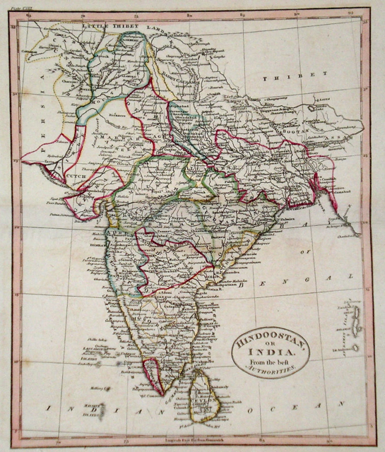
India 'Hindoostan or India from the best Authorities' Russell, J. (1818) 19 x 23 India from Guthrie's geography. Engraved by John Russell. Original hand colour. Excellent condition 60.00 GBP |
|
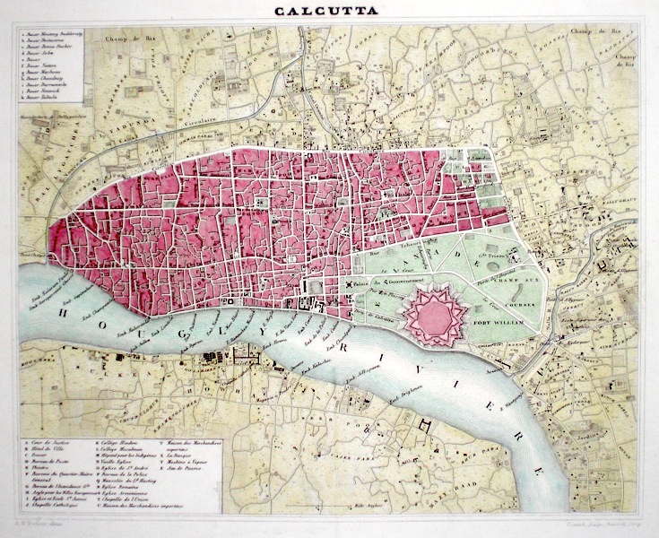
India Calcutta Dufour, A. (1842) 26 x 21 Finely engraved and detailed map of the city by the French Geographer Adolphe-Hippolyte Dufour. Later colour 45.00 GBP |
|
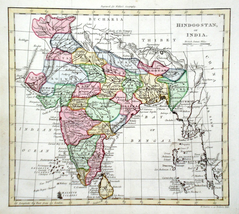
India 'Hindoostan or India' Darton, W. (c. 1810) 22 x 18 Detailed map of the subcontinent engraved by Darton for Walker's Geography. Later colour 40.00 GBP |
|
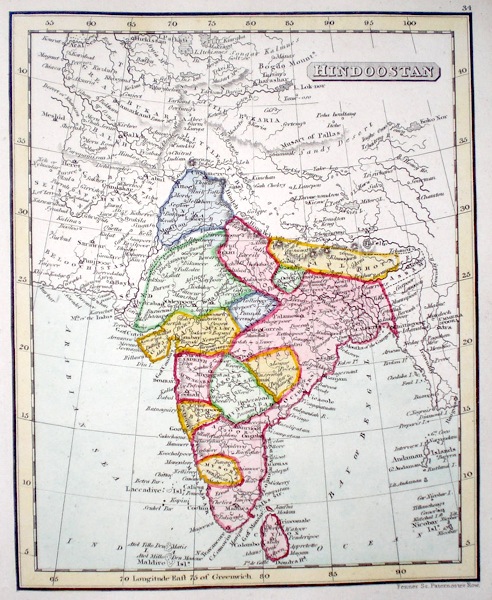
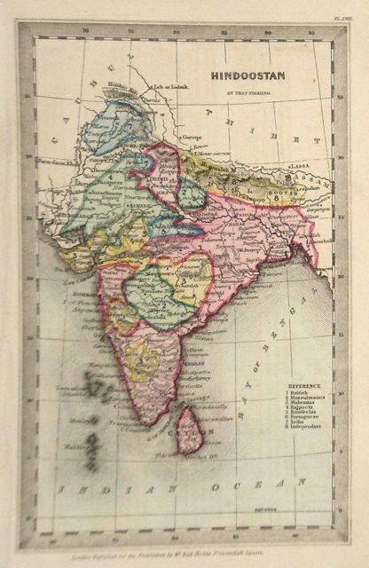
India 'Hindoostan' Starling, T. (c. 1832) 9 x 15 Uncommon and finely engraved map of the Indian subcontinent from The Royal Cabinet Atlas. Bright original colouring to the various countries. A numbered key identifies the various provinces. 40.00 GBP |
|
Hindoostan Fenner, R. (1828) 12 x 15 Highly detailed steel engraved map of India by Robert Fenner for “Fenner's Pocket Atlas”. Later full wash colour 25.00 GBP |