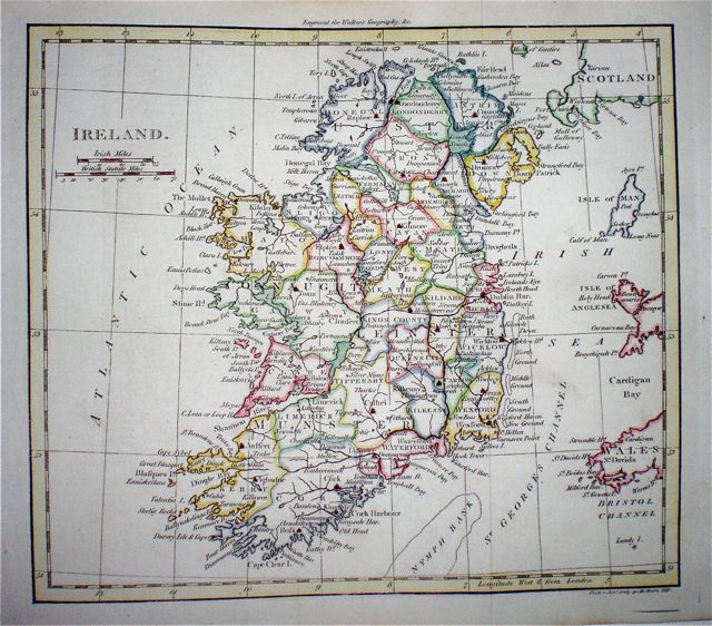
Ireland
|
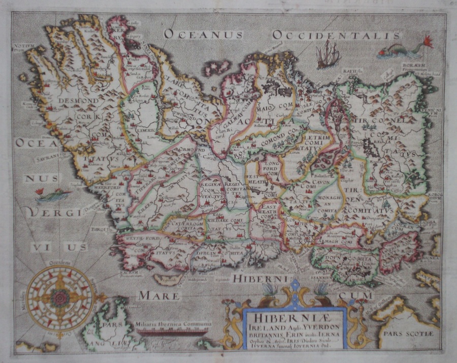
Ireland 'Hiberniae Ireland Anglis. Yverdon Britannis Erin incolis...' Hole, W. (c. 1607) 34.2 x 27 Superb early map of Ireland by William Hole after Mercator. From the 1607 edition of Camden's Britannia. Latin text verso on a single page. The map is based on Gerhard Mercator's map of 1595, feature include a large compass Rose, two mythical sea-monsters and a galleon. A rare item in excellent condition with full margins and no restoration. Later hand colour. 565.00 GBP |


|
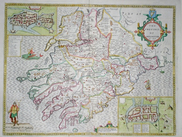
Munster 'The Province of Mounster' Speed, J (1676) 51.5 x 39 English text to verso. Bassett & Chiswell. Finely engraved map. Dark impression, later colour, good margin, small tear to top margin outside plate expertly repaired. 525.00 GBP |
|
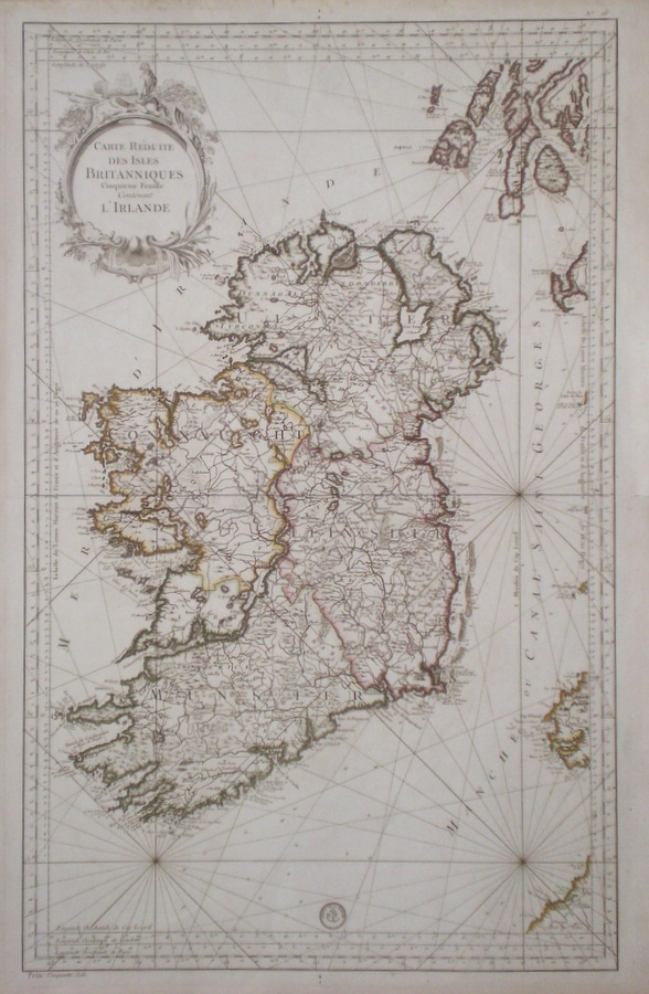
Ireland 'Carte Reduite Des Isles Britanniques Cinquieme Feuille contenant L'Irelande' Bellin, J.N. (c. 1750) 88 x 56 Large size and finely engraved sea chart showing the whole of the Island of Ireland and focusing on its coastlines. Features include a large and attractive title cartouche. Carries the imprint of the Depot de La Marine. Double page map on thick paper. Condition excellent. Later colour 385.00 GBP |
|
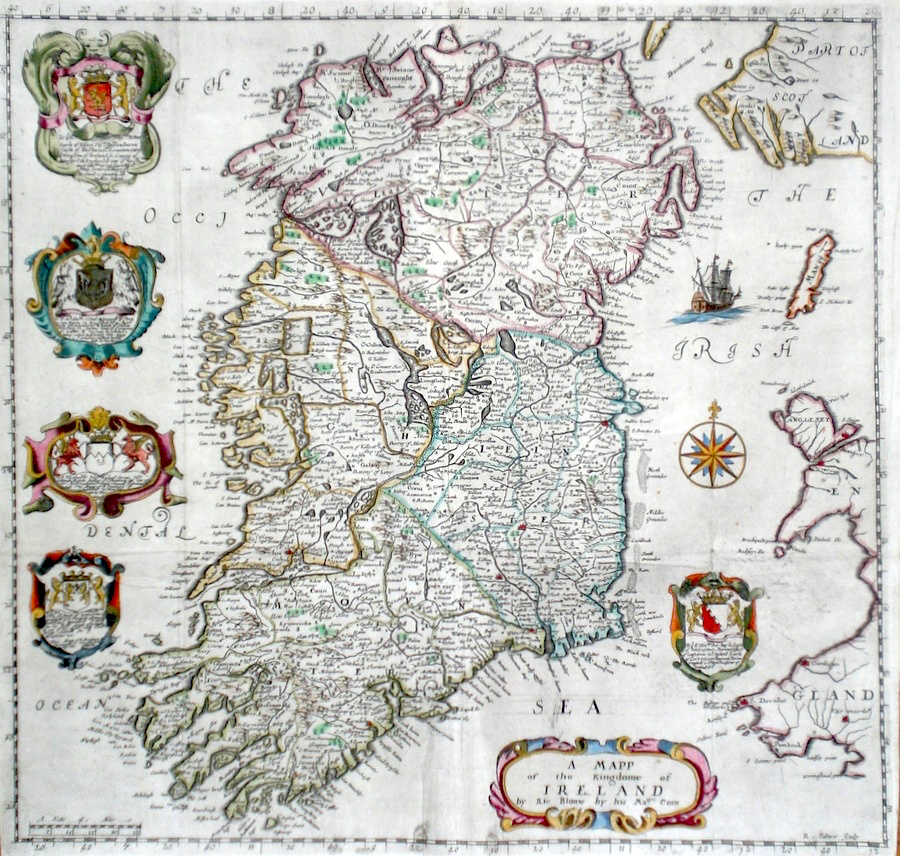
Ireland 'A Mapp of The Kingdome of Ireland' Palmer, R. (1673) 39 x 37 Finely engraved early map of Ireland by Richard Palmer for Richard Blome's publication "Britannia". The map features no less than six decorative cartouches, a sailing ship and compass rose. Old folds but in fine condition. Later colour 365.00 GBP |
|
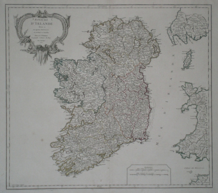
Ireland 'R. de Vaugondy, G. (1757) 58 x 46 Fine large size map of Ireland by Gilles Robert de Vaugondy. From his "Atlas Universel". No text verso. Original colour. 295.00 GBP |
|
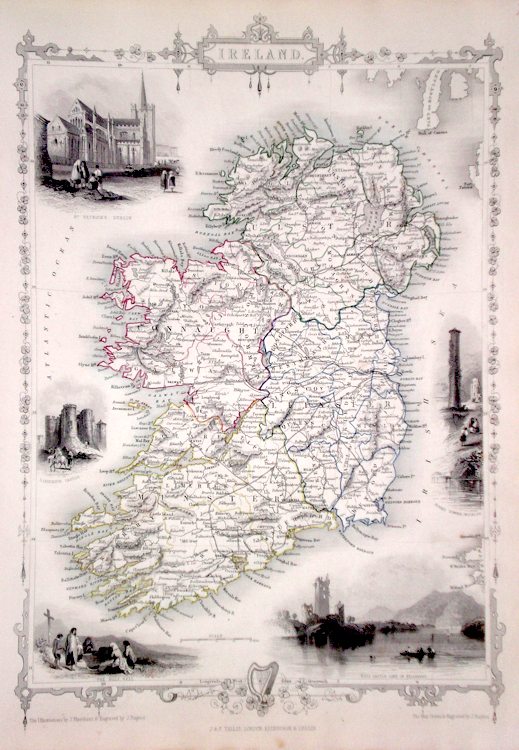
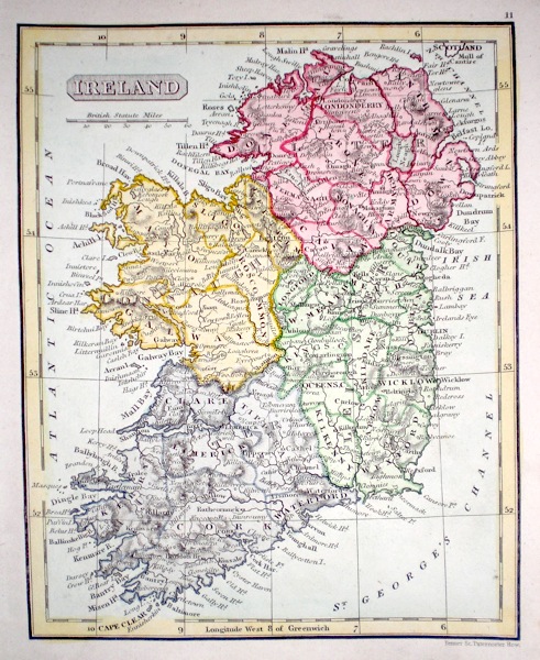
Ireland Rapkin, J. (1851) 26 x 35 Fine map of Ireland, engraved by John Rapkin, for John Tallis's highly decorative "The Illustrated Atlas". The vignettes show; St. Patrick's Dublin, Limerick Castle, The Holy Well, Ross Castle and Lake of Killarney, and Round Tower Wicklow, Single page map (no central fold). Original colour as published. Condition fine. 250.00 GBP |
|
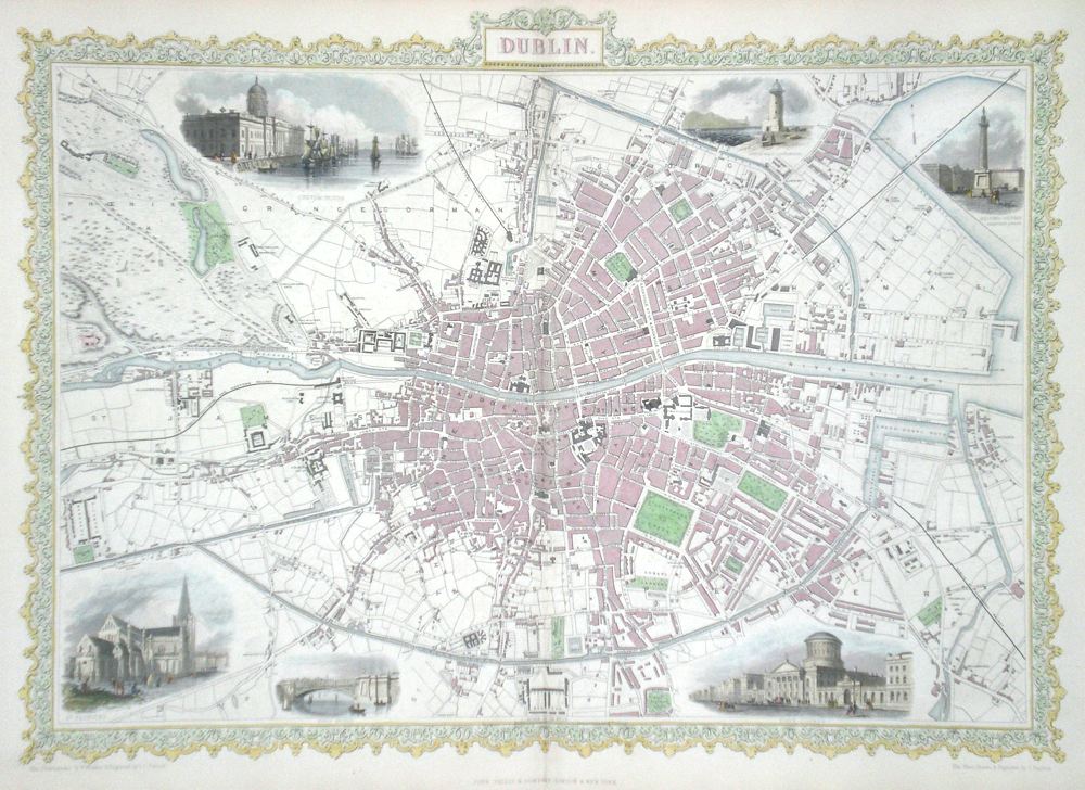
Ireland Dublin Rapkin, J. (1851) 48 x 36 Superb map of the City engraved by John Rapkin, for John Tallis's highly decorative "The Illustrated Atlas". The vignettes show; Custom House, South Wall Lighthouse, Nelson's Column, St. Patrick's, King's Bridge, Four Courts. Double page map, Later colour. Condition fine. 275.00 GBP |
|
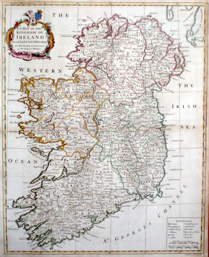
Ireland 'A Map of the Kingdom of Ireland...' Seale, R. (c. 1745) 39 x 49 A finely engraved and detailed map of Ireland by Richard Seale. Published in Tindal's translation of Paul Rapin De Toras's History of England. The map features extensive detail on the Kingdom and has a particularly fine title cartouche. Excellent condition. Later colour. 235.00 GBP |
|
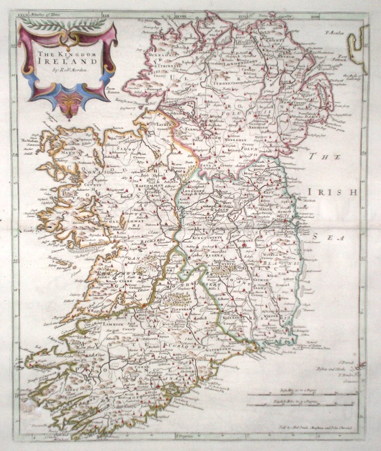
Ireland 'The Kingdom of Ireland by Robert Morden' Morden, R. (1722) 35 x 42 Superbly engraved and decorative map of Ireland by Robert Morden. From the 1722 edition of Camden's Britannia. A small hole repair outside the engraved area but otherwise excellent condition. A dark copy with good margins. Later colour 195.00 GBP |
|
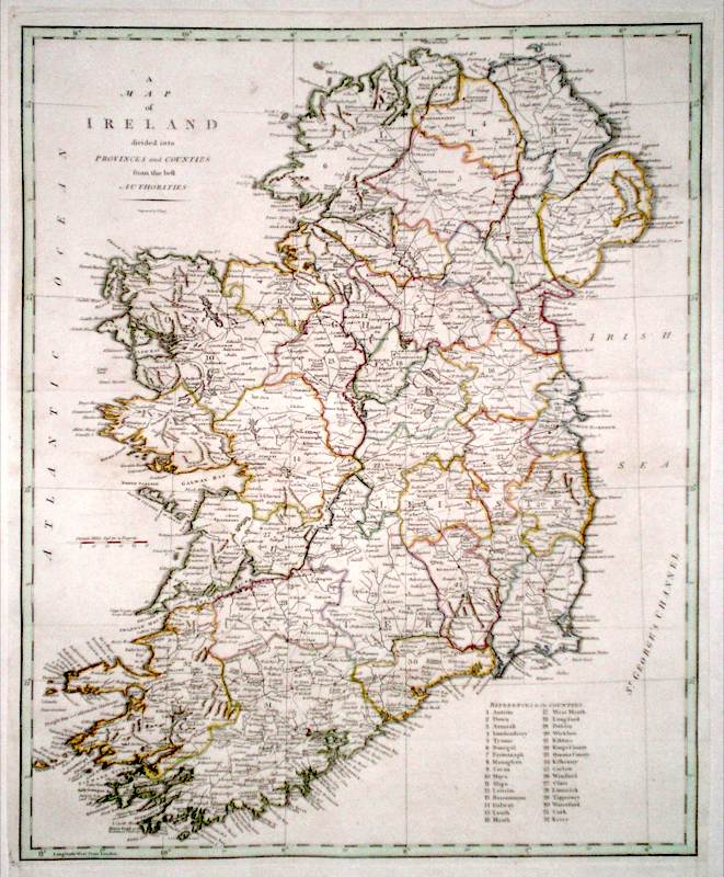
Ireland 'A Map Of Ireland Divided into Provinces and Counties' Cary, J. (1789) 42 x 54 Finely engraved map of the Island by John Cary for the first edition of Richard Gough's translation of Camden's Britannia. Excellent condition. Later colour 180.00 GBP |
|
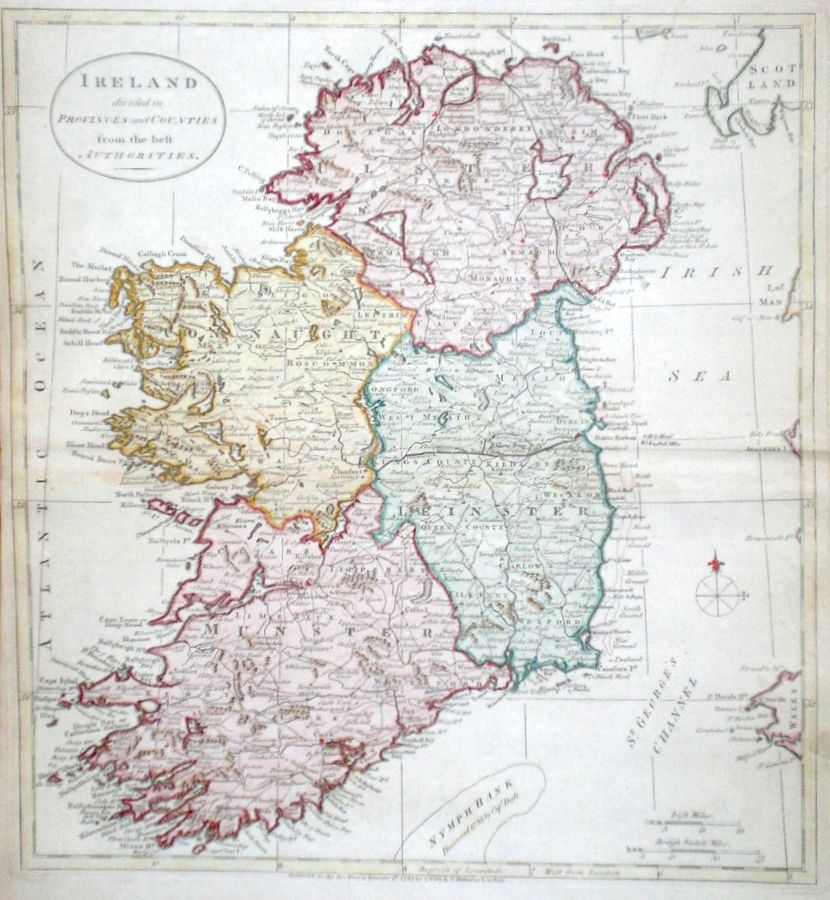
Ireland 'Ireland divided in provinces and counties from the best Authorities' Kitchen, T. (c. 1785) 34 x 37 Finely engraved map of Ireland by Thomas Kitchen for The Universal History. Later colour. Condition excellent 135.00 GBP |
|
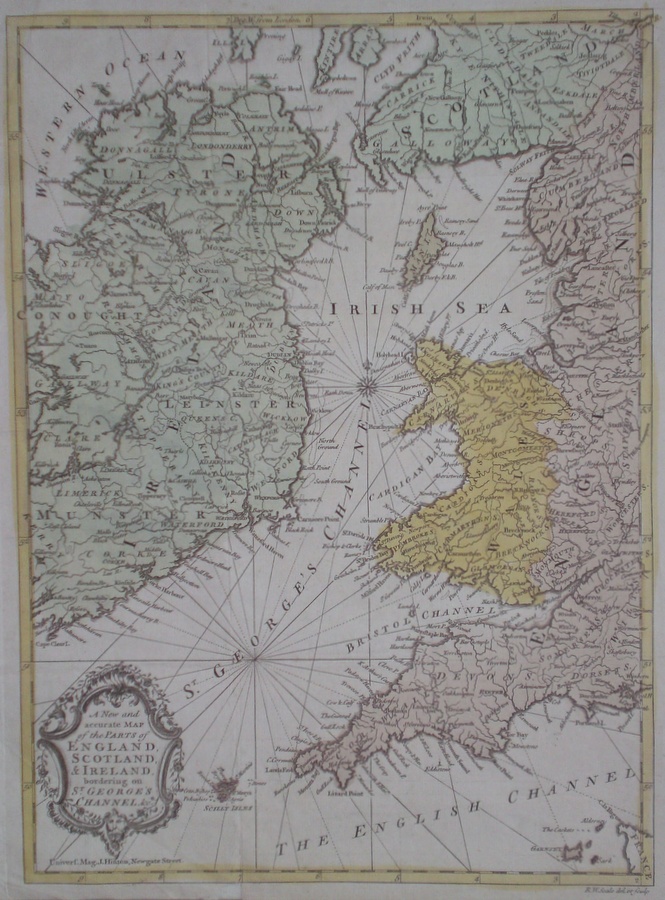
Ireland 'A New and accurate Map of the parts of England Scotland & Ireland bordering on St George' Channel…' Seale, R. W. (c. 1757) 27 x 36 Fine sea chart of the St George's Channel and the Irish Sea by Richard William Seale. The chart was published in volume twenty-one of the Universal magazine. In excellent condition although originally folded in the magazine, original wash colour. 120.00 GBP |
|
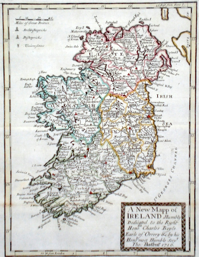
Ireland 'A New Mapp of Ireland...' anon. (c. 1731) 19 x 25 Finely engraved map of Ireland by an anonymous hand, possibly Blome from the atlas "England Exactly Described or a Guide to Travellers…" first published by Thomas Taylor, but herewith from the later edition published by Thomas Bakewell. A major addition to the earlier plates is that roads and distances between towns are now included, after the road surveys of John Ogilby. The title panel on this map carries the signature of Bakewell but the earlier date of 1716. Fine condition. Later colour 120.00 GBP |
|
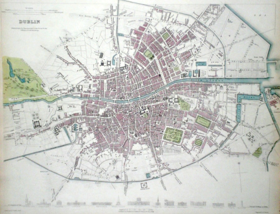
Ireland Dublin Turrell, E. (c. 1836) 40 x 31 Finely engraved plan of the city by Turrell for The Society for the Diffusion of Useful Knowledge. The map extends from Phoenix park in the west to the sea in the east. Original and some later colour. 120.00 GBP |
|
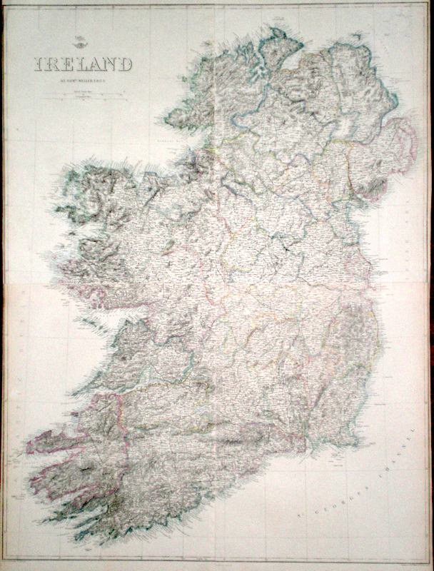
Ireland Weller, E. (1863) 63 x 83 Large scale map of the Island of Ireland by Edward Weller for the Dispatch Atlas. Four single page sheets joined. Side margins trimmed to neatlines otherwise condition is excellent. Original colour 85.00 GBP |
|
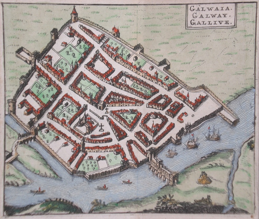
Ireland Galwaia Galway Hermannides, R. (1661) 13 x 11 Fine town plan of Galway by Rutger Hermannides after John Speed. Published, Amsterdam in "Britannia Magno". Later colour 75.00 GBP |
|
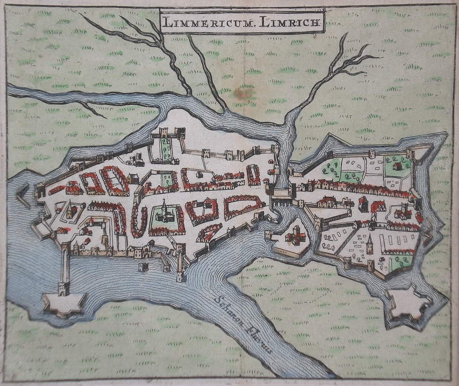
Ireland Limmericum Limrich Hermannides, R. (1661) 13 x 11 Fine town plan of Limerick by Rutger Hermannides after John Speed. Published, Amsterdam in "Britannia Magno". Later colour. 75.00 GBP |
|
Ireland Corcahia Corke Corcach Hermannides, R. (1661) 13 x 11 Fine town plan of Cork by Rutger Hermannides after John Speed. Published, Amsterdam in "Britannia Magno". Later colour. 75.00 GBP |

|
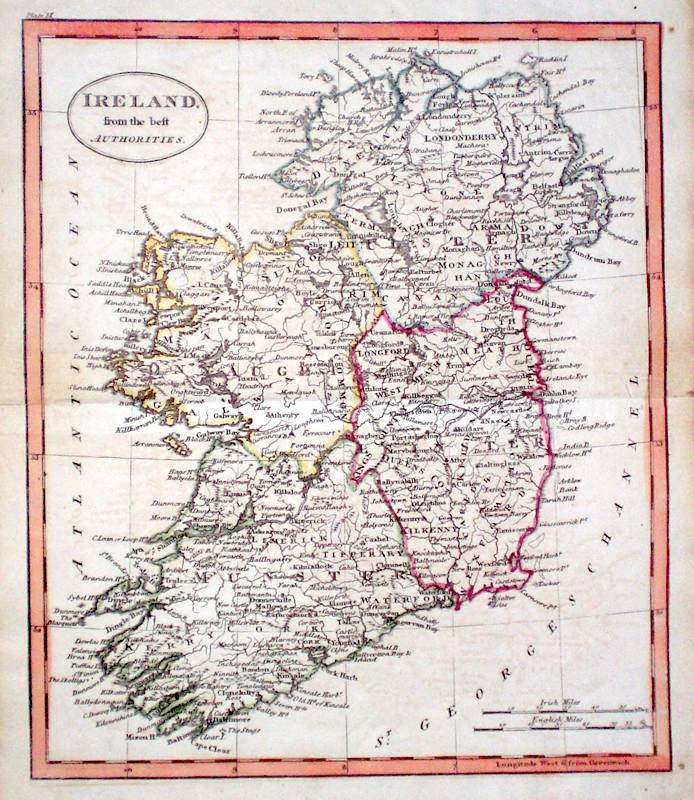
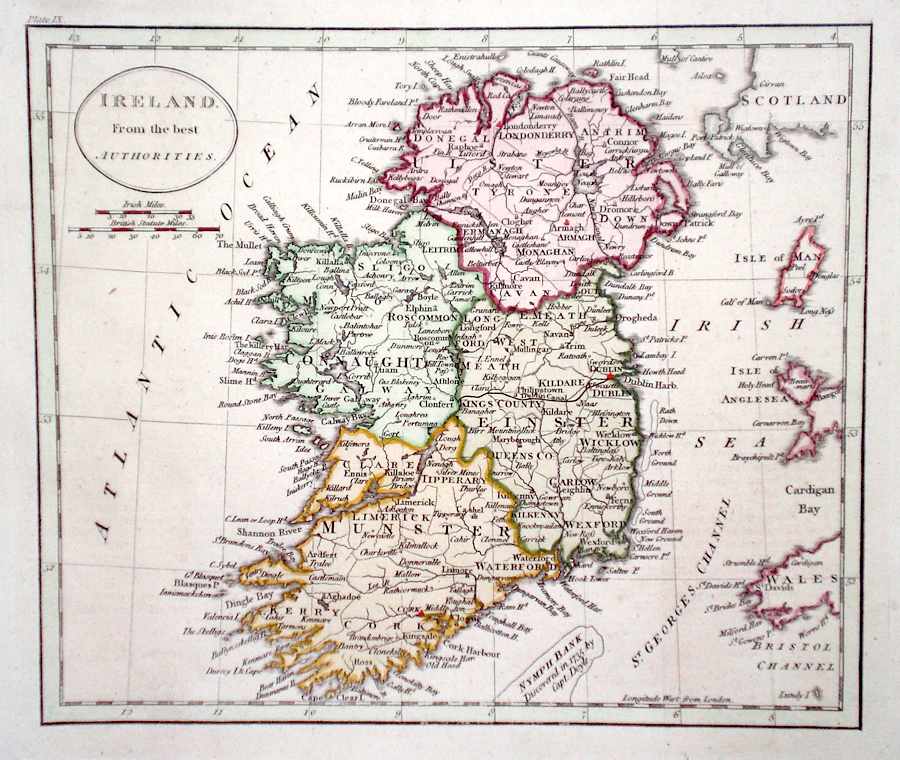
Ireland 'Ireland from the best Authorities' Russell, J. (c. 1818) 18 x 23 Ireland from Guthrie's Geography. Engraved by John Russell. Original colour. Excellent condition 65.00 GBP |
|
Ireland Starling, T. (c. 1832) 9 x 15 The Island of Ireland. Uncommon map from the Royal Cabinet Atlas. A numbered key identifies each county. Full bright original colouring to each of the provinces. 60.00 GBP |
|
Ireland 'Ireland from the best Authorities' Carey & Warner. (c. 1816) 21 x 18 Finely engraved map by Carey and Warner from their World Atlas. Later colour 48.00 GBP |
|
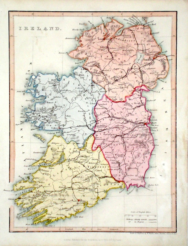
Ireland Hughes, W. (c. 1845) 20 x 26 Steel engraved map of the country engraved by William Hughes, and showing the four provinces. Later colour 40.00 GBP |
|
Ireland Findlay (c. 1840) 19 x 25 Attractive steel engraved map of the Island published by Thomas Kelly. Later colour. 40.00 GBP |
|
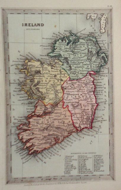
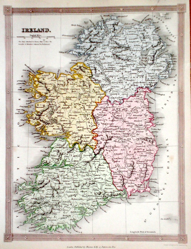
Ireland Johnston, A. K. (1873) 34 x 44 Detailed map of Ireland showing the four provinces. Original colour 40.00 GBP |
|
Ireland Fenner, R. (1828) 12 x 15 Highly detailed steel engraved map of the Island by Robert Fenner for "Fenner's Pocket Atlas". Later full wash colour. 30.00 GBP |
|
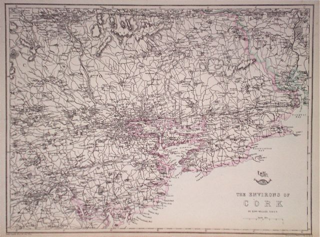
Ireland 'The Environs of Cork' Weller, E. (1863) 42 x 32 Map with original colour showing the area around Cork in great detail. Excellent condition 30.00 GBP |
|
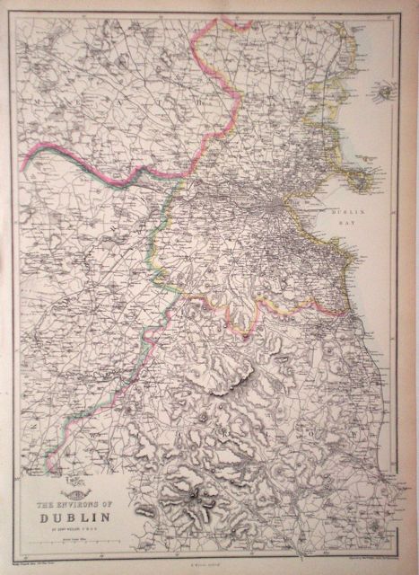
Ireland 'The Environs of Dublin' Weller, E. (1863) 31 x 43 Map detailing the coast of Ireland around Dublin area. Original colour, excellent condition. 35.00 GBP |
|
Ireland Darton, W. (1801) 21.5 x 19 Later hand colour to the counties. Traces of old folds but generally excellent condition. Good margins 30.00 GBP |