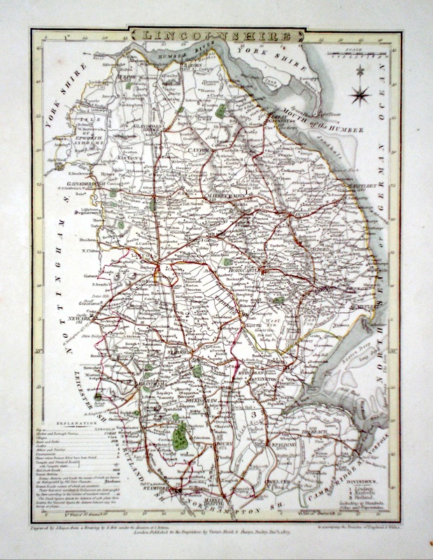
Lincolnshire
Including Lincoln, Grimsby, Scunthorpe, Boston, Grantham, Stamford, Skegness, Louth
|
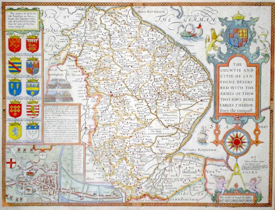
Lincolnshire 'The Countie and Citie of Lyncolne described with the armes of them that have bene Earles thereof...' Speed, J. (c. 1676) 51 x 39 Superb map of the county by John Speed, Bassett and Chiswell edition. Published in 1676 the plate carries the unaltered date of the first edition, 1610. Features include arms of the Earls of Lincolnshire and a fine town plan of Lincoln. Decorative features include a large sea-monster, a galleon and details of two battle scenes. An excellent copy with English text verso. Later colour 395.00 GBP |


|
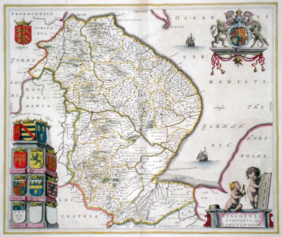
Lincolnshire 'Lincolnia Comitatus Anglis Lincoln-Shire' Blaeu, J. (c. 1645) 50 x 42 Very fine map of the county by Joan Blaeu. The map embodies the finest features of Dutch Cartography of the Seventeenth century. Superbly engraved and arranged, with shields, coats of arms, putti, and galleons depicted. German text verso and full margins. Original colour. 320.00 GBP |
|
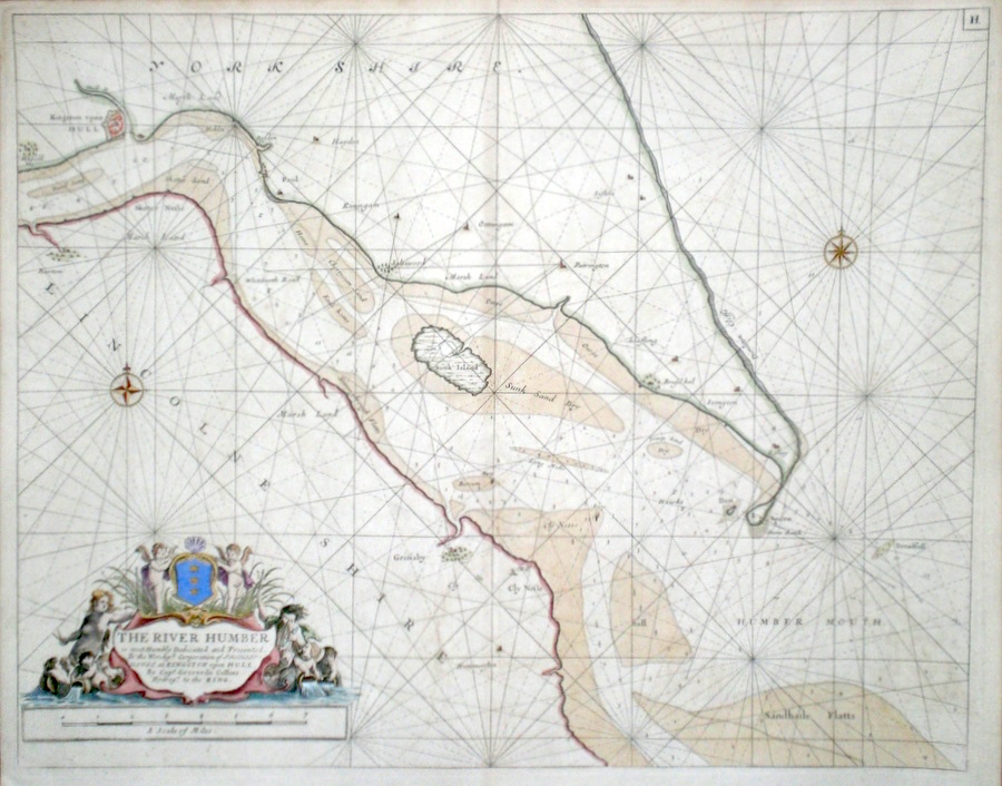
Yorkshire and Lincolnshire 'The River Humber' Collins Capt. G (c. 1750) 56 x 45 Finely engraved chart by Captain Greenvile Collins from the “Great Britain's Coasting Pilot”. The first original sea Atlas produced by an Englishman. Commissioned by King Charles II in 1676 and started in 1681 the work took seven years and was first issued as a complete atlas in 1693. This chart a later edition covers the Humber estuary Spurn head and an area of the North Sea.The particularly fine and decorative cartouche carries a dedication to Trinity House at Kingston upon Hull and is illustrated with mermaid and merman and putti. A dark engraving on heavy paper. Later colour. Fine condition 245.00 GBP |


|
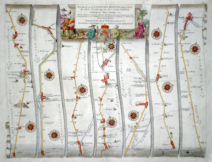
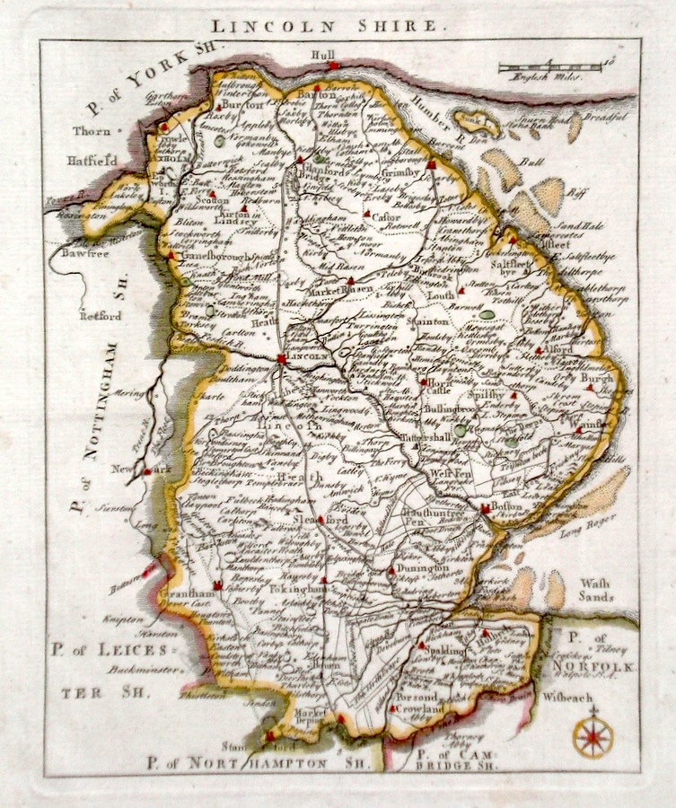
Lincolnshire 'The Road from London to Boston in Lincolnshire.continued to the City of Lincoln' Ogilby, J. (c. 1676) 44 x 33.5 The road from Stilton - to Peterborough, Crowland and Boston. Continued from Boston to Heckington, Sleaford, to Lincoln. From John Ogilby's Britannia, generally considered one of the most important cartographical works of the seventeenth century. Other features include a very fine cartouche showing country pursuits. Later colour. Plate number 36. Some professional repairs with no loss of engraving, generally excellent condition. 180.00 GBP |
|
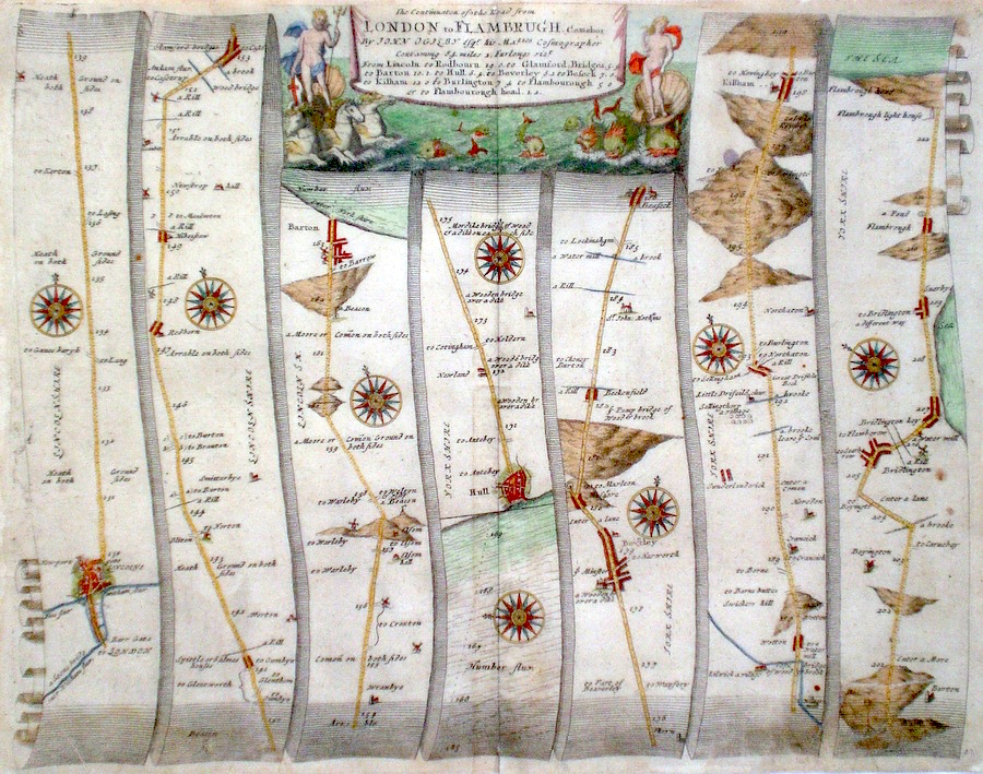
Lincolnshire 'The Continuation of the road from London to Flamburgh.com ebor' Ogilby, J. (c. 1698) 45 x 35 The Road from Lincoln to Barton, crossing the Humber to Hull, Kilham, Bridlington, Flambrough. From John Ogilby's Britannia, generally condidered one of the most important cartographical works of the seventeenth century. Features include town plans of Lincoln and Hull and a fine cartouche depicting a mythical seascape with sea monsters and white horses. Later colour. Plate number 42 Excellent condition 180.00 GBP |
|
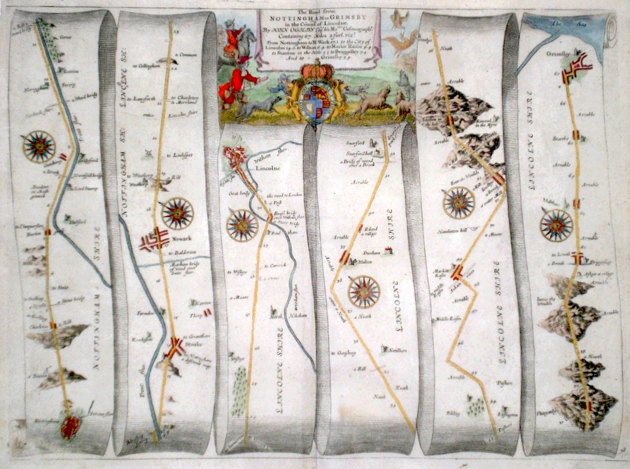
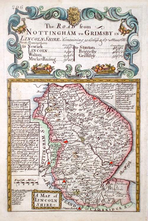
Lincolnshire 'The Road from Nottingham to Grimsby in the county of Lincolne' Ogilby, J. (1698) 44 x 34 The road from Nottingham to Newark, Lincoln, Market Rasen, Grimsby. From John Ogilby's Britannia, generally considered one of the most important cartographical works of the seventeenth century. Features include town plans of Nottingham and Lincoln and a fine cartouche depicting a rural scene. Later colour. Plate number 78. Excellent condition 175.00 GBP |
|
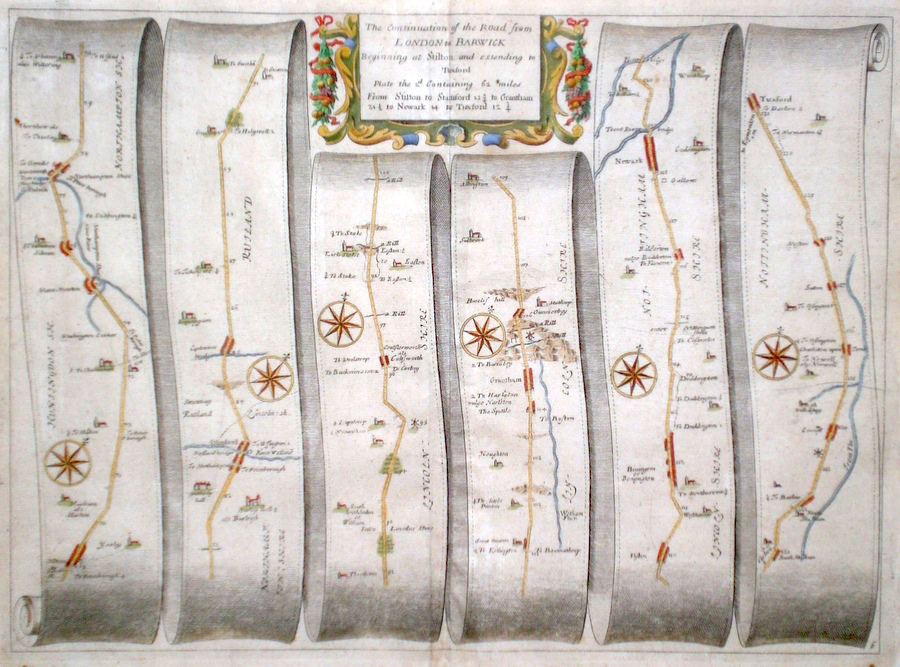
Lincolnshire 'The continuation of the Road from London to Barwick' Ogilby, J. (1698) 44 x 32 The road from Stilton to Stamford, Grantham, Newark, Tuxford. From John Ogilby's Britannia, generally considered one of the most important cartographical works of the seventeenth century. Features include town plans of Stamford, Grantham, and a fine cartouche. Later colour. Plate number 6. Excellent condition. 160.00 GBP |
|
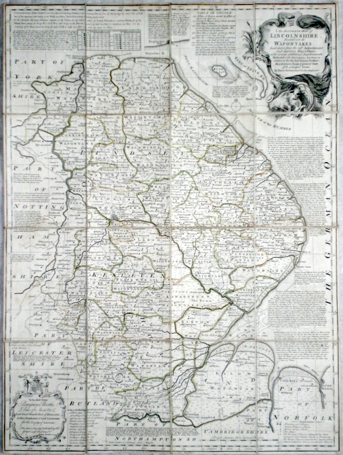
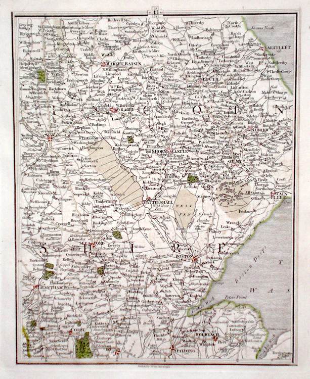
Lincolnshire 'An Accurate Map of Lincolnshire Divided into its Wapontakes' Bowen, E. (c. 1770) 54 x 72 Fine detailed map of the county by Emanuel Bowen and Thomas Kitchen. Although produced for the Large English Atlas, the maps were also issued separately and as in this copy, dissected and backed with linen for folding to facilitate both storage and use on carriage journeys etc. A particular feature of these maps is the extensive county information engraved on them, providing a complete guide to the county. Original colour. Excellent condition. 120.00 GBP |
|
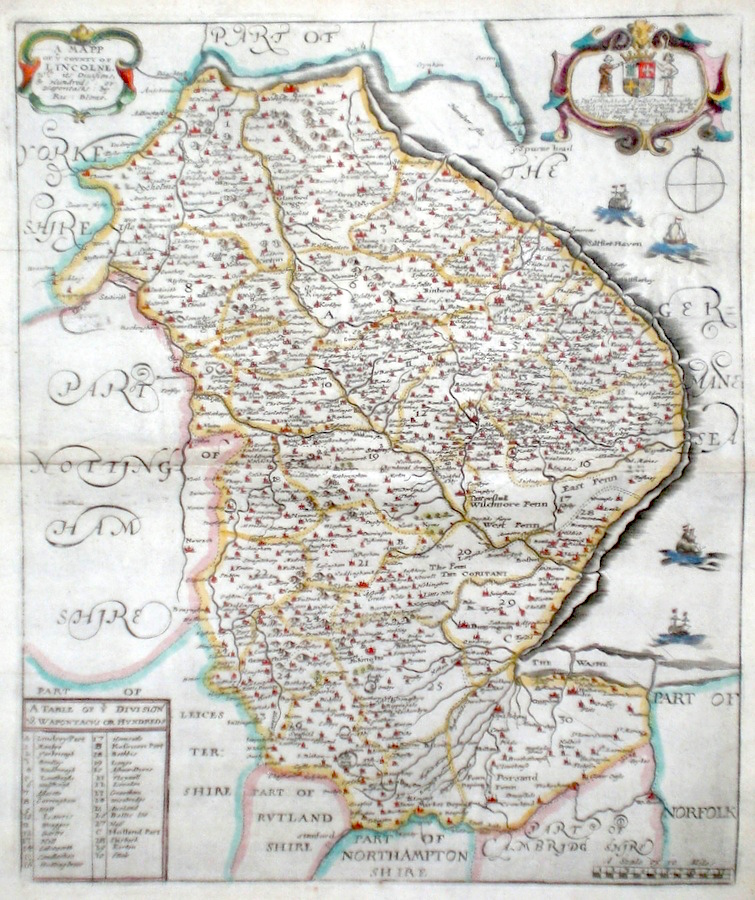
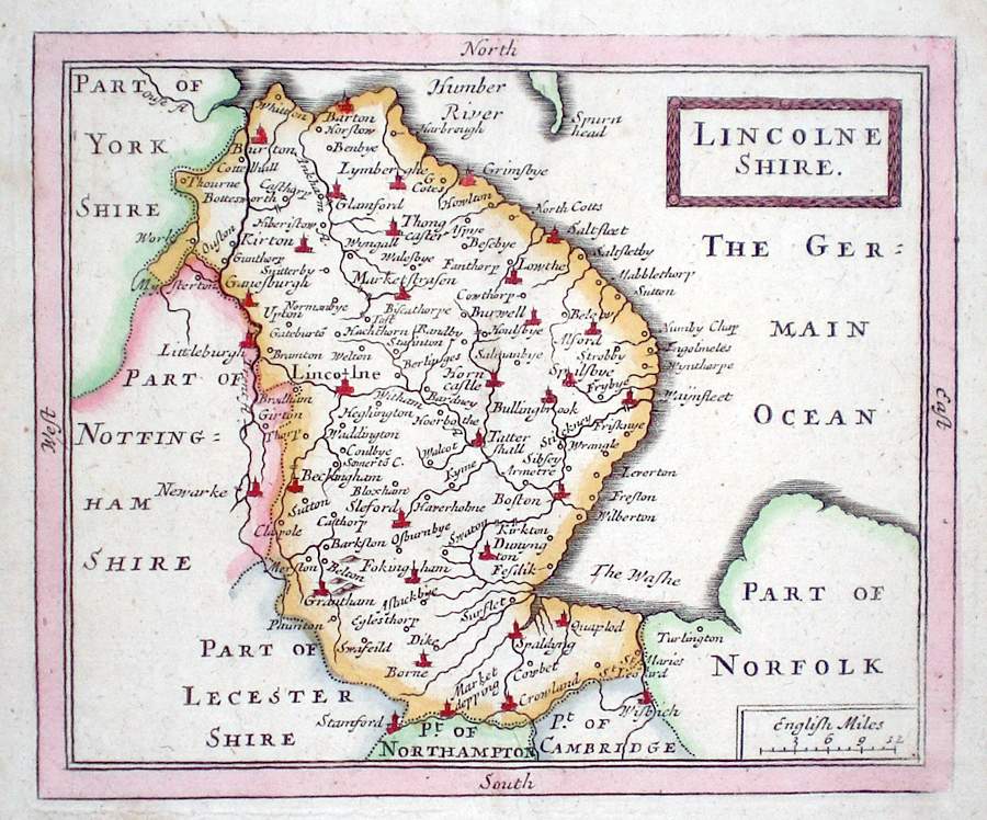
Lincolnshire 'A Mapp of Ye County of Licolne' Blome, R. (1673) 27 x 32 Decorative map of the County by Richard Blome for his publication "Britannia". The largest series of county maps published by Blome, and generally based on those of Speed. Maps by Blome are characteristic and attractive. Some restoration to the sea area top right, otherwise excellent condition, later colour. 120.00 GBP |
|
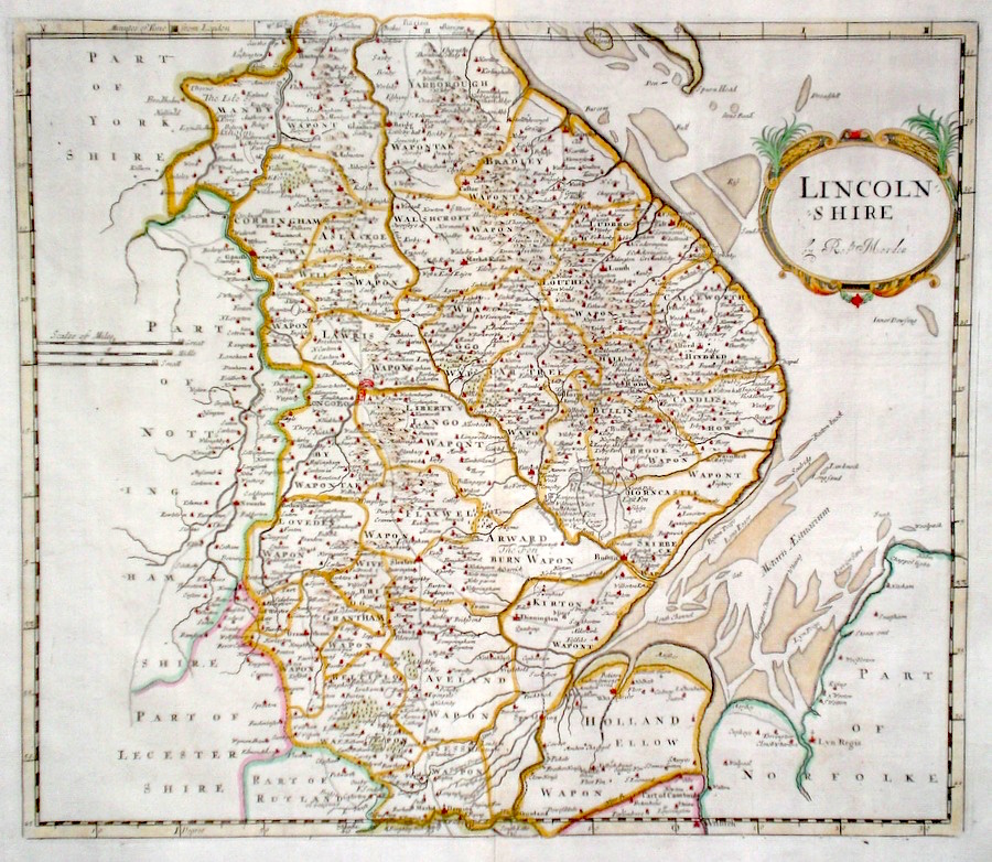
Lincolnshire 'Lincoln Shire by Robt. Mordern' Morden, R. (1722) 43 x 37 Attractively engraved map of the county by Robert Morden for the 1722 edition of Camden's Britannia. In general maps produced for this edition cannot be distinguished from the 1695 edition. Later colour. Condition excellent 110.00 GBP |
|
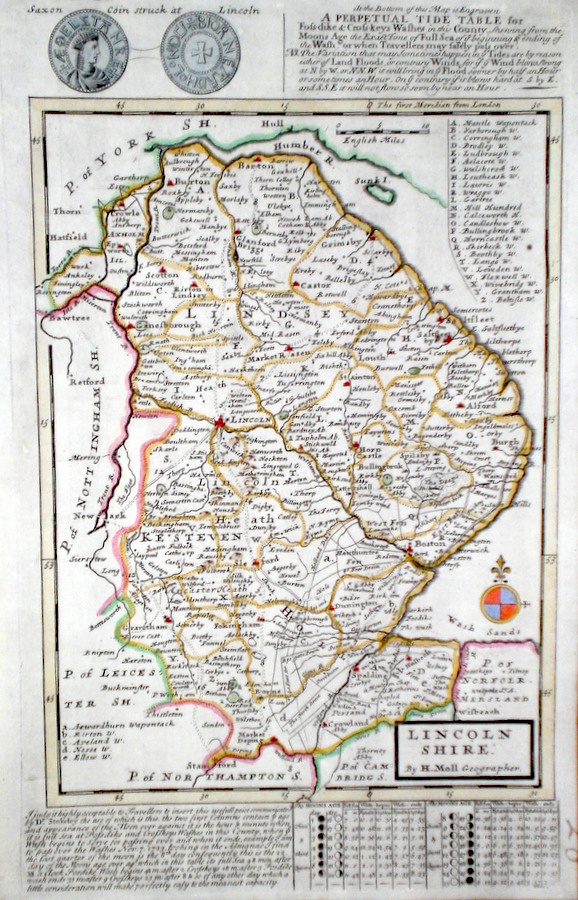
Lincolnshire Moll, H. (c. 1724) 20 x 32 Finely engraved map of the county by Herman Moll for the publication "A New Description of England and Wales…" The maps in this series include engraved borders of local architectural and antiquarian interest. A unique feature. On this map various ancient coins, but also a perpetual tide table to the bottom and explained at the top. This table being relevant to crossing the sands of the Wash. Later colour, fine condition. 70.00 GBP |
|
Lincolnshire 'A Map of Lincolnshire from the best Authorities' Cary, J. Camden's Britannia (1789) 40 x 53.5 Finely engraved map of the county by John Cary from the 1789 edition of Camden's Britannia. Later colour. 55.00 GBP |
|
Lincolnshire Rocque, J. (c. 1769) 16 x 21 Finely engraved map of the county by John Rocque, for the publication "England Displayed". Later colour 58.00 GBP |
|
Lincolnshire Moule, T. (c. 1845) 20 x 26 Decorative Steel engraved map of the county by Thomas Moule. Inset views of Grimsthorpe Castle and Lincoln Cathedral. Later colour 50.00 GBP |

|
Lincolnshire Fisher & Co. (c. 1842) 35 x 57 Detailed and attractive double page map of the county by Fisher & Co. This series of maps was the only cartographical publication from this publisher. Original colour 50.00 GBP |
|
Lincolnshire 'Lincolneshire' Seller, J. (c. 1703) 15 x 13 Fine map of the county by the Hydrographer and instrument maker John Seller for his "Anglia Contracta". This series of maps were first published in 1695. They were later used in a simplified form by Francis Grose for his "Supplement to the Antiquities of England and Wales", published from 1787. 40.00 GBP |
|
Lincolnshire Map of England and Wales Cary, J. (c. 1790) 21 x 27 Sheet 43 of John Cary's Map of England and Wales published in 81 sheets. Covers the area of Lincolnshire etc. Original colour. 40.00 GBP |
|
Lincolnshire 'A Map of Lincolnshire' Bowen, E. (c. 1724) 12 x 19 Finely engraved map of the county by Emanuel Bowen and John Owen for the publication "Britannia Depicta". To the top are given details of the Road from Nottingham to Grimsby and verso the road from Brecknock to Lampeter is engraved. After John Ogilby. Later colour 40.00 GBP |
|
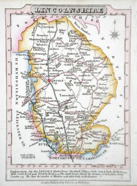
Lincolnshire Lewis, W. (c. 1835) 14 x 10 Detailed and attractive miniature map of the County by William Lewis for his "Lewis's New Traveller's Guide". A particular feature of this charming series of maps is the clear and precise engraving of the roads. Adjacent numbers indicating the distances from London. Also included with the map is the accompanying page of text giving the county information relevant to travellers - principal towns and inns are listed, distances between towns, principal fair dates, and even sites for the best views of the county. Later colour. 35.00 GBP |
|
Lincolnshire Roper, J. (1810) 18 x 24 Detailed and decorative map of the county by Cole and Roper for The British Atlas. Original hand colouring. Excellent condition. 30.00 GBP |