Norfolk
Including Norwich, Great Yarmouth, King's Lynn, Dereham, Cromer, Hunstanton
|
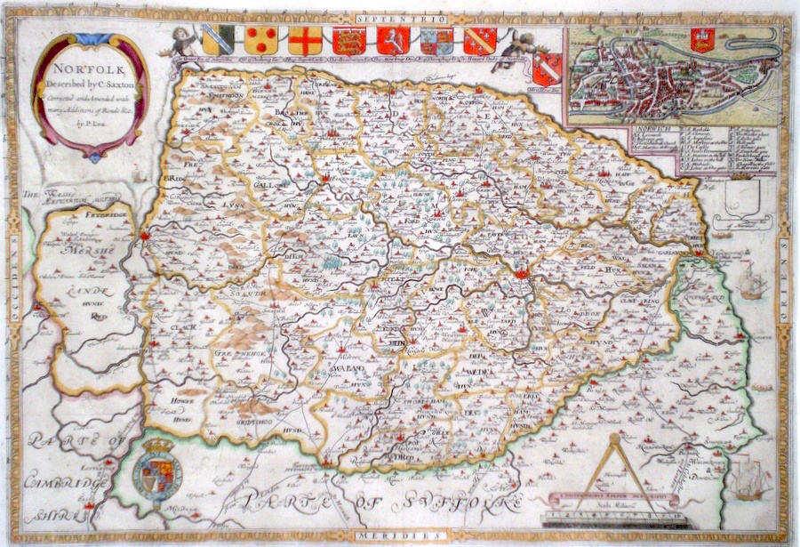
Norfolk 'Norfolk, Described by C. Saxton. Corrected and amended with many additions as Roads &c, by P. Lea.' Saxton, C. (c. 1693) 50 x 34 Superb map of the County by Christopher Saxton. This edition published by Philip Lea. The plate differs from Saxton's original mainly by removal of some embellishments and addition of a town plan (Norwich ) after John Speed and roads after Ogilby. Saxton's atlas, with in many cases the first maps of single English counties set the standard for English cartography until the mid eighteenth century. Later colour. Fine condition 745.00 GBP |


|
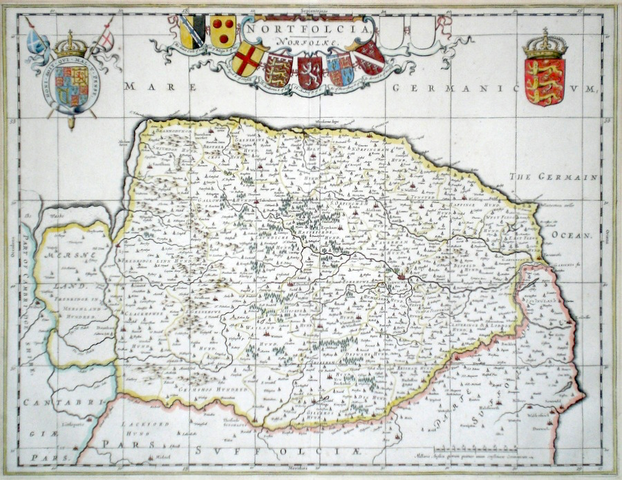
Norfolk 'Nortfolkia Norfolke' Blaeu, J. (c. 1645) 50 x 38 Very Finely engraved map of Norfolk by J. Blaeu. The map features a substantial Title cartouche with a collection of decorative shields, and two other extensive heraldic embellishments. No text verso. Full margins with fine hand colour. 320.00 GBP |
|
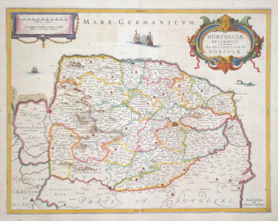
Norfolk 'Norfoliae Descriptio. The Description of Norfolk' Jansson, J. (c. 1650) 49 x 39 Attractively engraved map of the county by Johannes Jansson published in Amsterdam, c.1650 Features include a fine cartouche, galleons in the sea and a sea monster. Later colour. German text verso. Excellent condition. 280.00 GBP |
|
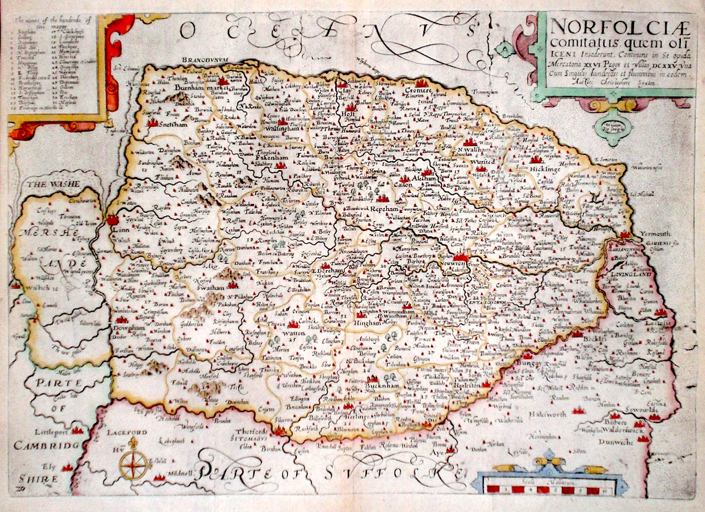
Norfolk 'Norfolkiae comitatus, quem oli iceni insederunt...' Kip, W. (1637) 38.5 x 27 Fine early map of the county by William Kip after Christopher Saxton. From the second English translation edition of Camden's Britannia. Plate number and compass rose lower left. One of the earliest maps of the single county. No text verso. This copy with good margins all round. Later colour. Condition excellent. 265.00 GBP |
|
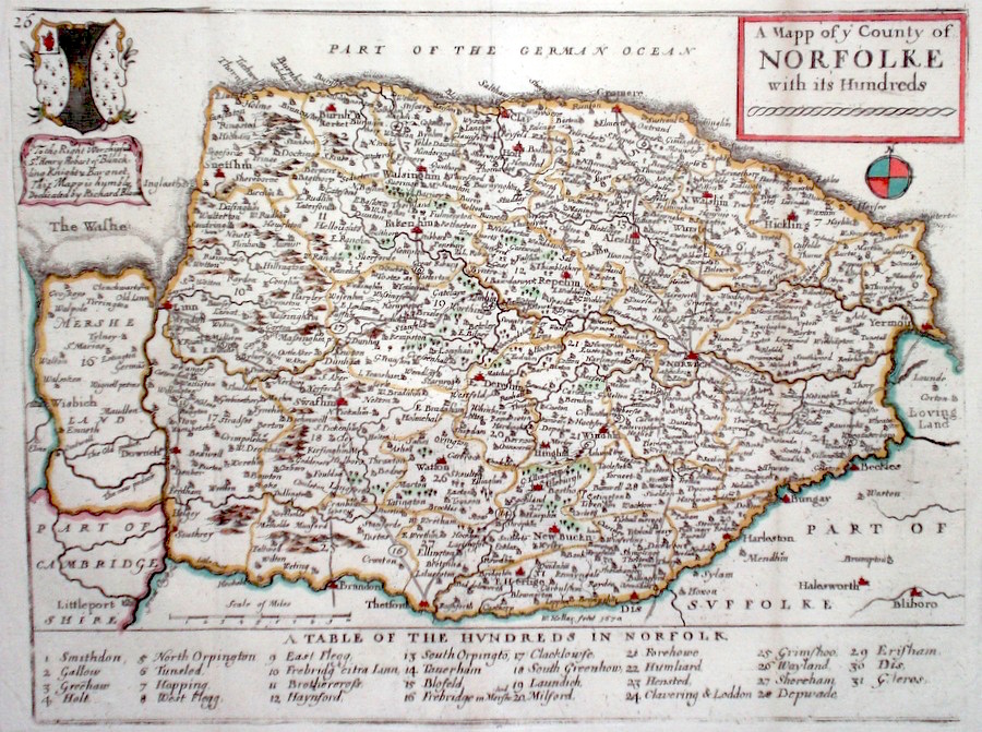
Norfolk 'A Mapp of the County of Norfolck with its Hundreds...' Blome, R. (1673) 33 x 25 Decorative map of the County by Richard Blome for his publication "Britannia". The largest series of county maps published by Blome, and generally based on those of Speed. Maps by Blome are characteristic and attractive. Good condition, later colour. 200.00 GBP |

|
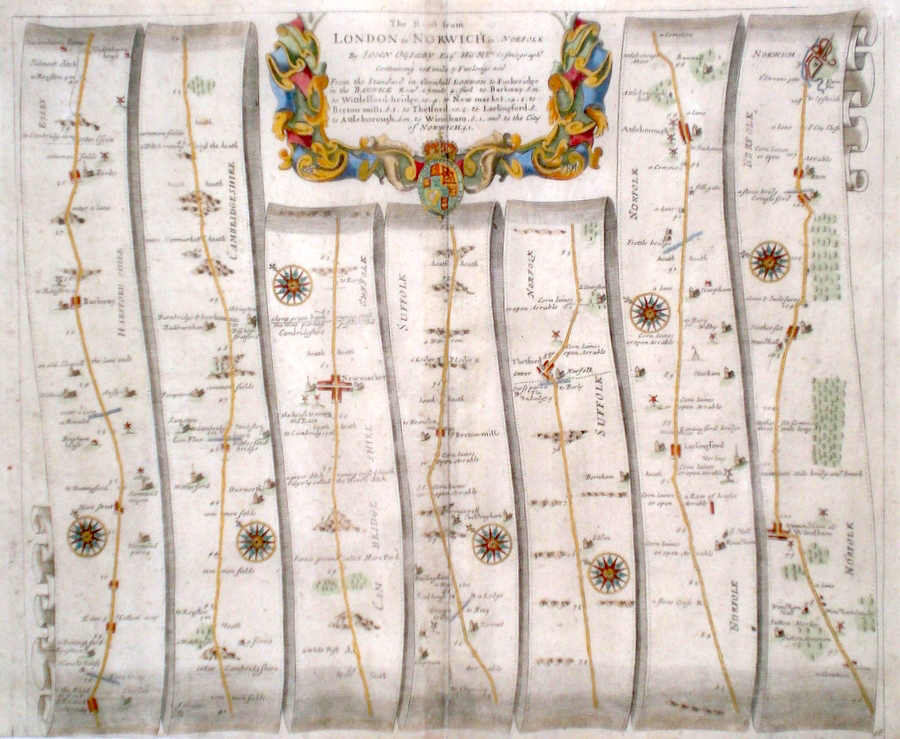
Norfolk 'The Road from London to Norwich in Norfolk' Ogilby, J. (1698) 45 x 35 The Road from Puckeridge in Hertfordshire to Barkway, Newmarket, Thetford, Larlingford, Attleborough, Wymondham, Norwich. From John Ogilby's Britannia, generally considered one of the most important cartographical works of the seventeenth century. Features include town plans of Newmarket, Norwich and a fine cartouche. Later colour. Plate number 46. Excellent condition. 190.00 GBP |
|
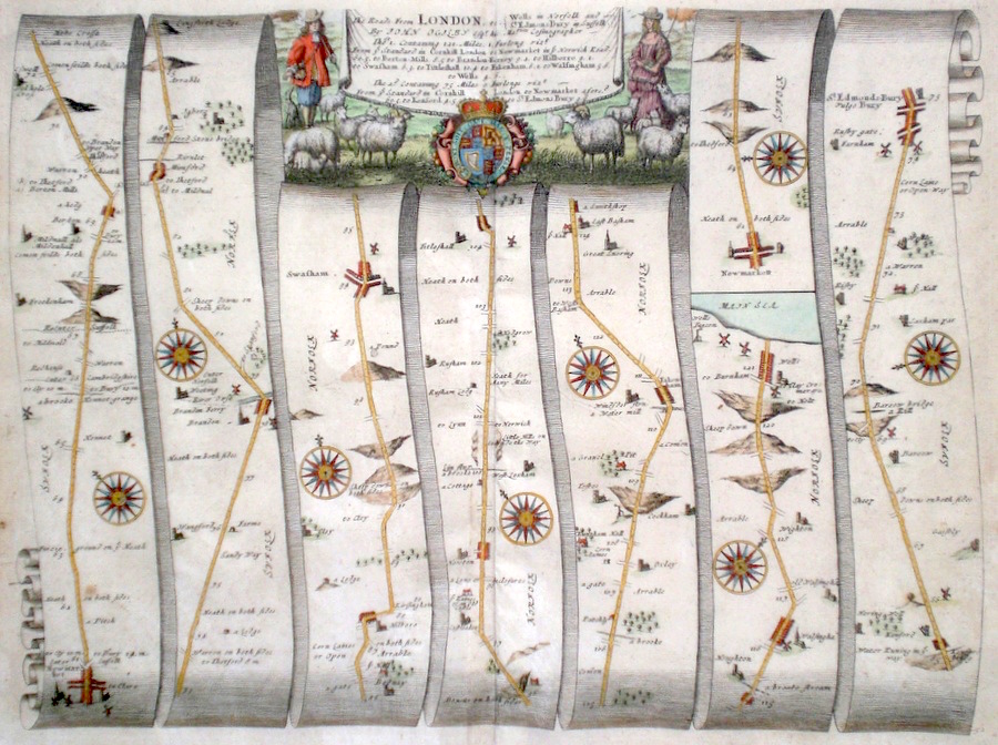
Norfolk 'The Roads from London to Wells in Norfolk and St. Edmonsbury in Suffolk' Ogilby, J. (1698) 45 x 33 The Road from Newmarket, Swaffham Fakenham, Walsingham, to Wells. And from Newmarket to Bury St. Edmunds. From John Ogilby's Britannia, generally considered one of the most important cartographical works of the seventeenth century. Features include town plans of Newmarket, Bury and a fine cartouche depicting a rural scene. Later colour. Plate number 52. Excellent condition . 185.00 GBP |
|
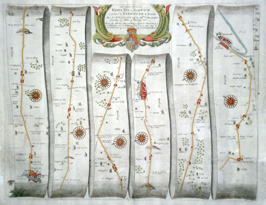
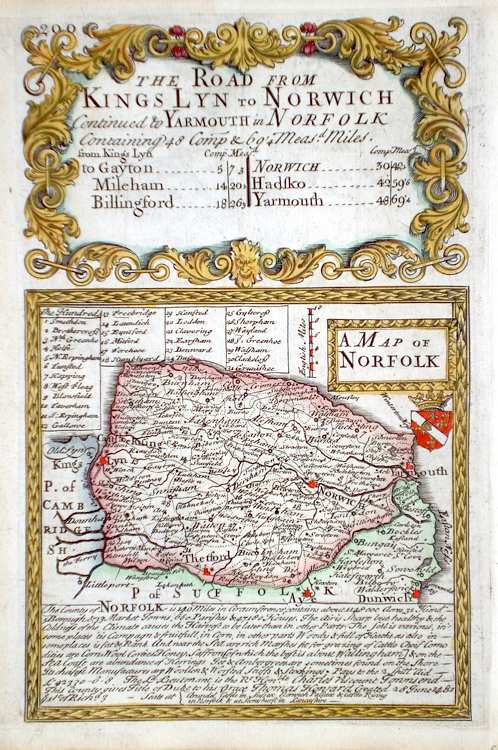
Norfolk 'The Road from Kings-Lyn to Norwich continued to Yarmouth in Norfolk' Ogilby, J. (c. 1676) 44.5 x 35 The road from Kings-Lyn -to Gayton, Mileham, Billingford to Norwich, continuing to Yarmouth. From John Ogilby's Britannia, generally considered one of the most important cartographical works of the seventeenth century. Other features include a very fine cartouche. Later colour. Plate number 76. Some professional repairs to the right hand side, left margin and centre fold strengthened. Otherwise good condition 170.00 GBP |
|
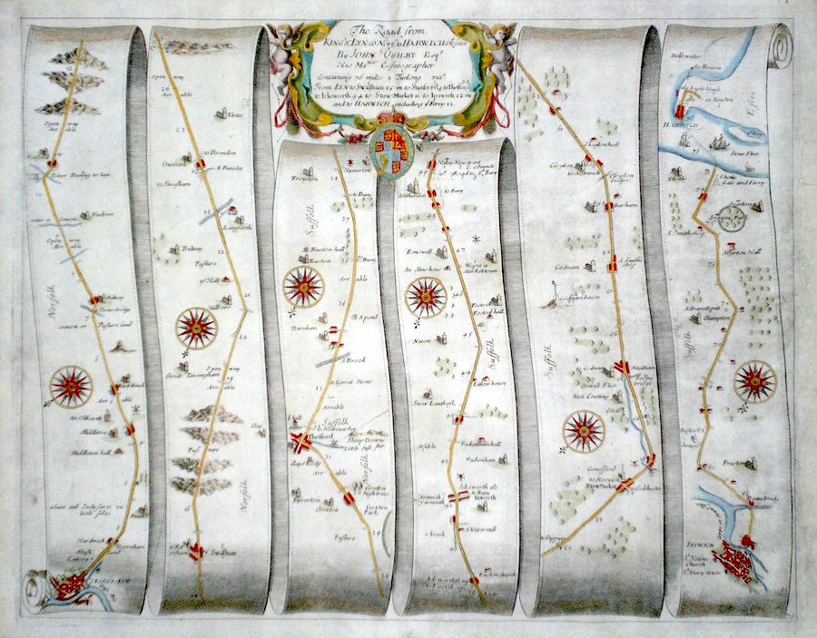
Norfolk 'The Road from King's-Lyn in co. Norf. To Harwich co. Essex' Ogilby, J. (c. 1676) 44.5 x 34.5 The road from Kings-Lyn-to Swaffam, Stanford, Thetford, Ickworth, Stowmarket, and Ipswich, continuing to Harwich by ferry. From John Ogilby's Britannia, generally considered one of the most important cartographical works of the seventeenth century. Other features include a very fine cartouche. Later colour. Plate number 75. Some professional repairs to the right margin, otherwise excellent condition. 165.00 GBP |
|
Norfolk 'Yarmouth and the Sands about it'. Collins, G. Capt. (c. 1720) 57 x 45.5 Attractive and decorative sea chart by Captain Greenvile Collins from the 'Great Britain's Coasting Pilot', the first original sea Atlas produced by an Englishman. Commissioned by King Charles II in 1676 and started in 1681 the work took seven years and was first issued as a complete atlas in 1693. This chart covering almost thirty miles of Norfolk and Suffolk coastline and a large area of the North Sea. The particularly fine and decorative cartouche carries a dedication to the Duke of Norfolk and is illustrated with mermaid and merman and the main industry of the area, fishing. Later colour. 160.00 GBP |
|
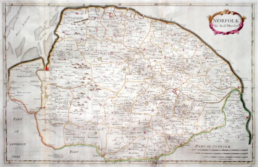
Norfolk 'Norfolk by Robt. Morden' Sturt, J. (1722) 58.5 x 37.5 Elegantly engraved map of the county by John Sturt for Robert Morden's series of maps published in Camden's Britannia. Hand coloured. 120.00 GBP |
|
Norfolk 'A Mapp of ye County of Norfolke with its Hundreds' Blome, R. (c. 1731) 25 x 20 Finely engraved map of the county by Richard Blome from the atlas "England Exactly Described or a Guide to Travellers…" first published by Thomas Taylor, but herewith from the later edition published by Thomas Bakewell. A major addition to the earlier plates is that roads and distances between towns are now included, after the road surveys of John Ogilby. Here Bakewell has not removed the name of Blome from the plate as is usually the case. Fine condition. Later colour 120.00 GBP |
|
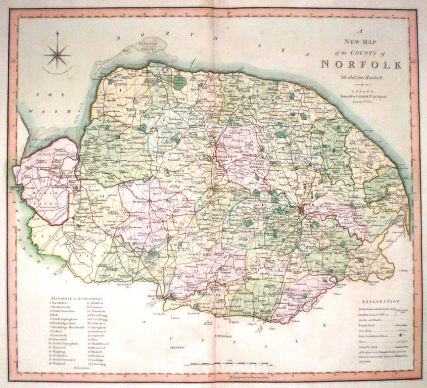
Norfolk 'A New Map of the County of Norfolk divided into Hundreds' Smith, C. (1804) 50 x 45 Large size and decorative map of the County by Jones, Smith & Co. for Smith's New English Atlas. The first map of the County to show longitudes measured from the meridian of Greenwich. Very fine original hand colouring. 100.00 GBP |
|
Norfolk Barnett, T. (1831) 42 x 35 Clearly engraved and decorative map of the county published by Henry Teesdale after Robert Rowe. Original colour. Excellent condition. 75.00 GBP |
|
Norfolk Simpson, S. (1746) 18 x 16 Fine map of the county by Samuel Simpson for his publication "The Agreeable Historian". Most of the maps in this rare series are said by Simpson to be based on those of Herman Moll. Later colour 65.00 GBP |
|
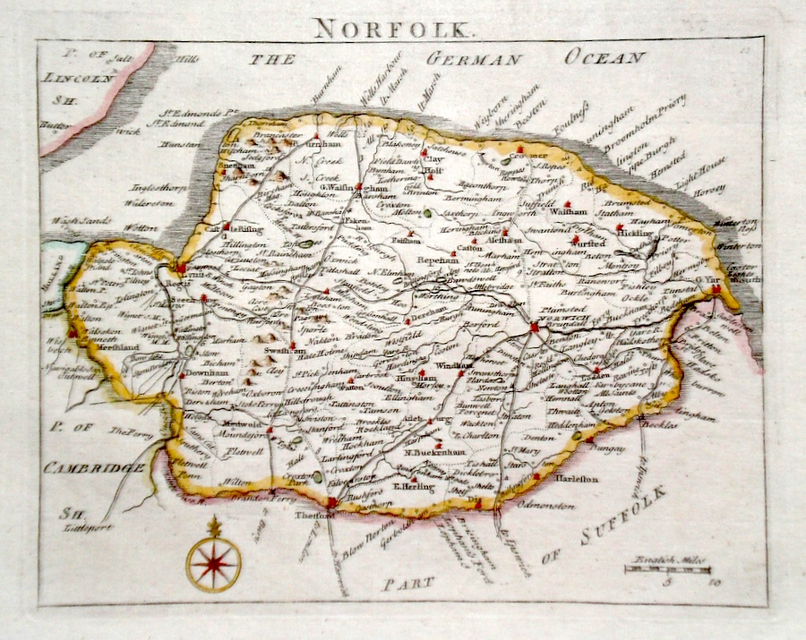
Norfolk Rocque, J. (c. 1769) 20 x 17 Finely engraved map of the county by John Rocque, J. (c. 1769) for the publication "England Displayed". Later colour 60.00 GBP |
|
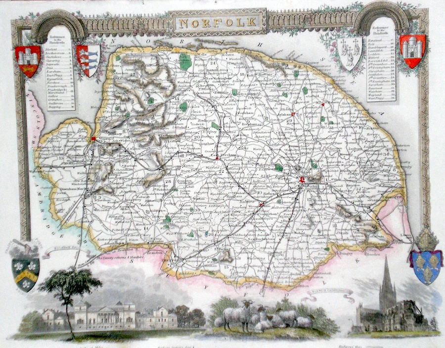
Norfolk Moule, T. (c. 1848) 26 x 20 Decorative Steel engraved map of the county by Thomas Moule. Inset views of Norwich Cathedral and Holkham Hall. Later colour. 55.00 GBP |
|
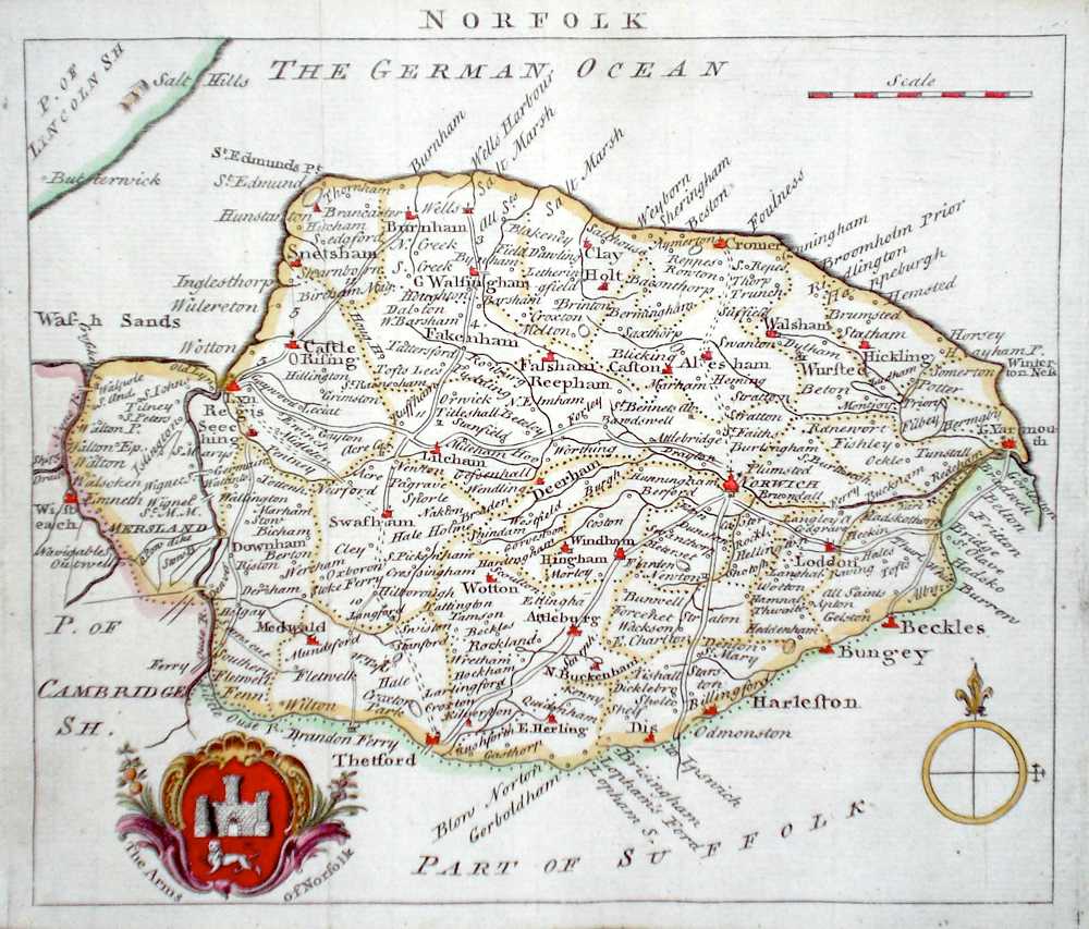
Norfolk 'A Map of Norfolk' Bowen, E. (c. 1724) 12 x 19 Finely engraved map of the county by Emanuel Bowen and John Owen for the publication "Britannia Depicta". To the top are given details of the Road from Kings Lyn to Norwich and verso a section of the road through Suffolk to Ipswich and Harwich is engraved. After John Ogilby. Later colour 50.00 GBP |
|
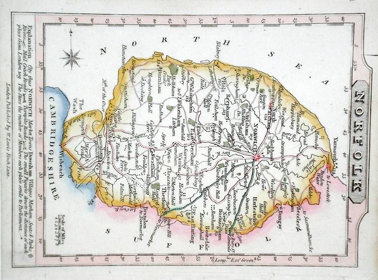
Norfolk Lewis, W. (c. 1835) 10 x 14 Detailed and attractive miniature map of the County by William Lewis for his "Lewis's New Traveller's Guide". A particular feature of this charming series of maps is the clear and precise engraving of the roads. Adjacent numbers indicating the distances from London. Also included with the map is the accompanying page of text giving the county information relevant to travellers - principal towns and inns are listed, distances between towns, principal fair dates, and even sites for the best views of the county. Later colour. 40.00 GBP |
|
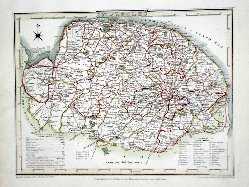
Norfolk Roper, J. (1810) 24 x 18 Detailed and decorative map of the county by Cole and Roper for The British Atlas. Original hand colouring. Excellent condition. 40.00 GBP |
|
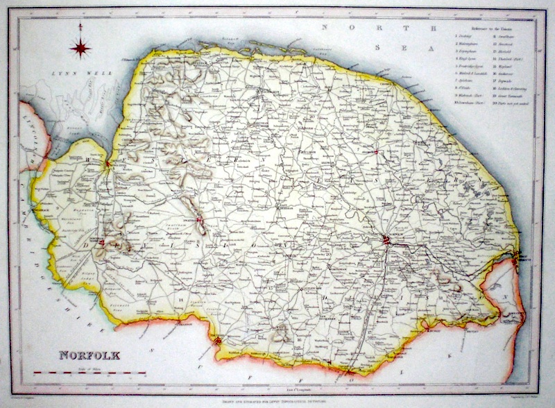
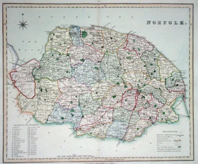
Norfolk Walker, J & C (c. 1840) 33 x 25 Steel engraved map of the county produced for Samuel Lewis' Topographical Dictionary and engraved by J & C Walker. Later colour 40.00 GBP |