Scandinavia
|
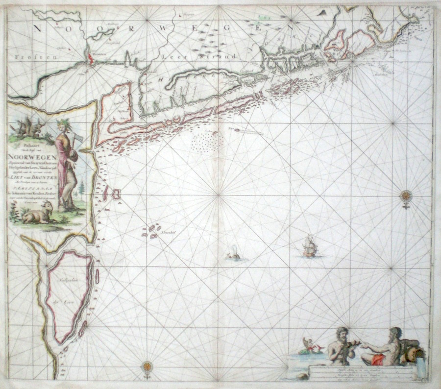
Scandinavia - Norway 'Pascarte van de Kuste van Noorwegen Beginnende van de Swarten Ostot aan Heyligerlander Leen...' Van Keulen, J. (c. 1681) 59 x 52 Fine sea chart of part of the Norwegian coastline by Johannes Van Keulen. The area covered is the coastline area around Trondheim (Dronten, on the chart) and the Trondheim Fjord, on Norway's West coast. The chart features two fine cartouches. a rural scene in the title cartouche, and a mythical ocean scene in the scale cartouche. The compass point indicates that the chart is orientated to the south. Condition excellent, later colour. 320.00 GBP |


|
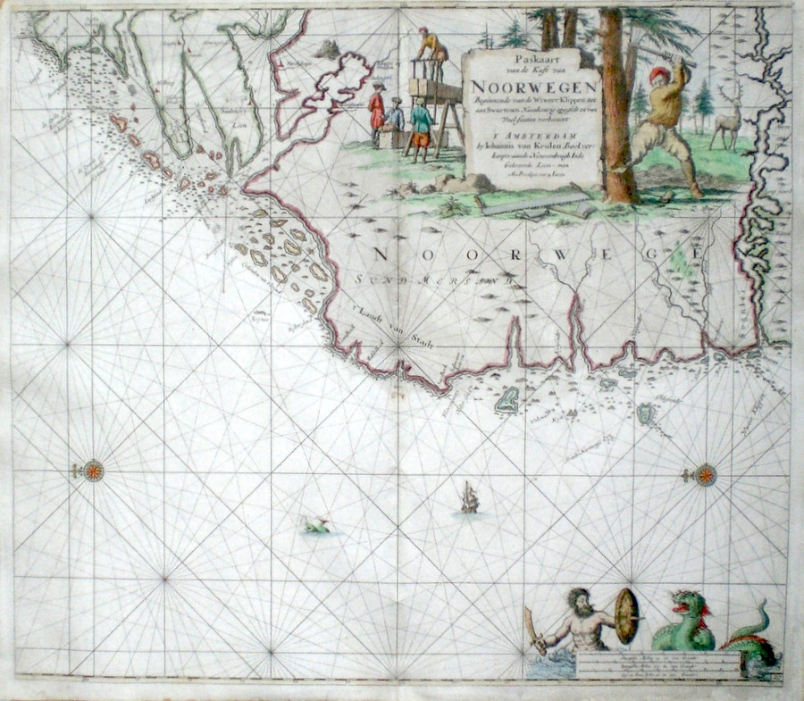
Scandinavia - Norway 'Pascarte van de Kuste van Noorwegen Beginnende van de Wtweer Klippen tot aan Swartenos...' Van Keulen, J. (c. 1681) 59 x 52 Fine sea chart of part of the Norwegian coastline by Johannes Van Keulen. The area covered is from the Sognler river, northwards on Norway's West coast. The chart features two fine cartouches. Logging and sawing in the extensive forests in the title cartouche, and a merman fighting a large sea monster in the scale cartouche. Two compass points indicate that the chart is orientated to the west. Condition good, later colour. 295.00 GBP |
|
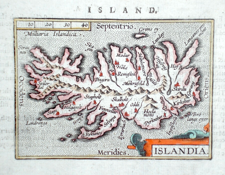
Scandinavia - Iceland 'Islandia' Ortelius, A. (c. 1603) 10 x 8.5 Fine early map of Iceland by Abraham Ortelius , engraved in small format by Philippe Galle, and published in the Epitome, or pocket- edition of the "Theatrum Orbis Terrarum". This map from an English text edition of c.1603 published in London and thus one of the first world atlases published in England. Fine condition. Later colour 150.00 GBP |
|
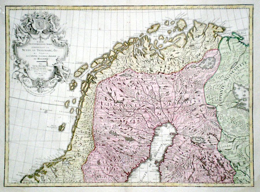
Scandinavia - Lapland 'Carte des Courones du Nord Comprenant La Suede, Le Danemarc, &c La Norwege' De Lisle, G. (c. 1788) 62 x 45 Large size and influential map of Northern Scandinavia by Guillaume de Lisle (1675-1726). This copy an edition of circa 1788 issued by the publisher and engraver J. A. Dezauche. The map features the lands extending into the Arctic circle - Northern Norway, Swedish and Russian Lapland. Other features include an attractive cartouche of putti, military and religious figures. Original outline colour and later wash colour. Excellent condition 145.00 GBP |
|
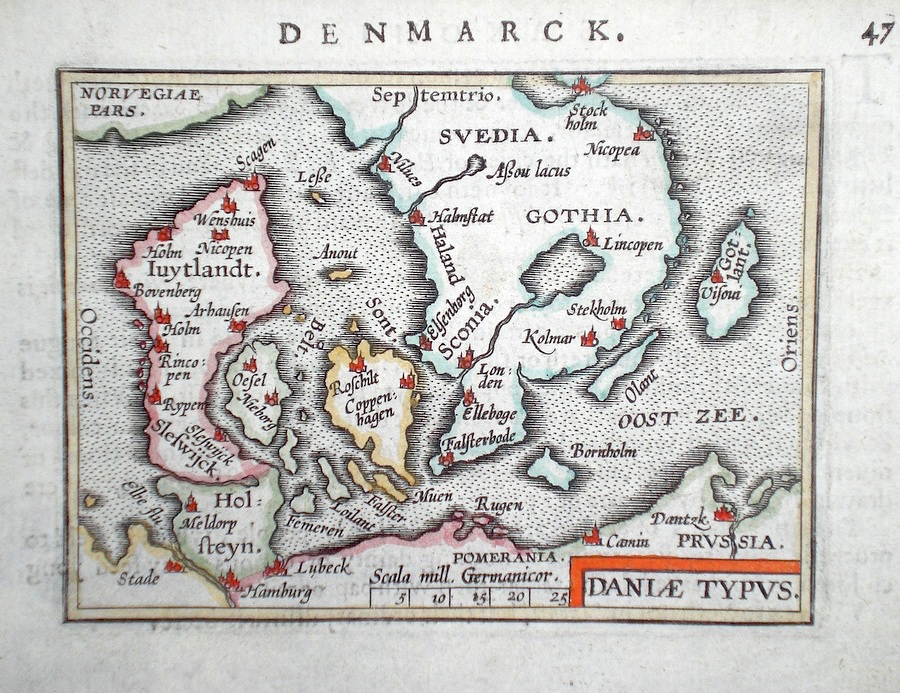
Scandinavia - Denmark 'Daniae Typus' Ortelius, A. (c. 1603) 10 x 8.5 Fine early map of Denmark and including southern Sweden by Abraham Ortelius , engraved in small format by Philippe Galle, and published in the Epitome, or pocket-edition of the "Theatrum Orbis Terrarum". This map from an English text edition of c. 1603 published in London and thus one of the first world atlases published in England. Fine condition. Later colour 125.00 GBP |
|
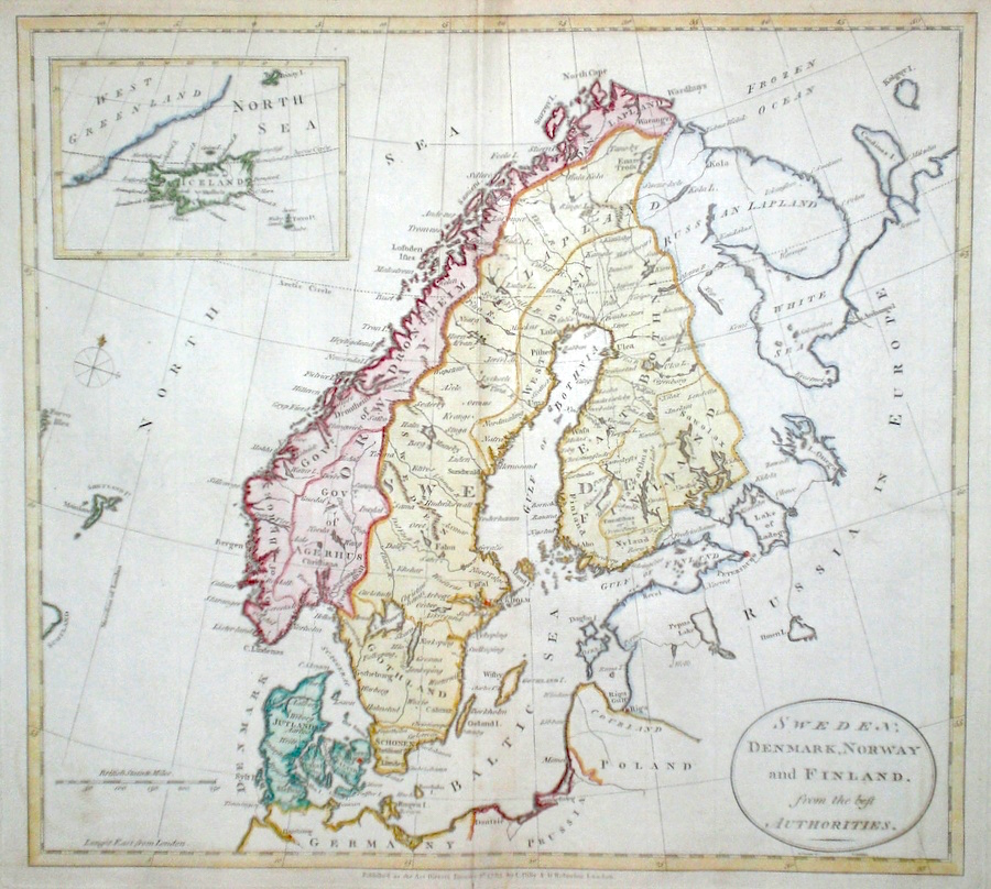
Scandinavia 'Sweden, Denmark, Norway and Finland from the best Authorities' Darton, W. (c. 1785) 37 x 34 Finely engraved map of Scandinavia by William Darton for The Universal History. The inset map shows Iceland and the west of Greenland. Later colour. Condition excellent 90.00 GBP |
|
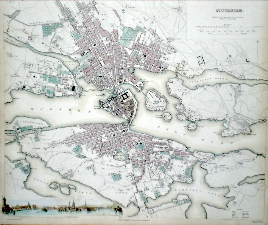
Stockholm Davies B.R. (c. 1836) 40 x 33 Finely engraved plan of the city by B.R.Davies for the Society for the Diffusion of Useful Knowledge. Features include view of Stockholm from the Island of Langholmen. Early colour with additional later colour. 85.00 GBP |
|
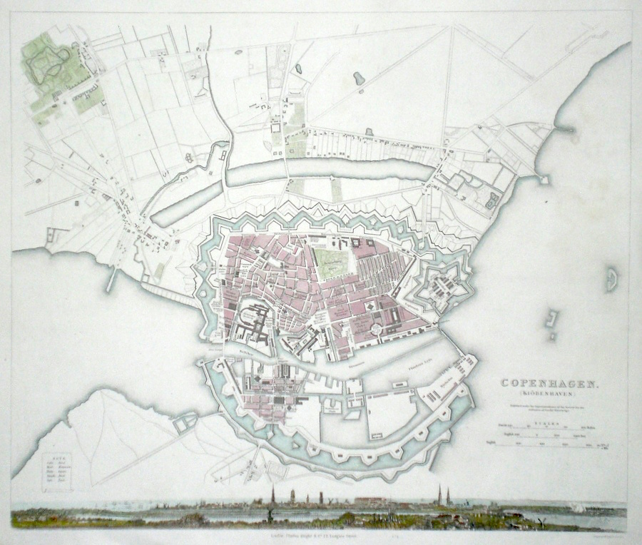
Copenhagen Henshall, J. (c. 1840) 39 x 33 Finely engraved plan of the city by Henshall for the Society for the Diffusion of Useful Knowledge. Features include a fine view of the city along the bottom line. Early colour with additional Later colour. 80.00 GBP |
|
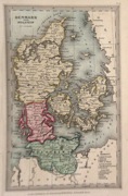
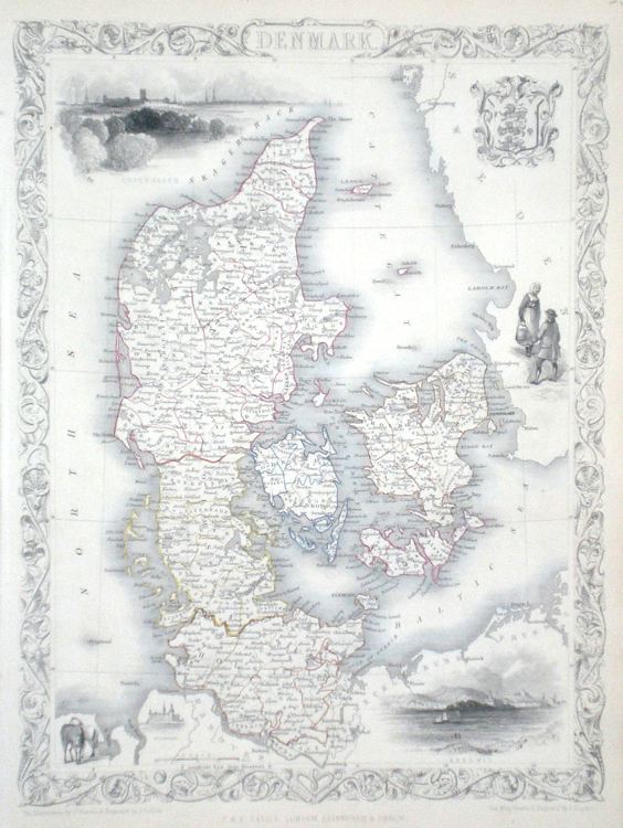
Denmark Rapkin, J. (1851) 26 x 36 Fine map of the Country by John Rapkin, for John Tallis's highly decorative "The Illustrated Atlas". The vignettes show; Copenhagen, Elsinore, Sleswig, Danish costume and Coat of Arms. Single page map (no central fold). Original colour as published. Condition fine. 75.00 GBP |
|
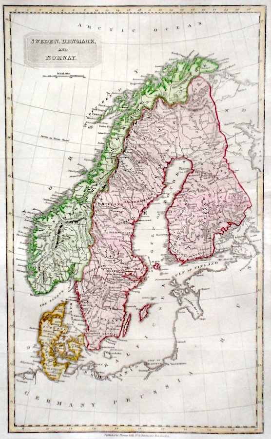
Scandinavia Sweden, Denmark, and Norway Findlay, A. (c. 1820) 24 x 40 Fine detailed map of Scandinavia by Alexander Findlay and published in the Universal Geography. Good condition. Later colour 65.00 GBP |
|
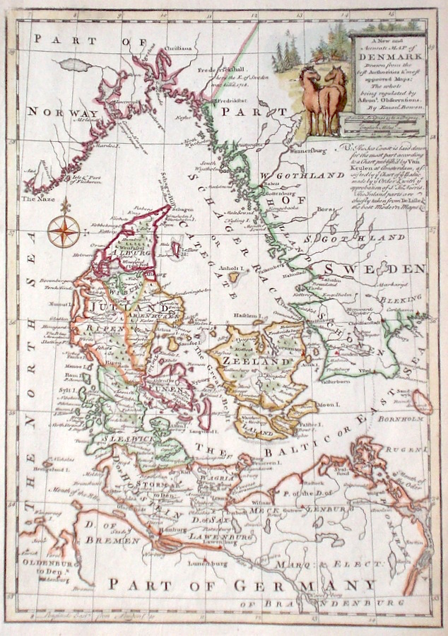
Denmark 'A New and Accurate Map of Denmark' Bowen, E. (c. 1766) 22 x 32 Fine map of Denmark by Emanuel Bowen. Features include a fine cartouche of a rural scene. Later hand colour, excellent condition. 60.00 GBP |
|
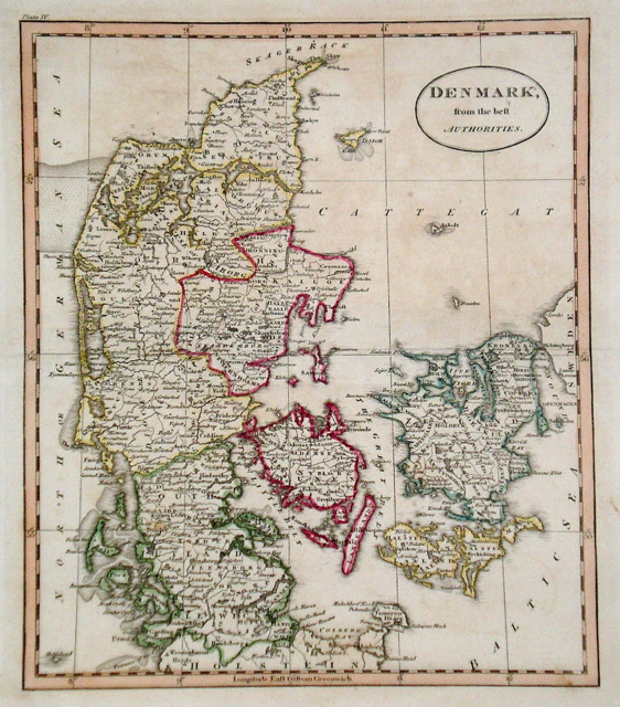
Denmark 'Denmark from the best Authorities' Russell, J. (1818) 19 x 22 Denmark from Guthrie's Geography. Engraved by John Russell. Original hand colour. Excellent condition 60.00 GBP |
|
Denmark 'Denmark including Schleswig & Holstein' Lowry, J. (1863) 43 x 60 Two sheets joined. Original hand colour, a few brown spots in the margin but generally good condition 45.00 GBP |
|
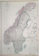
Scandinavia 'Sweden and Norway' Lowry, J. (1863) 43 x 62 Two sheets joined. Original hand colour, excellent, clean condition. 45.00 GBP |
|
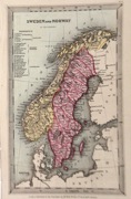
Scandinavia 'Sweden and Norway' Starling, T. (c. 1832) 9 x 15 Uncommon and finely engraved map of the two countries from The Royal Cabinet Atlas. Bright original colouring to the various countries. A numbered key identifies the various provinces. 40.00 GBP |
|
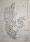
Denmark 'Denmark with Holstein' Starling, T. (c. 1832) 9 x 15 Uncommon and finely engraved map of the country from The Royal Cabinet Atlas. Bright original colouring to the various areas. A numbered key identifies the various provinces. 40.00 GBP |