Sussex
Including Chichester, Brighton, Worthing, Crawley, Hastings, Eastbourne, Bognor Regis, Horsham
|
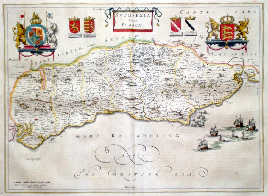
Sussex 'Suthsexia vernacule Sussex' Blaeu, J. (c. 1645) 52 x 38 Very fine map of the County by Joan Blaeu for volume IV of the "Atlas Novus". The map embodies the finest features of Dutch Cartography of the Seventeenth century. Superbly engraved and arranged, with shields, coats of arms and several galleons depicted. Latin text verso and full margins. Original colour throughout. 495.00 GBP |
||||||||||||||


|
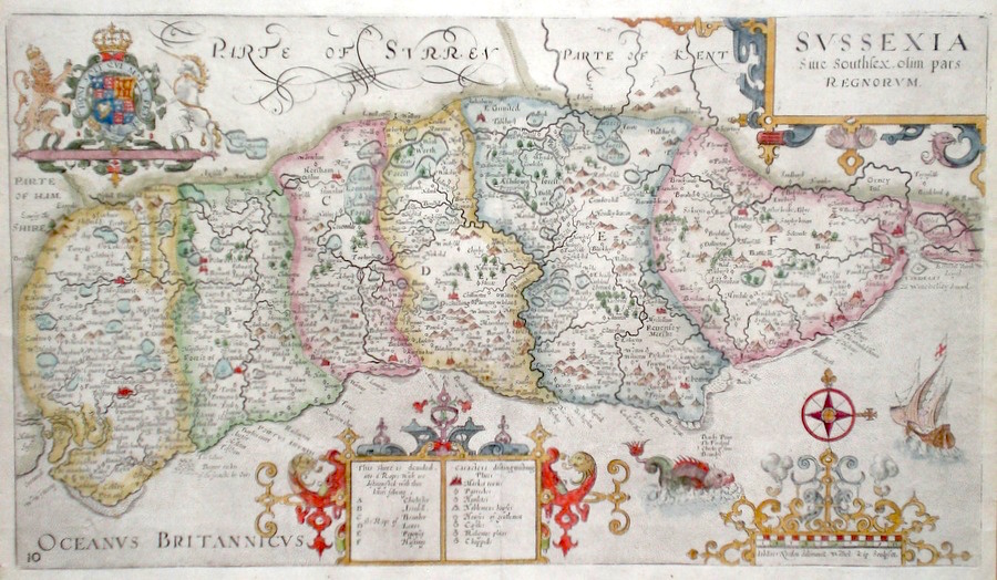
Sussex 'Sussexia Sive Southsex. olim pars Regnorum' Kip, W. (c. 1637) 39 x 22 Fine map of the County by William Kip after the survey of John Norden. Published in early editions of William Camden's Britannia containing county maps. Features include four fine cartouches, a galleon and a sea monster. The six main divisions of the county with differentiating hand colour. Excellent condition 295.00 GBP |
||||||||||||||
|
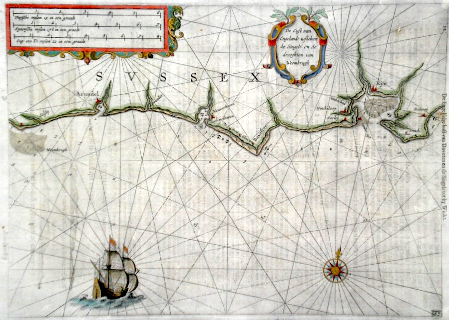
Sussex 'De Cust van Engelant...' Blaeu, W. J. (c. 1640) 36 x 26 Early engraved sea chart of the Sussex coast by Willem Janszoon Blaeu. The area covered is from Selsey in the west to Rye and Romney in the east. The ancient towns of Rye and Arundel being marked prominently. Text and some coastal profiles to the back of the engraving. Good condition. Later colour. 295.00 GBP |
||||||||||||||
|
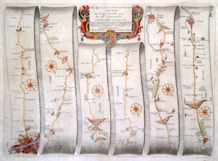
Sussex 'The Road from London to Arundel com. Sussex...' Ogilby, J. (1698) 45 x 33 The road from Southwark, London. to Leatherhead, Dorking, Billinghurst, Amberley, Arundel. Arundel to Chichester From John Ogilby's Britannia, generally considered one of the most important cartographical works of the seventeenth century. Features include miniature town plans of London, Arundel and Chichester and a fine cartouche. Later colour. Plate number 4. Excellent condition. 265.00 GBP |
||||||||||||||
|
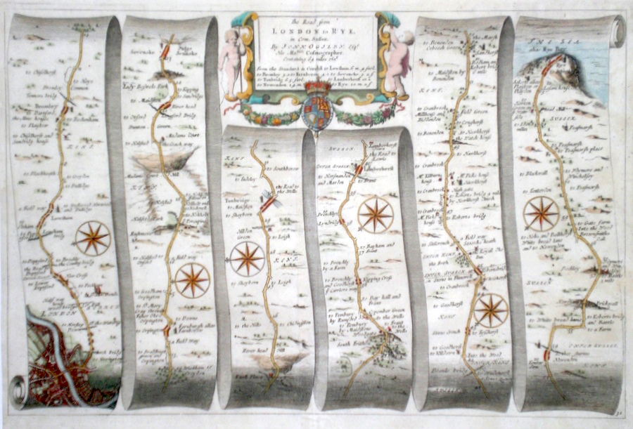
Sussex 'The Road from London to Rye in Com. Sussex...' Ogilby, J. (1698) 45 x 30 The road from Southwark and London to Lewisham, Sevenoaks, Tunbridge, Lamberhurst, Rye. From John Ogilby's Britannia, generally considered one of the most important cartographical works of the seventeenth century. Features include miniature town plans of London and Rye, and a fine cartouche. Later colour. Plate number 31. Excellent condition. 245.00 GBP |
||||||||||||||
|
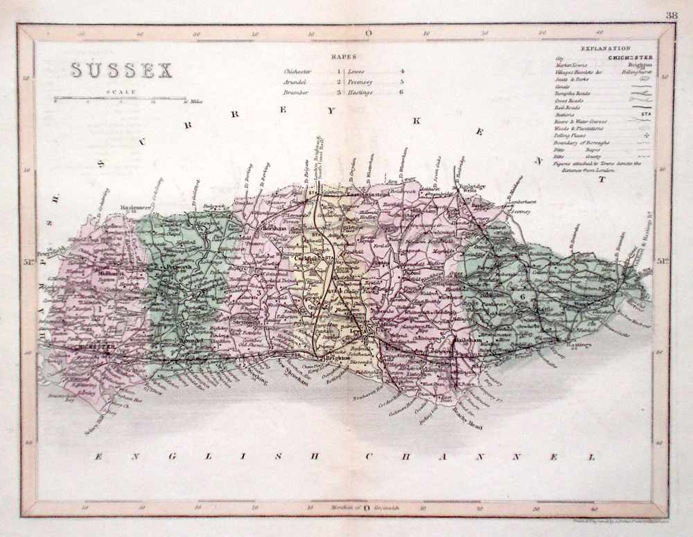
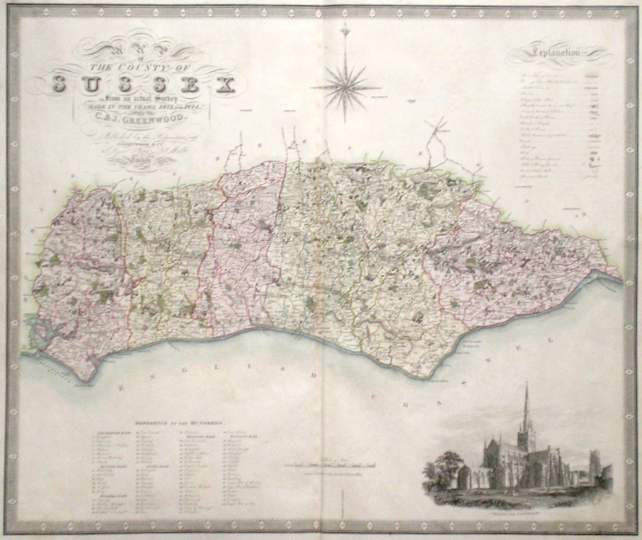
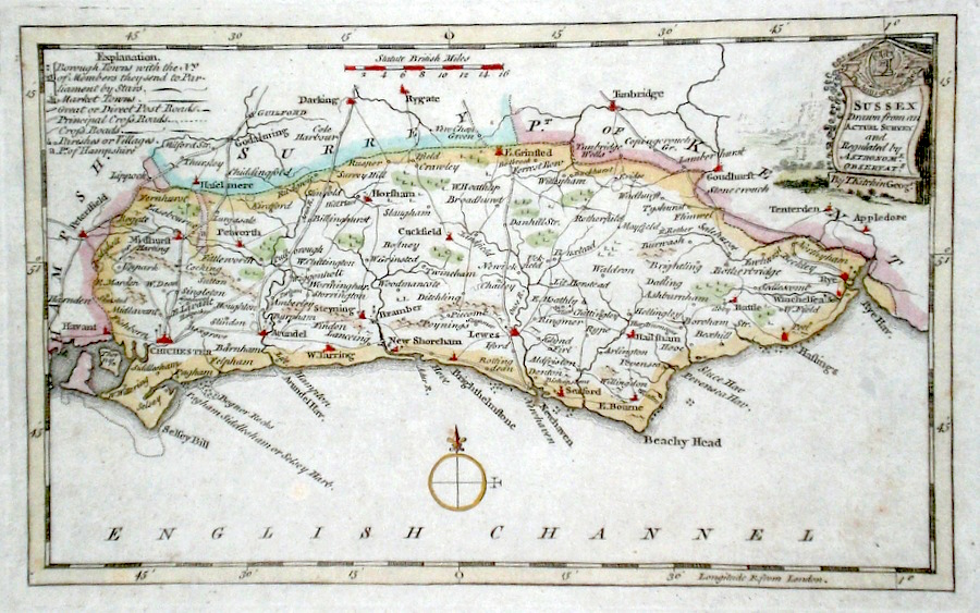
Sussex 'Map of the County of Sussex, from an Actual Survey made in the years 1823 and 1824' Frost, H. (1829) 69 x 58 Finely engraved and detailed map of the county by Christopher and John Greenwood. The brothers published their county maps from their original surveys over the period 1817 until 1833, and then in 1834 as an atlas. With their large size, accuracy and decorative vignettes the maps are generally recognised as being amongst the finest published in England in the nineteenth century. On this map the vignette is of Chichester Cathedral. Original hand colouring. 185.00 GBP |
||||||||||||||
|
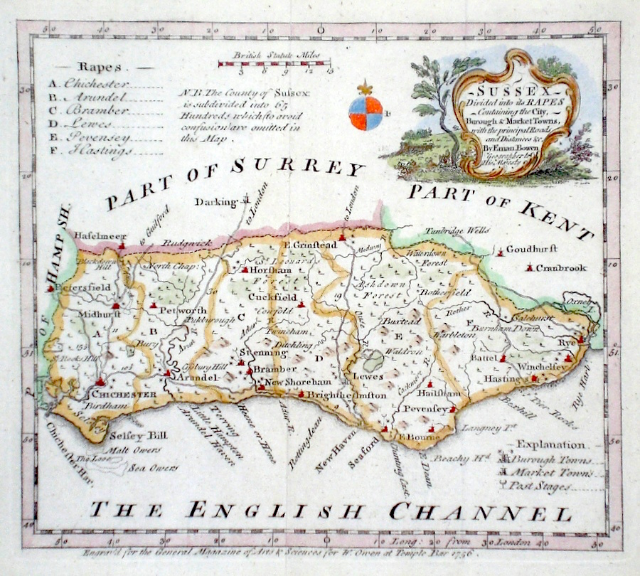
Sussex Bowen, E. (c. 1756) 20 x 18 Attractive map of the county by Emanuel Bowen, engraved for the General Magazine of Arts and Sciences. Features include a fine rococo style cartouche. Later colour excellent condition. 70.00 GBP |
||||||||||||||
|
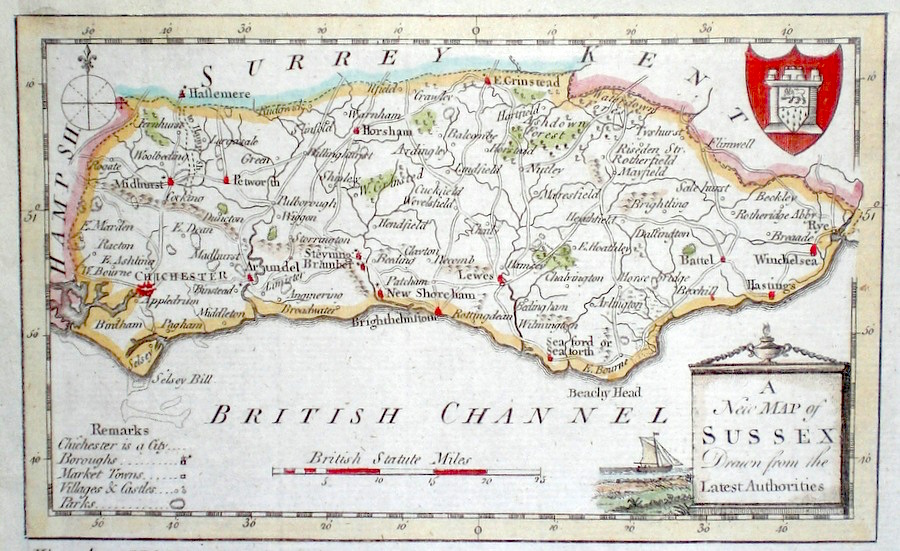
Sussex 'Sussex drawn from an actual survey...' Kitchen, T. (c. 1786) Finely engraved and detailed map of the county by Thomas Kitchen. Showing Road, Borough and market towns etc. Later colour. 60.00 GBP |
||||||||||||||
|
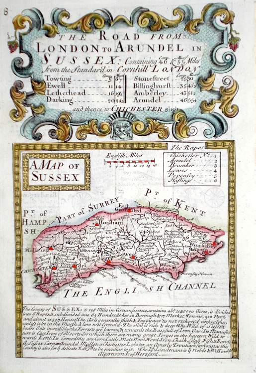
Sussex 'A Map of Sussex' Bowen E. (c. 1724) 12 x 19 Finely engraved map of the County by Emanuel Bowen and John Owen for the publication "Britannia Depicta". To the top are given details of the Road from London to Arundel and verso part of the road to Aberystwith is engraved. After John Ogilby. Later colour 55.00 GBP |
|
Sussex 'A New Map of Sussex Drawn from the latest Authorities' Conder, T. (c. 1784) 19 x 12 Finely engraved and decorative map of the County by Thomas Conder for the publication "The New British Traveller". Features include a cartouche of a rural scene and coat of arms. Later colour 50.00 GBP |
|
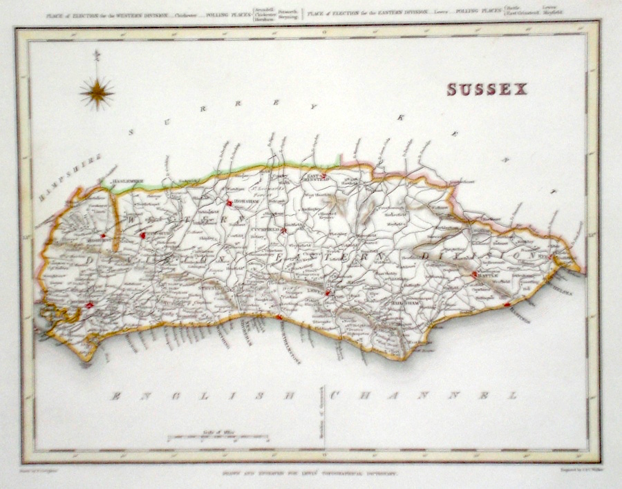
Sussex Walker J.& C. (c. 1833) 24 x 19 Detailed map of the County drawn by R. Creighton and engraved by J.& C. Walker for Lewis's Topographical dictionary. The table above the map gives political boundary details. Later colour 50.00 GBP |
|
Sussex Archer, J. (c. 1850) 24 x 18 Detailed and attractive steel engraved map of the County by Joshua Archer. Original colour. 40.00 GBP |