Greece
|
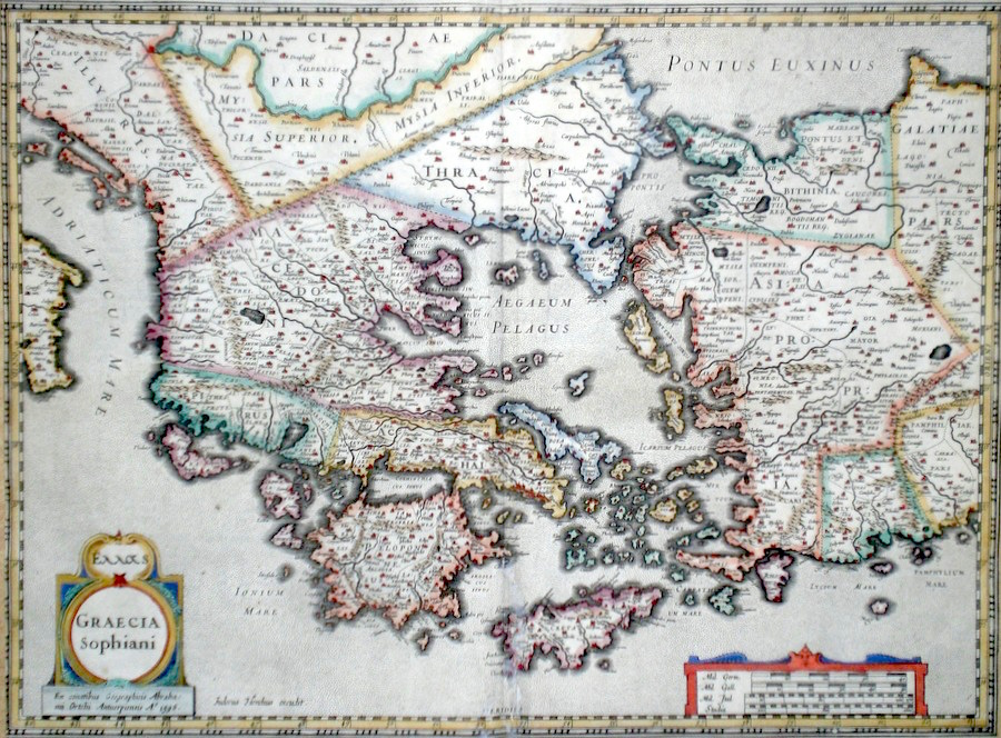
Greece 'Graecia Sophiani' Ortelius, A. (c. 1618) 50 x 37 Superb map of classical Greece by Abraham Ortelius after Nikolas Sophianos engraved by Hondius and Published by Petrus Bertius in the Atlas "Theatrum Geographiae Veteris". This rare atlas compiled by Bertius used purchased Ortelius copperplates and other plates from Mercator to publish a classical atlas similar to the Ortelius Parergon. The map covers the area of northern Greece, Thracia, Peloponese, the Greek Islands and Asia Minor. Features include two fine cartouches. Latin text to verso. Later hand colour. Condition-trimmed to map border on two vertical sides otherwise excellent 495.00 GBP |


|
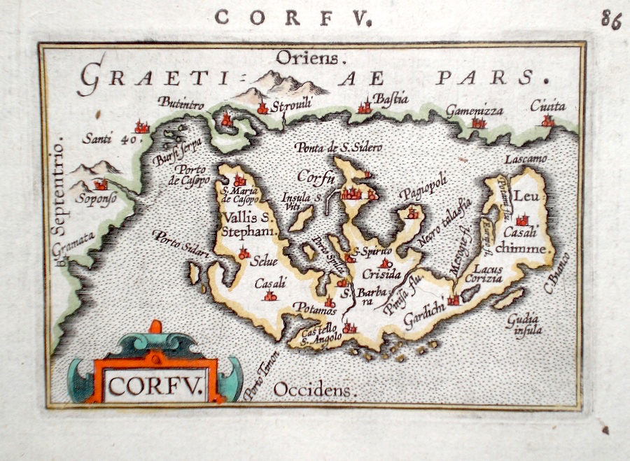
Greece 'Corfu' Ortelius, A. (c. 1603) 10 x 8.5 Fine early map of Corfu by Abraham Ortelius, engraved in small format by Philippe Galle, and published in the Epitome, or pocket-edition of the "Theatrum Orbis Terrarum". This map from an English text edition of c. 1603 published in London and thus one of the first world atlases published in England. Fine condition. Later colour 130.00 GBP |
|
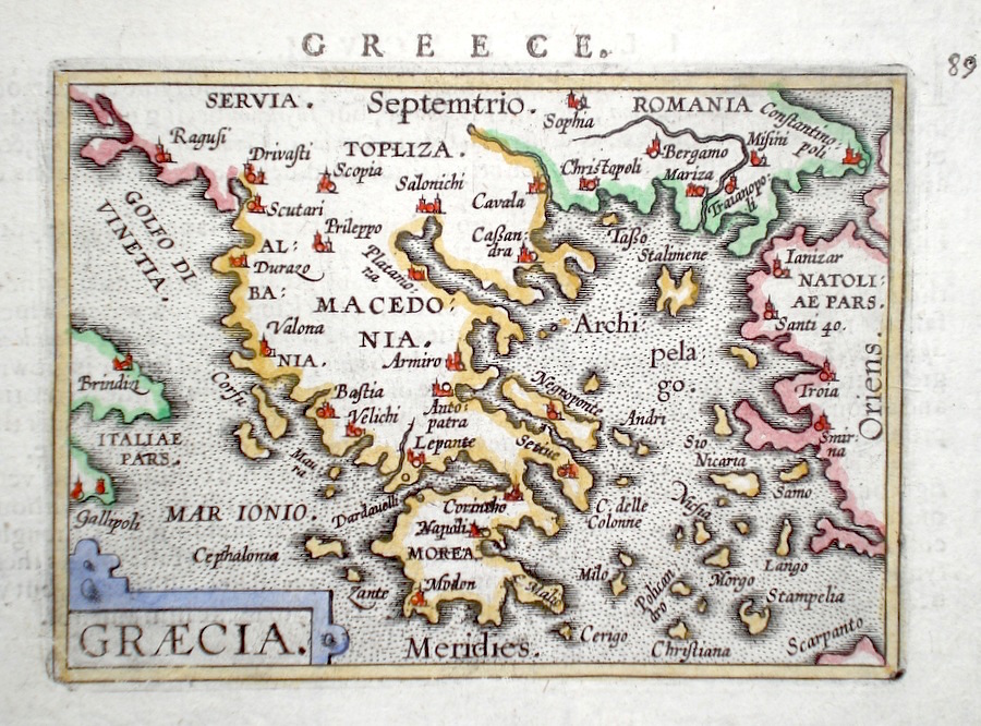
Greece 'Graecia' Ortelius, A. (c. 1603) 10 x 8.5 Fine early map of Greece by Abraham Ortelius, engraved in small format by Philippe Galle, and published in the Epitome, or pocket-edition of the "Theatrum Orbis Terrarum". This map from an English text edition of c. 1603 published in London and thus one of the first world atlases published in England. Fine condition. Later colour 120.00 GBP |
|
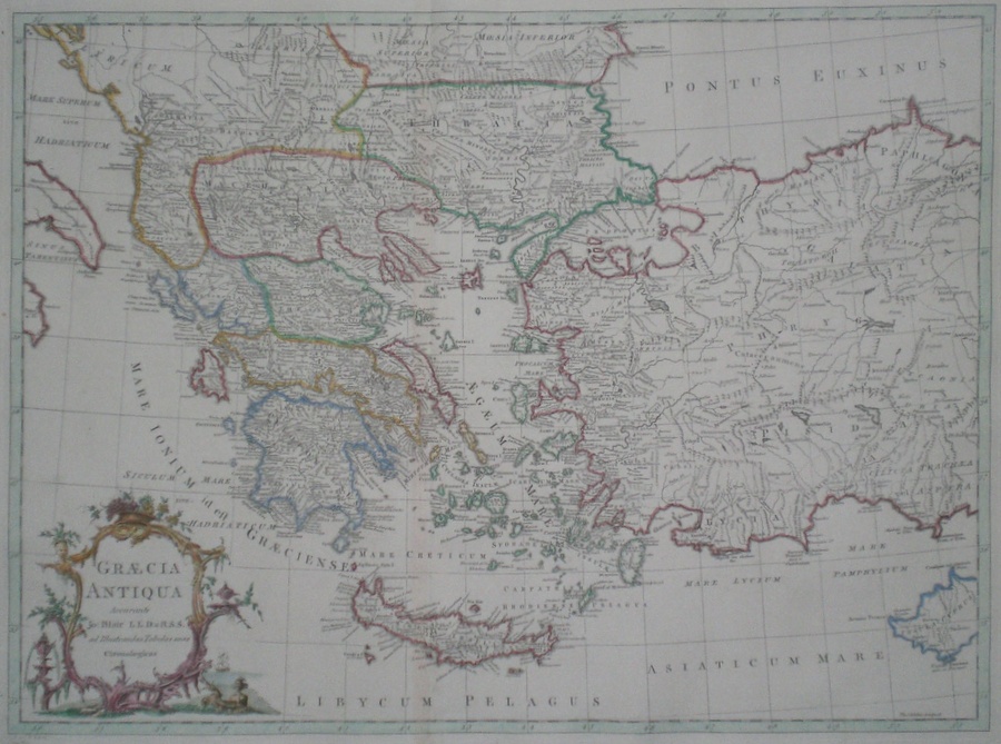
Greece 'Graecia Antiqua Accurante' Kitchen, T. (1768) 57 x 43 Finely engraved map of the area of Ancient Greece by John Bayly for John Blair's "The Chronology and History of The World". Covers in detail the Ancient Kingdoms of Macedonia, Thracia, Peloponnese, Crete and the ancient Kingdoms of what is now western Turkey. Fine condition. Later colour 120.00 GBP |
|
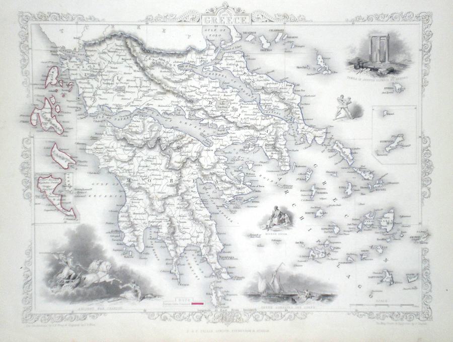
Greece Rapkin, J. (1851) 36 x 26 Fine map of the Country by John Rapkin, for John Tallis's highly decorative "The Illustrated Atlas". The vignettes show; Temple of Jupiter Olympus Athens, Greek Corsairs off Corfu, Ancient War Chariot. Single page map (no central fold). Original colour as published. Condition fine. 75.00 GBP |
|
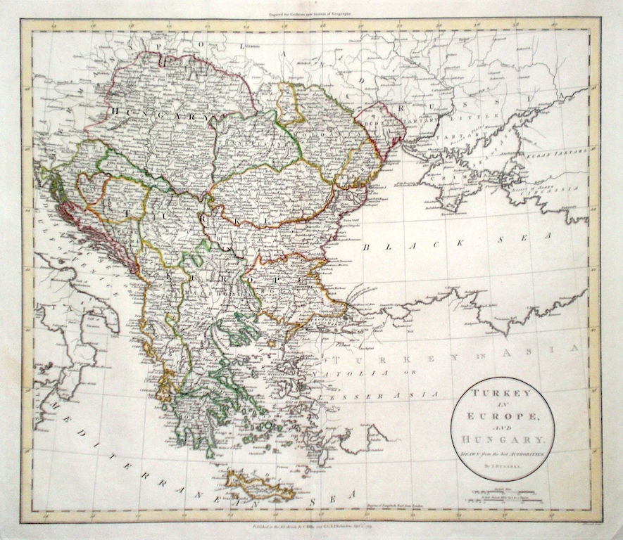
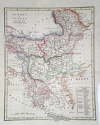
Greece 'Turkey in Europe and Hungary….' Russell, J. (1799) 46 x 41 Fine map of Greece and the Balkans by John Charles Russell for Guthrie's " New System of Geography". Also shows Hungary. Double page folio size map. Original hand colour. 75.00 GBP |
|
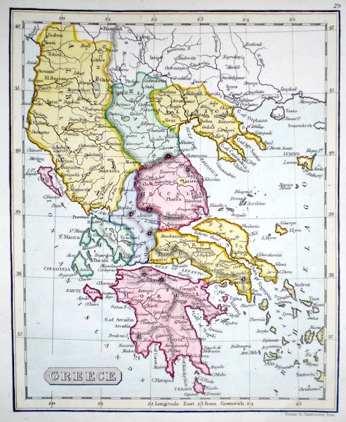
Greece 'Hellas or Greece' Hall, S. (1854) 40 x 31 Finely engraved map of Greece by Sidney Hall. Steel engraving published in the "General Atlas of The World". Inset map of Corfu. Condition excellent. 50.00 GBP |

|
Greece Starling, T. (c. 1832) 15 x 9 Uncommon and finely engraved map of the country from The Royal Cabinet Atlas. Bright original colouring to the various provinces. 40.00 GBP |
|
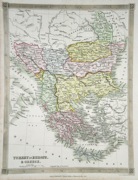
Greece 'Turkey in Europe drawn from many astronomical observations and Surveys' Cooke's New Encyclopaedia (c. 1789) 22 x 27.5 Map of Greek peninsula including, Albania, Romania and the Balkans. Traces of old folds, later hand colour. 35.00 GBP |
|
Greece Turkey in Europe and Greece Findlay, A (c. 1850) 20 x 26 Detailed steel engraved map with later outline color to the regions 30.00 GBP |
|
Greece Fenner, R. (1828) 12 x 15 Steel engraved map of Greece and including Albania by Robert Fenner for “Fenner's Pocket Atlas”. Later full wash colour 25.00 GBP |
|
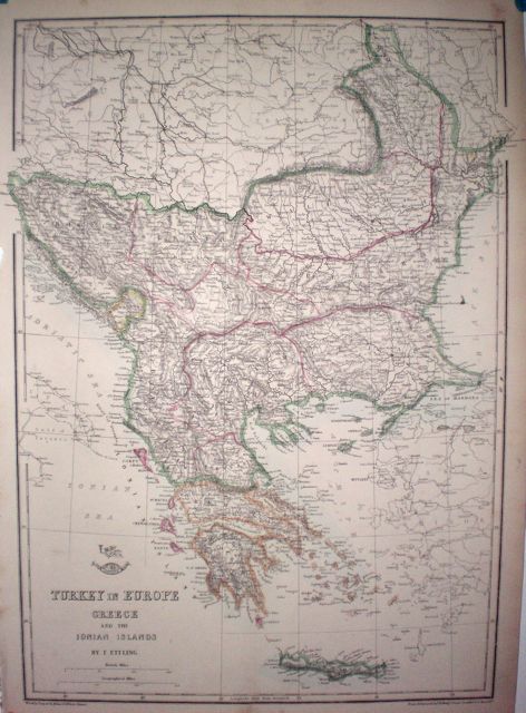
Greece 'Turkey in Europe Greece and the Ionian Islands' Dispatch Atlas (1863) 32 x 43 Early outline colour. 20.00 GBP |