Staffordshire
Including Stafford, Stoke-on-Trent, Wolverhampton, Walsall, Cannock, Lichfield
|
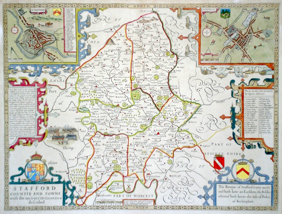
Staffordshire 'Stafford Countie and Town with the Ancient Citie Lichfield described' Speed, J. (c. 1676) 51 x 39 Superb map of the county by John Speed, Bassett and Chiswell edition. Published in 1676 the plate carries no date. Features include coats of arms and two fine town plans, symmetrically arranged, of Stafford and Lichfield. A fine battle scene from the wars of the Roses is depicted to the left. This copy laid down onto thin card. Bright attractive hand colour. 425.00 GBP |


|
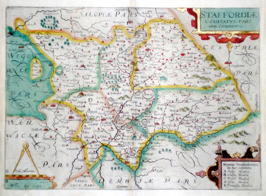
Staffordshire 'Staffordiae Comitatus pars olim Cornuaiorum' Kip, W. (c. 1637) 38 x 27 Early map of the county engraved by William Kip for Camden's Britannia. The map is copied from the William Smith map of 1602/3. North is to the right. The later hand colouring is in a bright and attractive style. Plate number 31 bottom left. No text verso 130.00 GBP |
|
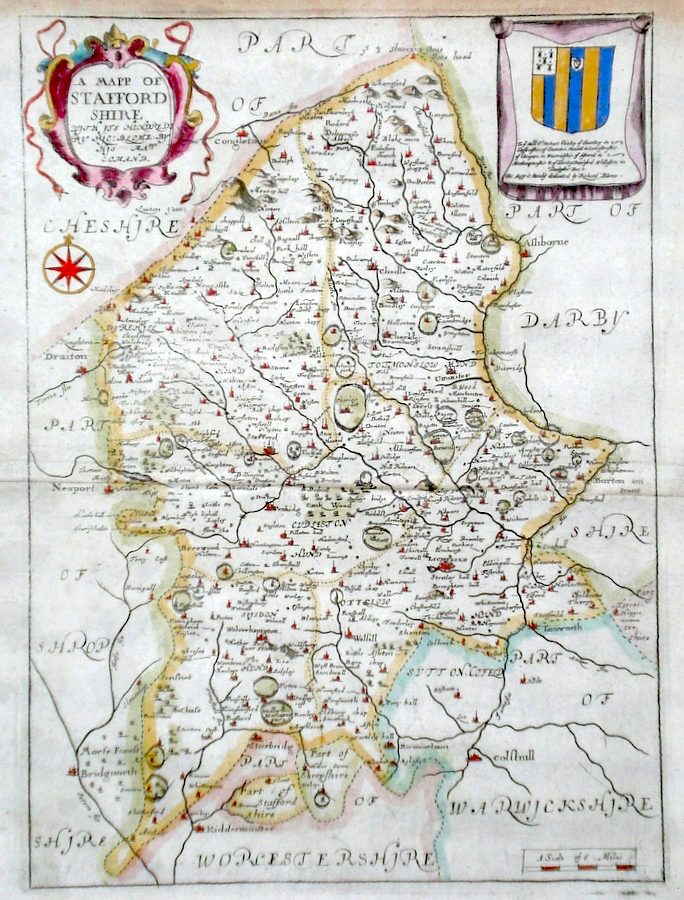
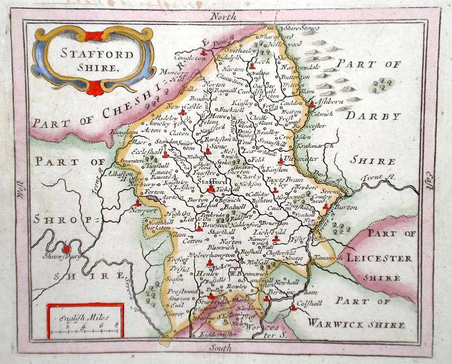
Staffordshire 'A Mapp of Staffordshire' Blome, R. (1673) 24 x 33 Decorative map of the County by Richard Blome for his publication "Britannia". The largest series of county maps published by Blome, and generally based on those of Speed. Maps by Blome are characteristic and attractive. Fine condition, later colour. 135.00 GBP |
|
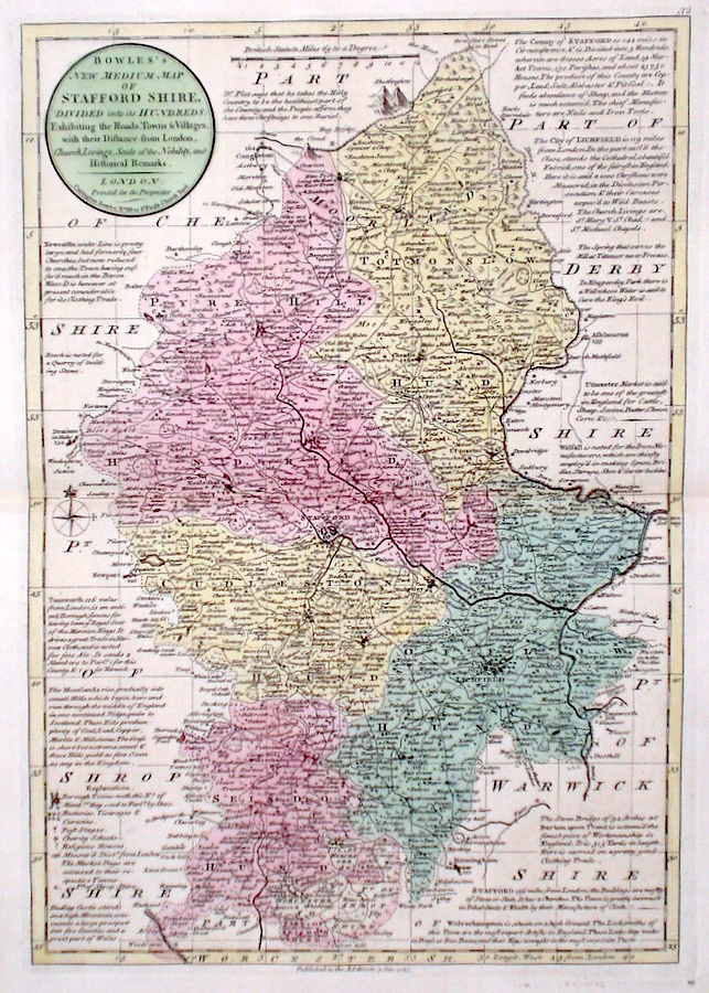
Staffordshire 'Bowles's New Medium Map of Staffordshire...' Bowen, E. & T. (1785) 23 x 33 Finely engraved and detailed map of the county from "Bowles's New Medium English Atlas". The maps in this series are based on those in Emanuel and Thomas Bowen's Atlas Anglicanus, and feature extensive county information on the map. They are distinguished primarily by having newly engraved cartouches, distances from London added to towns, and different imprints at the bottom. Full original colour. Fine condition. 110.00 GBP |
|
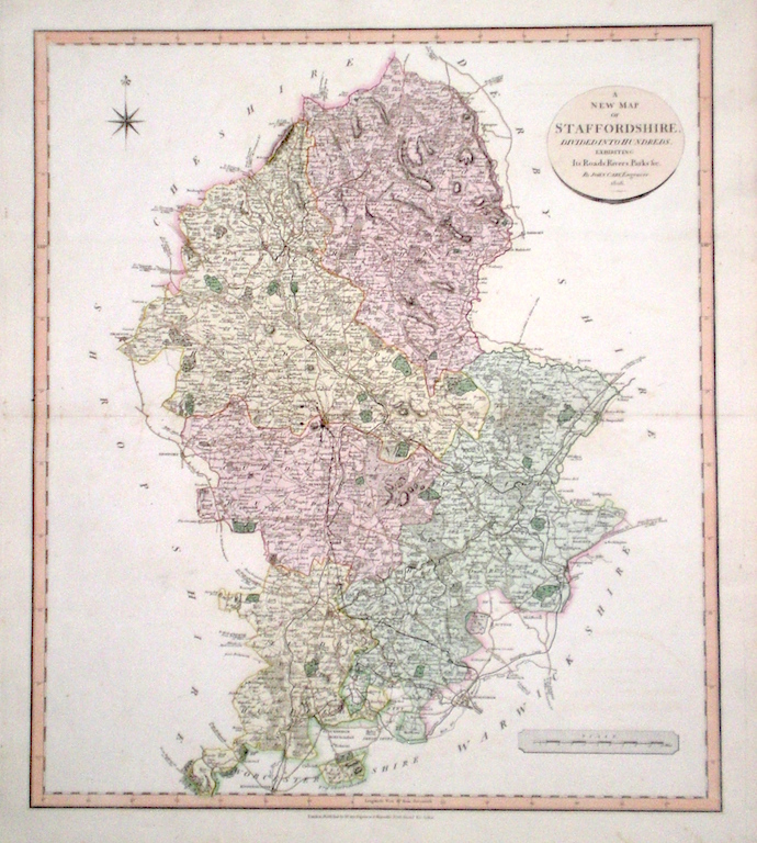
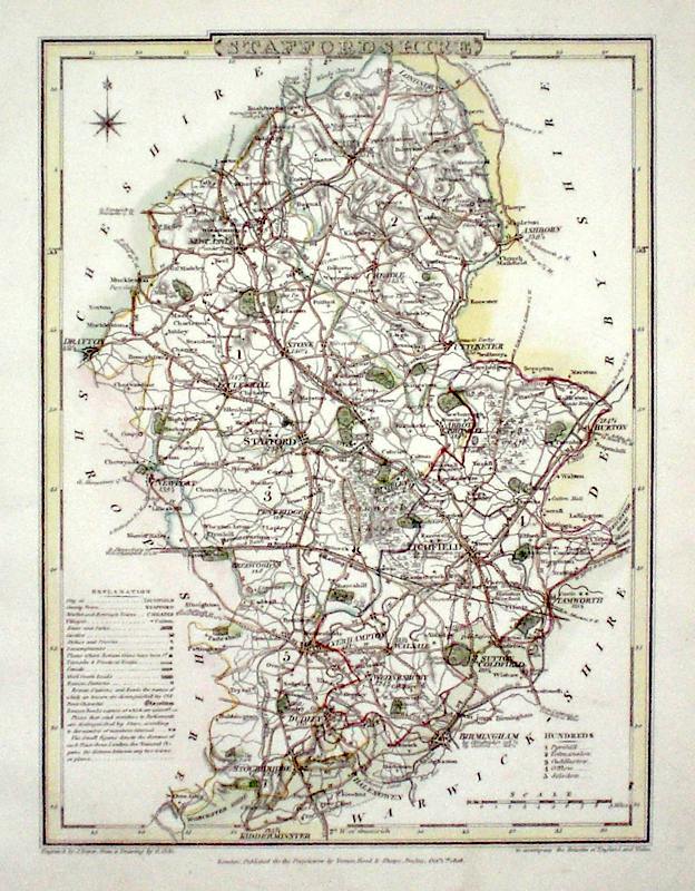
Staffordshire 'A New Map of Staffordshire divided into Hundreds exhibiting its Roads, Rivers, Parks' Cary, J. (1809) 49 x 54 Superbly engraved map of the county by John Cary. From "Cary's New English Atlas". The atlas was issued in parts from 1801 to 1809 and published as a complete work in 1809. Very fine original hand colour. 95.00 GBP |
|
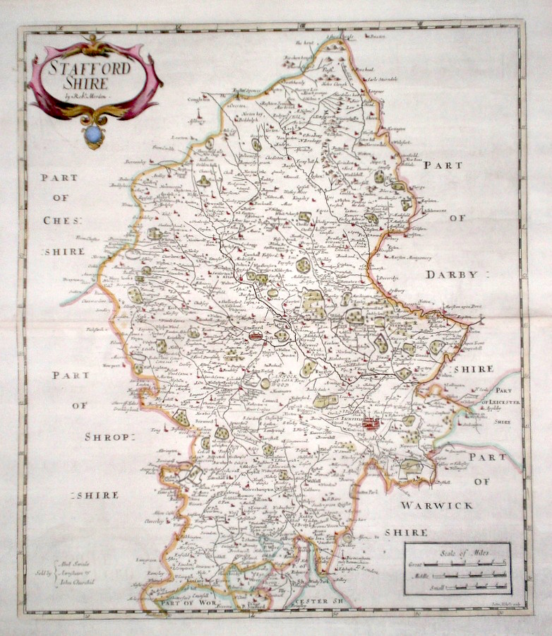
Staffordshire 'Staffordshire by Robert Morden' Nicholls, S. (1722) 37 x 43 Finely engraved and decorative map of the county by Sutton Nicholls for Robert Morden. From the 1722 edition of Camden's Britannia. Excellent condition with good margins. Later colour 85.00 GBP |
|
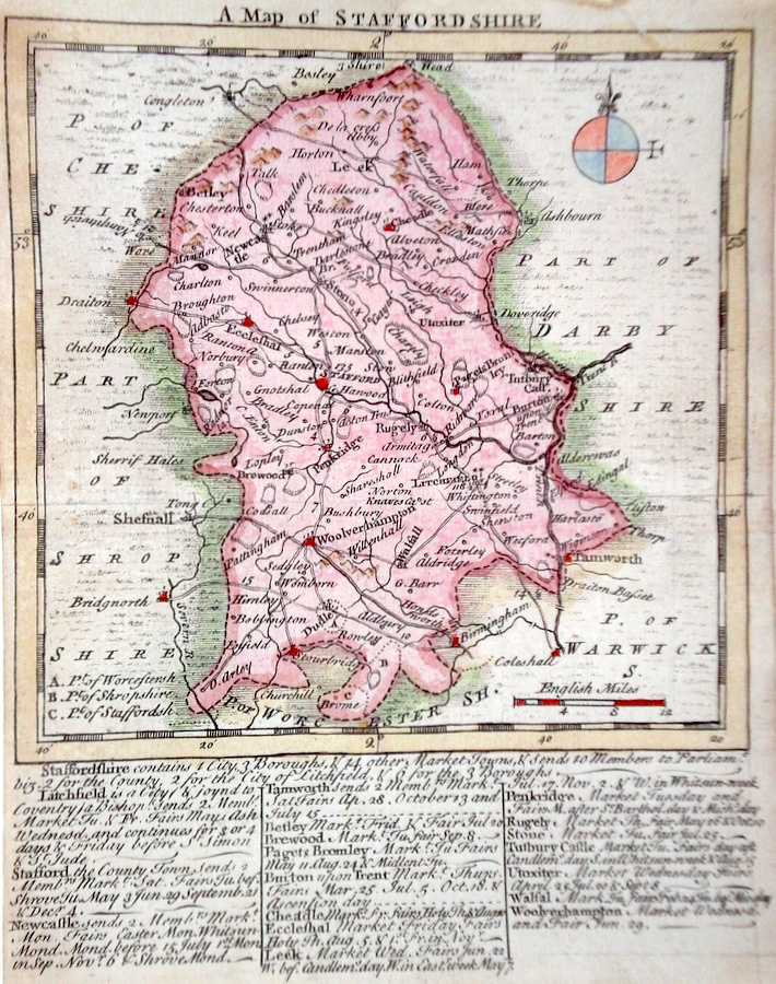
Staffordshire 'A Map of Staffordshire' Kitchen/Jefferys (1751) 13.5 x 18 Finely engraved map of the county by Thomas Kitchin and Thomas Jefferys from their publication "The Small English Atlas". This rare series of maps are distinctive by featuring considerable county information below the map. Later colour 50.00 GBP |
|
Staffordshire Rocque, J. (c. 1769) 16 x 20 Finely engraved map of the county by John Rocque for the publication "England Displayed". Later colour 50.00 GBP |
|
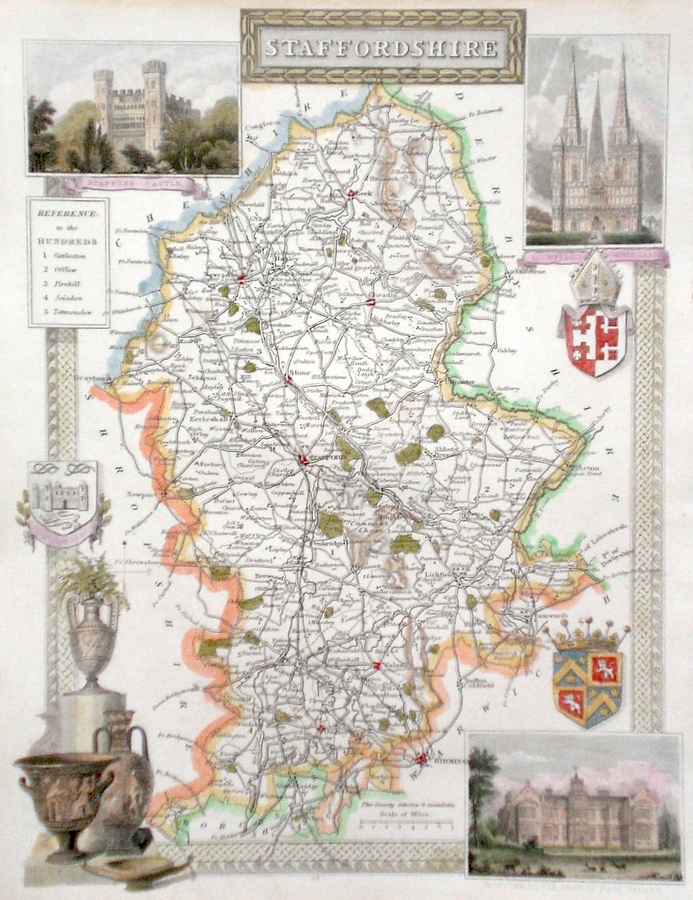
Staffordshire Moule, T. (c. 1848) 20 x 26.5 Decorative steel engraved map of the county by Thomas Moule. The inset illustrations are of Stafford Castle, Lichfield Cathedral, Ingestre House the seat of Earl Talbot. Later colour. 50.00 GBP |
|
Staffordshire Fisher & Co. (c. 1842) 28 x 35 Detailed and attractive map of the county by Fisher & Co. This series of maps was the only cartographical publication from this publisher. Original colour 40.00 GBP |
|
Staffordshire Stockdale, J. (c. 1794) 21 x 26 Attractive and detailed map of the county by John Stockdale. Later colour 40.00 GBP |
|
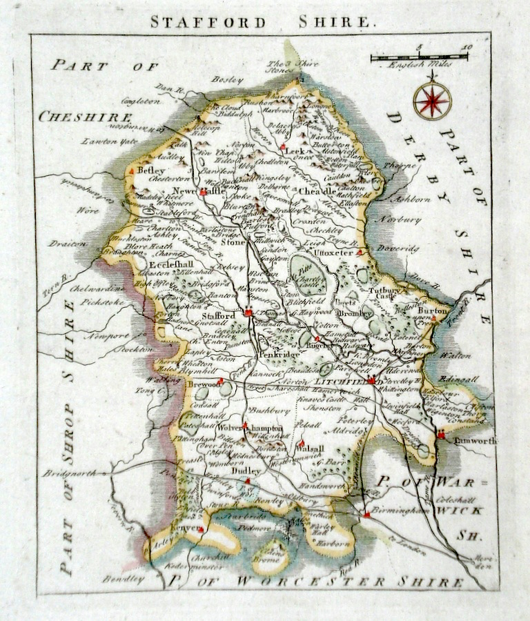
Staffordshire Seller, J. (c. 1703) 15 x 13 Fine map of the county by the Hydrographer and instrument maker John Seller for his "Anglia Contracta". This series of maps were first published in 1695. They were later used in a simplified form by Francis Grose for his "Supplement to the Antiquities of England and Wales", published from 1787. 40.00 GBP |
|
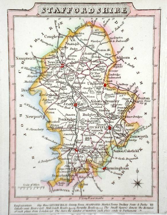
Staffordshire Roper, J. (1810) 26 x 18 Detailed and decorative map of the county by Cole and Roper for The British Atlas. Original hand colouring. Excellent condition. 40.00 GBP |
|
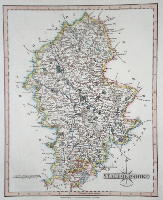
Staffordshire Cary, J. (1821) 21 x 27 Finely engraved map of the county by John Cary from the 1821 edition of his New and Correct Atlas. Excellent condition with particularly fine original colour. 40.00 GBP |
|
Staffordshire Lewis, W. (c. 1835) 10 x 14 Detailed and attractive miniature map of the Region by William Lewis for his "Lewis's New Traveller's Guide". A particular feature of this charming series of maps is the clear and precise engraving of the roads. Adjacent numbers indicating the distances from London. Also included with the map is the accompanying page of text giving the county information relevant to travellers,- principal towns and inns are listed, distances between towns, principal fair dates, and even sites for the best views of the county. Later colour. 35.00 GBP |
|
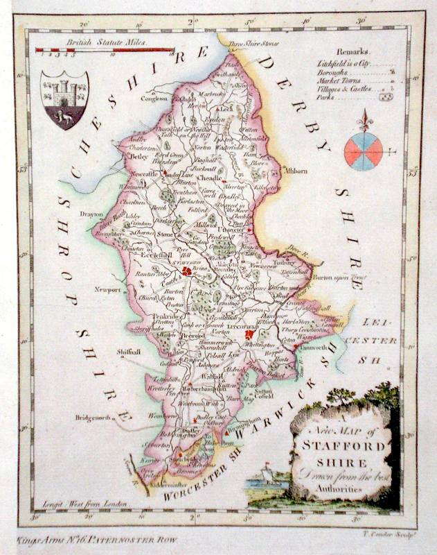
Staffordshire 'A New Map of Staffordshire Drawn from the Best Authorities' Conder, T. (c. 1784) 18 x 21 Finely engraved map of the county by Thomas Conder for the publication "The New British Traveller" Features include a Coat of Arms, and decorative Title Cartouche. Later colour 35.00 GBP |